West Canada 2026
The Plan
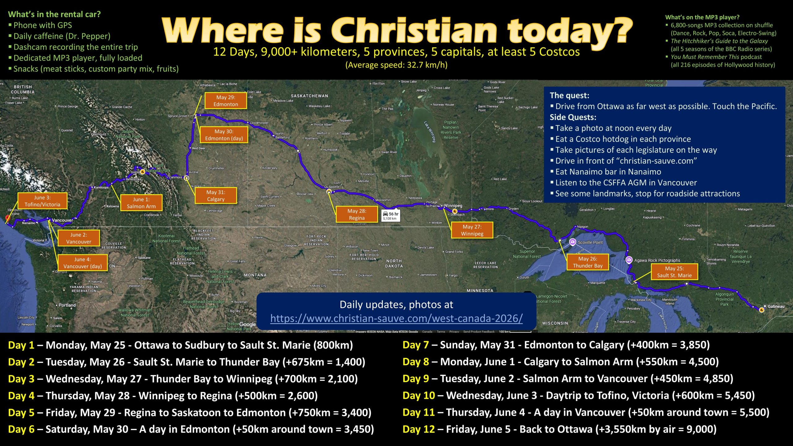
12 Days, 9,000+ kilometers, 5 provinces, 5 capitals, at least 5 Costcos
Photo Gallery (Updated Daily)


Intro – Preparations
All major trips start the same way: In my library, having doubts about the entire thing.
This one was not different. On the morning of my departure, I once again found myself surrounded by books, thinking Is this really a good idea? I have a line of credit to pay, books to read and review, reviews to edit and publish, CDs to digitize, a novel to finish, the next one to outline, a garden that needs tending and a house to clean. I could be doing any of those things rather than drive across Canada over 12 days.
But, of course, the decision to go had been taken a long time ago.
Back in the quarantined days of the Pandemic, I drew up a plan — a ten-year roadmap of increasingly ambitious annual summer roadtrips that would prepare me and my daughter to drive to Los Angeles by 2030. That roadmap did not and will not happen as planned: the pandemic lasted longer than we thought, I skipped 2023 due to a house fire, and the entire United States should now be considered an unfriendly destination. But bits and parts stuck: Quebec 2022 and Toronto 2022 worked well, Boston 2024 was fun, and Maritimes 2025 extended our range beyond the single-day drive.
In fact, it was probably in Halifax that the plan began to take form. As mentioned in my closing thoughts to that trip, I ended up driving a total of 3,500 kilometres in a week during that trip, with major drives on six days out of the trip’s seven days. “This is the distance from Ottawa to Calgary”, I wrote.
Then I turned fifty, and I knew that I had to do something significant for the occasion. I had to do the cross-country trip that had been earmarked for 2028. My daughter having declined to spend another very long trip in the passenger’s seat with no one but boring-old-dad, this enabled me to attempt something bolder.
A few scribbles later, the plan came into focus: From Ottawa to the Pacific, complementing the previous year’s Ottawa-to-the-Atlantic run. Having already been to Sudbury, Winnipeg, Calgary and Vancouver in a semi-distant past, I knew what to focus on. Rather than just following the Transcanadian highway to Mile Zero, I added a few tweaks while I was going through the neighbourhood: Saskatoon and Edmonton and, after some waffling, Tofino as the western end of the road.
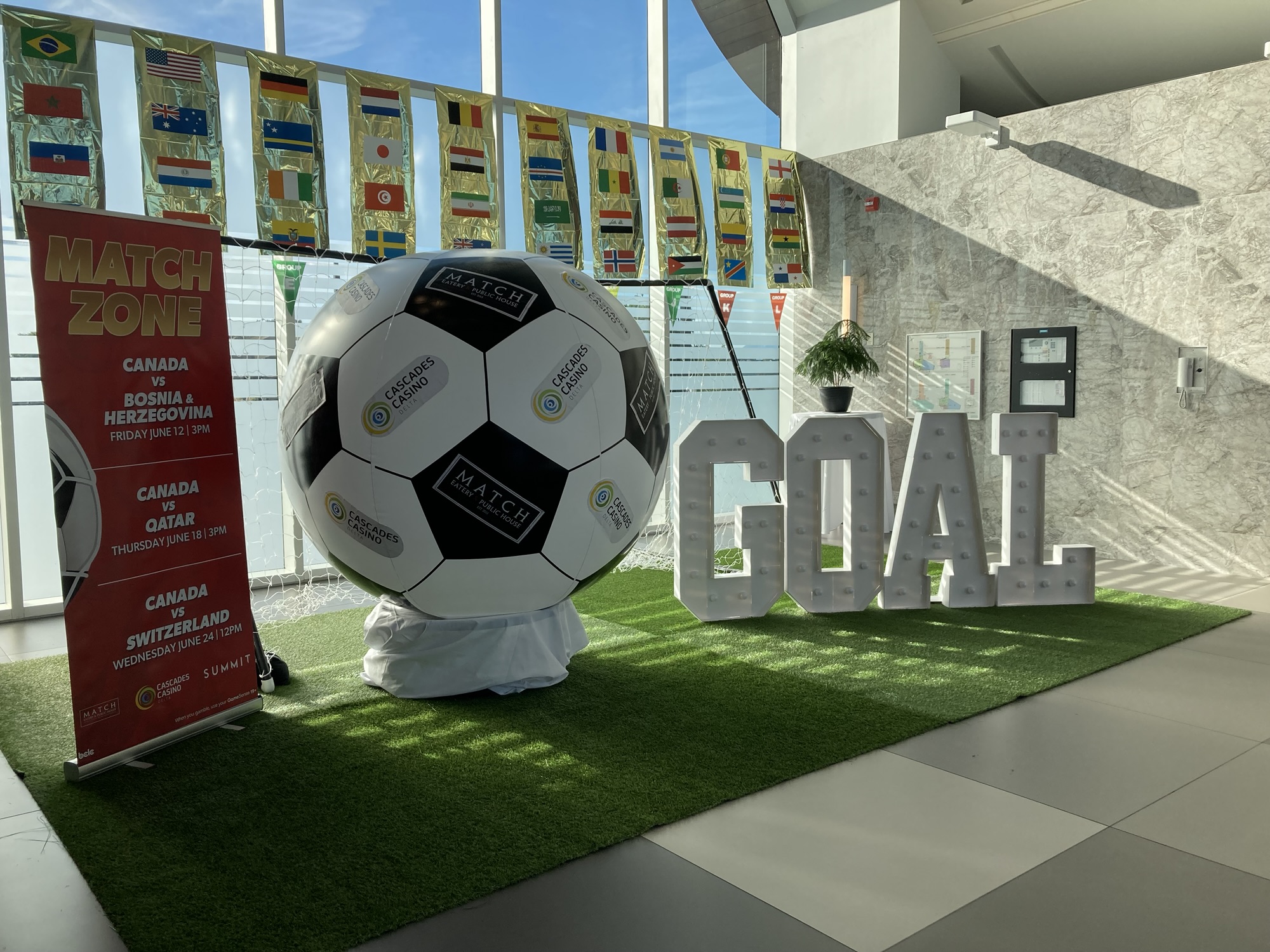
Unconstrained by my daughter’s school schedule, I settled for a late-May, early-June timeframe, avoiding snow on one side and the summer high season on the other. (Also, it turned out that scheduled my stay in Vancouver one fortunate week before FIFA came to town, although as you’ll see I wasn’t completely able to avoid the impact of that event.) Once I had my outline, my planning became increasingly detailed — the end result being a fourteen-pages, 2,800-word document with planned stops (plus non-stops) and custom maps.
Things got serious in April — Car rental, hotel booking, flight reservation, telling everyone about it.
But it all stayed a paper exercise until I went to pick up the rental car the day before the trip. I had the generally good idea to schedule my trip from a Monday to the following week’s Friday, on the theory that I could use the weekends to finish my preparation and then to decompress. I did a lot of things that weekend before the trip: Packing my travel kit, configuring electronics, cleaning up the house, communicating the final plan to family and friends, and so on. I strongly suspect that having more time to prepare meant that I just got increasingly persnickety about everything. For instance, all of my clothing was picked so that it could all be replaced by a visit to Loblaws, Mark’s and Costco. This is probably excessive, but if you give me enough time to properly prepare Plan B, I’ll get working on Plan C.
In any case, the adventure really began when setting out to pick up the car. In theory, it was a simple two-buses ride from the Quebec side to Ottawa’s south side. In practice, though, I hadn’t accounted for Ottawa’s Race weekend, in which the entire downtown and surrounding areas was blocked for a marathon and half-marathon. While my final trip was more or less the same (bus to downtown, plus train ride south), I had to wait until mid-afternoon rather than noon. By the time I got to the rental office, the place was surprisingly packed. I read through the first tenth of Project Hail Mary before I was served and even then it was…
“Sir, we’ve prepared a Jeep for you.”
“I don’t want a Jeep. I booked a mid-size car.”
“This will take longer, sir.”
“I’ll wait.”
This wasn’t just me being picky. For one thing, I wanted to drive more or less the same car I have, as so not to have to re-learn how to drive another kind of vehicle on the fly. For another, with the price of gas these days due to those idiots in the White House, a Jeep would easily double my gas expenses.
(It was admittedly a very nice Jeep, though.)
In the end, it didn’t take that much more time, and I got a very, very similar vehicle to mine. Then the dealership threw in a substantial discount for my troubles that saved me about 500$ from my single biggest expense of the trip. Not bad!
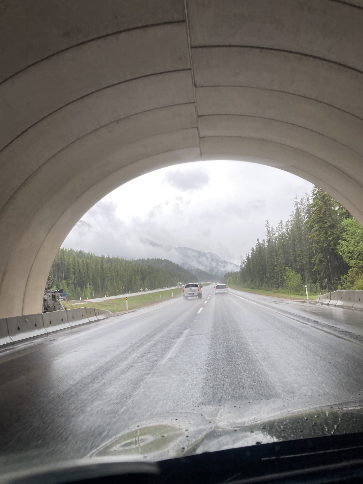
I ran a few errands around town after that — to pick up a few last-minute things (a paper atlas, a cell phone holder, a few memory cards for the dashcam) but also to get a better feel for the car and how it handled. Good brakes. Same turning radius. Stop-and-start engine. Many new features, since my car is thirteen years old and rental standards have advanced quite a bit since then. (“They have steering wheels now? Fancy!”) I had to get used to pressing the brakes before turning on the engine. Everything taking place during a gray drizzle, I got to learn the windshield wipers in a hurry.
Then I got back home and ran some more errands considering that my daughter had things she had to pick up right now. This was a blessing in disguise since I had a few more specialized electronic pieces to pick up as well considering that the car only came with USB-C ports and everything else in my kit was for USB-A plugs.
At some point, I discovered that the tub of feta cheese that I had picked up during one of my errands had spilled open, sending some brine on the trunk carpet. Nothing that some quick work with a hose and a hook (for drying) couldn’t handle, but that did push some stuff for the following morning.
The rest of the day was a dash of miscellaneous activities, testing the car’s various systems with my add-ins (such as a dashcam, phone-as-GPS and audio-loaded USB key) and cleaning up a few last-minute things around the house. I tweaked my road kit some more, getting rid of a few things that took up a lot of bulk to little effect. Would I regret leaving a heavy sweatshirt at home? Would I miss having a full pyjama? Maybe, but one the other hand I had to think ahead to an airborne return trip in which I would have one check bag and one carry-on luggage —
I did allow myself one indulgence — a full-size keyboard, since typing those travelogues every night on a laptop would be torture.
I went to sleep with a relatively high confidence in my preparation, but also a short list of things to do in the morning.
Day 1 – Monday, May 25 – Ottawa to Sault Ste. Marie (800kms)
After a relatively good night (shorter than usual due to the usual trepidation, but still restful), I woke up before my alarm clock and was ready to go by eight o’ clock even after the short list of things to do. The dry cleaned-up trunk carpet went back into the car, the last few things were cleaned, stowed, rearranged or removed.
By happenstance, I was ready to leave at nearly exactly the same time as my daughter walked to school, so I gave her a quick ride instead — and a goodbye.
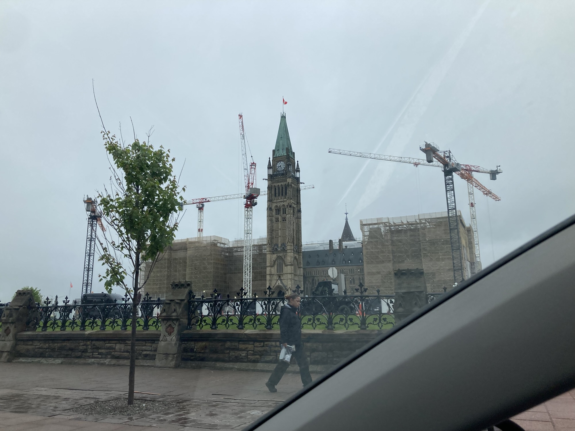
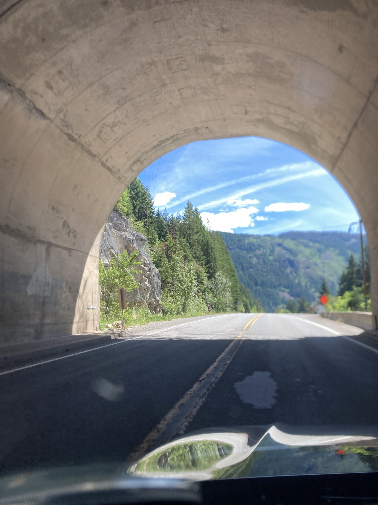
While it would have made more sense for me to immediately head for the quickest way out of town, I wanted to be symbolic about the whole thing — and that meant making a not-so-quick-hook through downtown Ottawa to take a picture of Parliament. (After all, I have promised you “five capitals”.) Monday morning traffic isn’t terrible, but it still ate away at my schedule. Having miraculously snapped an acceptable picture of Parliament, I headed west.
The morning was overcast but not rainy, which suited me just fine. Switching from the radio to my MP3 key right after the nine o’ clock news, I drove farther and farther away from familiar roads as the first few episodes of The Hitchhiker’s Guide to the Galaxy BBC radio series rolled by. The Earth was destroyed (in the show!) just as the highway went from four to two lanes.
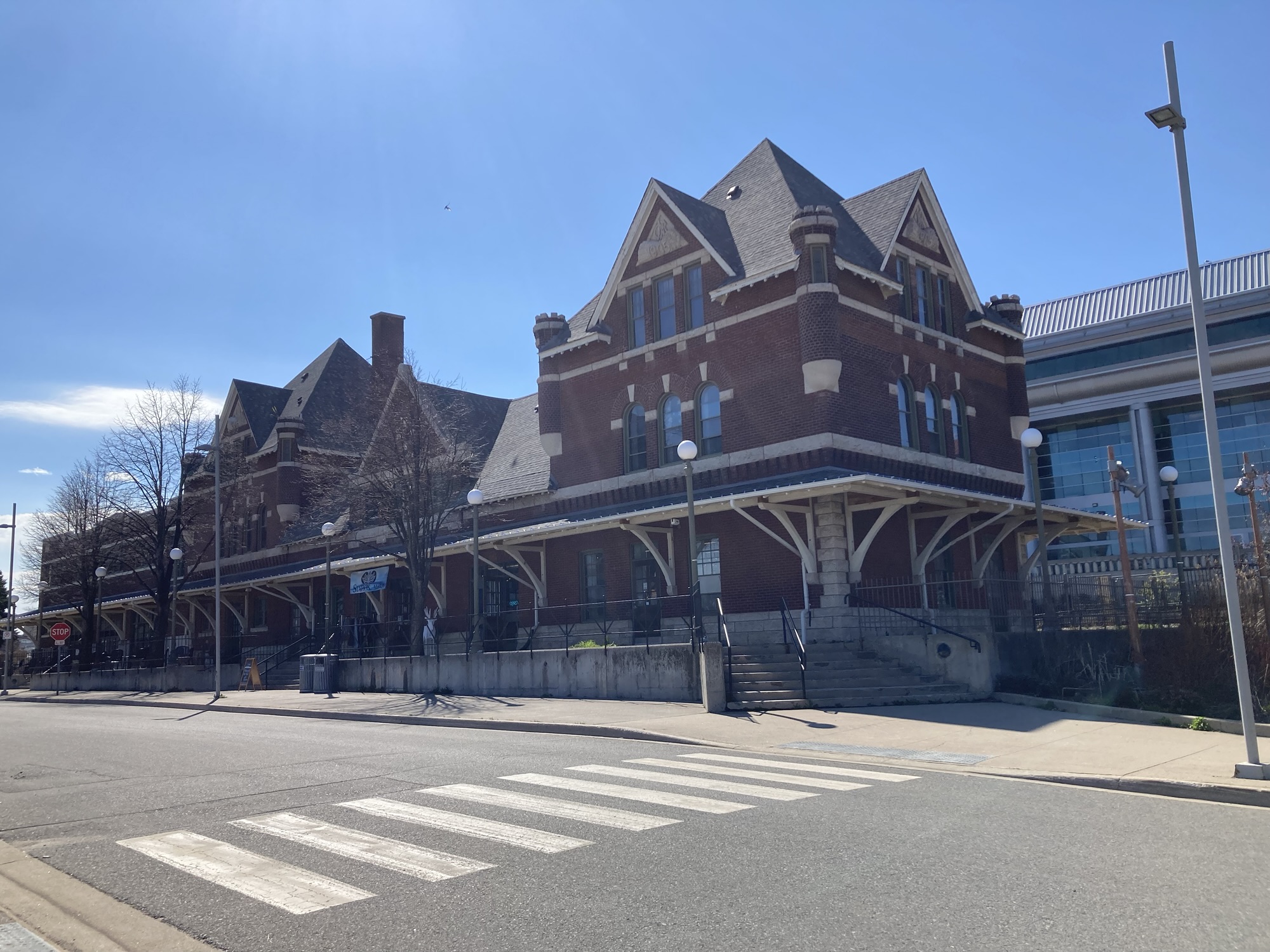
The second episode finished right as I pulled over to the first stop of the day: The Irving Big Stop in Pembroke. This is a notable location because while Irving (and its supersized Irving Big Stops trucker’s stops) is omnipresent in the Maritimes, they’re practically unknown in Ontario, and the Pembroke location is their westernmost to date. It’s an authentic trucker’s stop: Showers and a lounge for long-haulers, a section of the store dedicated to big-rig equipment, a site-down restaurant all accompany the usual Circle-K conveniences and expansive gas stations.
I picked up a slush — a grape-and-orange mixture. “What’s your favourite flavour?” asked the cashier. “Can’t decide — that’s why it’s a mix!”
You will see a lot of references to slush in this travelogue. Let me give you ten reasons why it’s the greatest summer / roadtrip drink.
- Relatively ubiquitous in convenience stores and nowhere else. Sure, I make my own slush at home, but this is really a roadtrip drink.
- More expensive, but not that much more –and you get more for it.
- All sugar and flavour, no filler. No caffeine, no alcohol, little (if any) carbonation — just straight-up tasty sugar without distractions.
- No caffeine (if you pick it carefully). Repeated, because this is important — I have my own caffeine intake mechanisms and often I don’t want any.
- The ice is the point, part 1: It stays cool even when it’s warm in the car! While admittedly not such a big deal in overcast late May, you never know.
- The ice is the point, part 2: It delays how quickly you can drink it, and that’s a good thing: Slushes will last hours, whereas a regular drink can disappear in a few minutes.
- The ice is the point, part 3: That tasty crunchy feeling from the ice is terrific for keeping awake and alert during long drives.
- Mix and match flavours! Since slush is always self-poured, it’s almost mandatory to blend different flavours together. No, it doesn’t really stay separated once it melts — but it does increase the number of flavours available!
- We reclaim our natural heritage. Slush in its natural state is a terrible, wet, frustrating thing. Well, we now take one of the worst features of winter and make it one of the greatest things about summer. This is what Canadians do.
- Slushes are fun. I don’t have to explain this one.
My second stop of the day was at Deep River (a historically important town if you’re into Canadian nuclear history) for the Canadian Clockwork Museum. My plan was to stop briefly for a quick lookaround (and especially heararound — I visited the great virtual tour, but it doesn’t feature the sound of an entire museum of clocks.) Alas, the place was closed. An overlapping set of mutually contradicting signs took a while to decipher, but ultimately I understood that it was closed on Mondays in May. Ah well — I hope to be back later this summer.
Deep River also announces a shift in how the Transcanadian looks like — from agrarian landscape from Ottawa up the valley, it shifts to a more borealian-forest one once you go through Deep River. This is where the road gets closer to the Ottawa river, and conifer trees take over from leafy ones. (An impression magnified by the very small leaves at this time of the year.) The landscape turns from farms to forests, with frequent water elements betraying the proximity to the river. The Deep River – Mattawa leg was probably (next to the big rocks of Sudbury) my favourite part of the day’s drive.
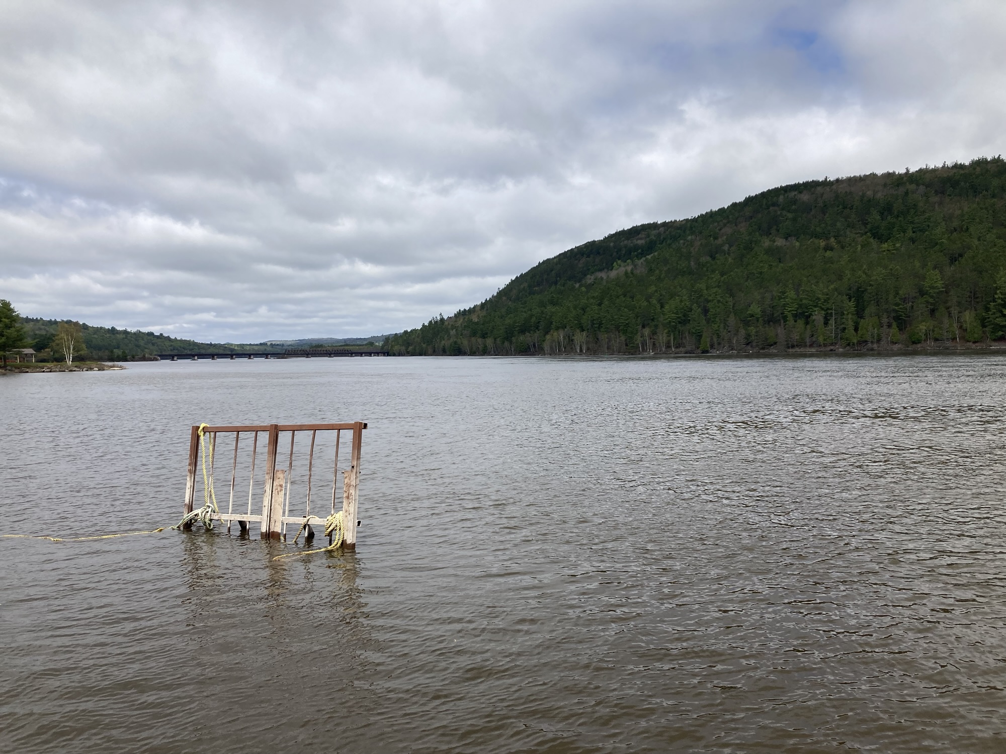
I had another stop planned in Mattawa — Valois Restaurant, which is located very near to when the road abruptly turns west. It marks a significant shift in the road. It’s the last that we see of the Ottawa river running all the way to Montréal and farther on. It’s also a space with some personal signification, as I had stopped there on a previous trip to Sudbury with my daughter and then-wife — one of my favourite pictures of them was taken on the pier next to the restaurant.
The pier is gone. I am no longer married. The river flows on.
I ordered a cheeseburger to go (great sear on the patty — I first thought it had bacon in it) and ate it on the remnants of the pier. In theory, one could take a boat and float down the river. Back to Ottawa. Back home.
But not today. Today was for going somewhere new.
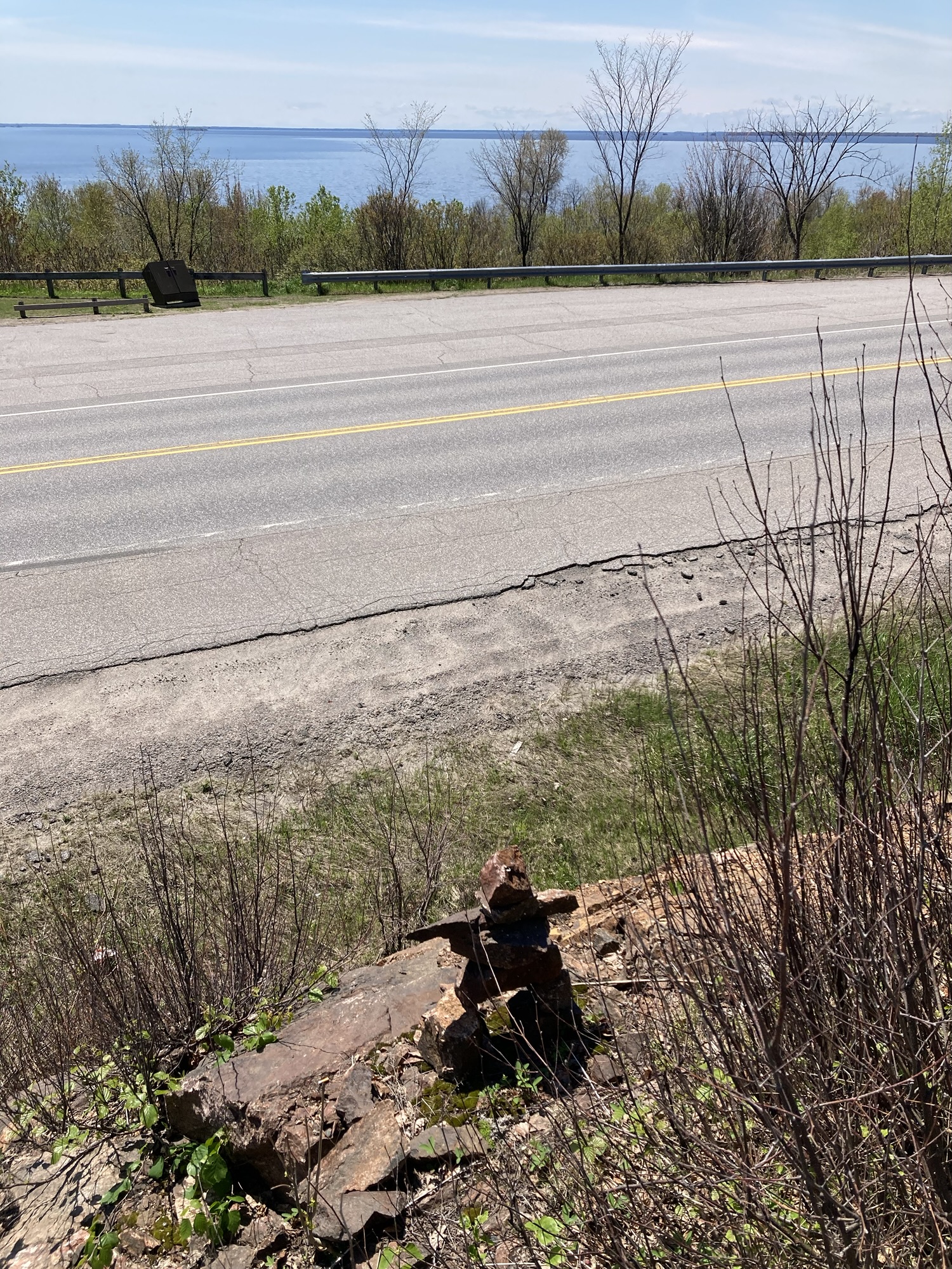
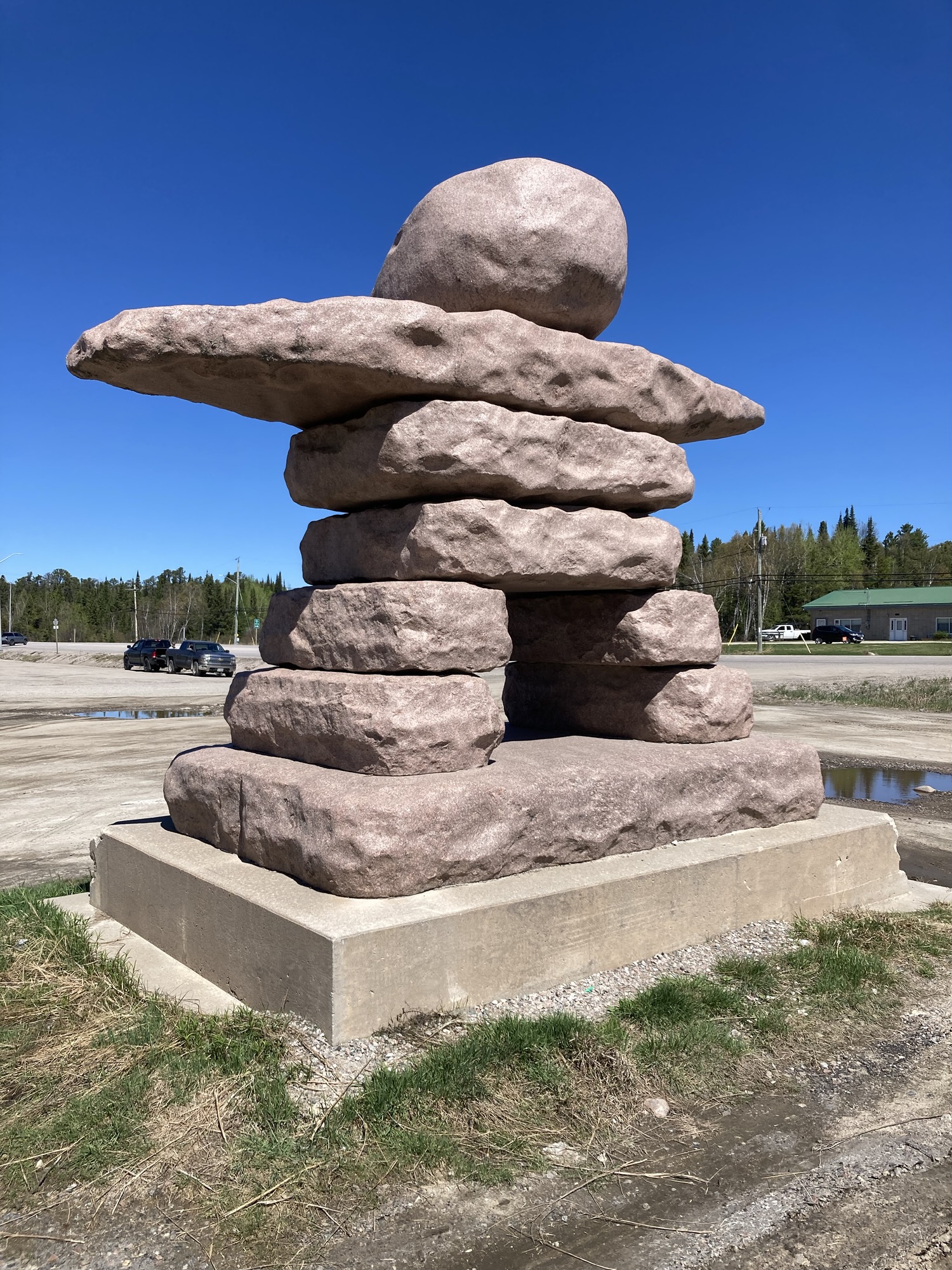
The road from Mattawa to Sudbury is a blend of farms, forest and fleeting water. It nears the northern shores of Lake Nipissing, and just as I was wondering when I would get a clear photo of the lake, a lookout presented itself. Seizing the opportunity for an unplanned stop, I made my way up and to the nice picnic table set up with an unobstructed look at the lake. Then I looked down and saw that someone had built an inuksuk right next to the lookout platform.
Yes, I know — I should be calling it an inunnguaq and the meaning of such stone figures varies widely, but the one meaning I like is twofold: One: “Someone has been here” and two: “You are on the right path”.
Onward.
The road to Sudbury is not that interesting. Well, if it wasn’t for the feeling that we’re clearly getting somewhere else. Billboards become the main mean of communication to the drivers. Mostly local business, with the occasional bible verse thrown in. The road got sunnier and sunnier after Mattawa, and traffic was inconsistent — one half-hour I was almost alone of the road, and at other times there was city-like traffic in North Bay.
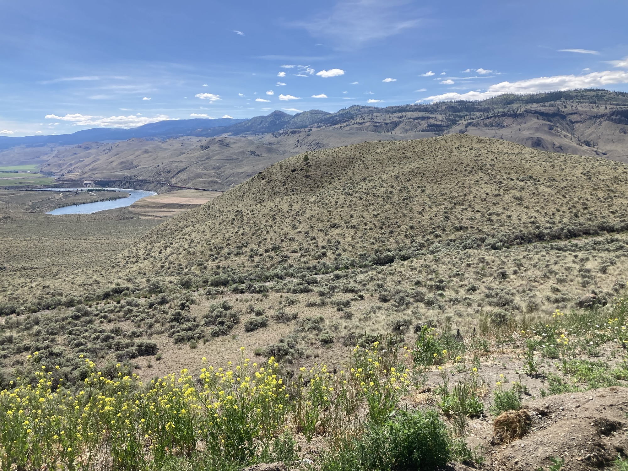
The land gets more interesting as you approach Sudbury — rocky formations, and a clear human intent to forge a road in-between chunks of rocks. The Kingsway through which one approaches Sudbury from the east is remarkable in that it shows just how much the rocky formations on both sides of the road have shapes the development of land.
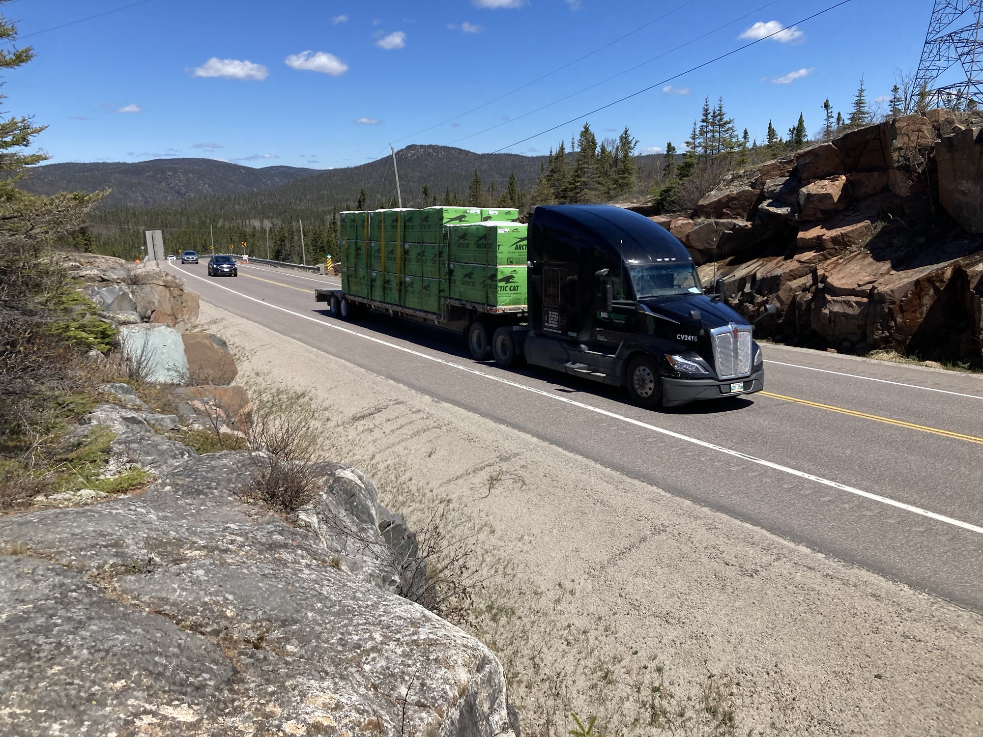
My first stop in Sudbury was disappointingly ordinary — one of my sub-quests for this trip was to eat a Costco hotdog in each province, so Sudbury was the obvious choice for the Ontarian hotdog. While I did walk the floor of the warehouse (of, what subtle differences!), I only spend $1.58 on the hotdog. Yes, it’s possible to go through a Costco and not spend hundreds. Watch me do it four more times.
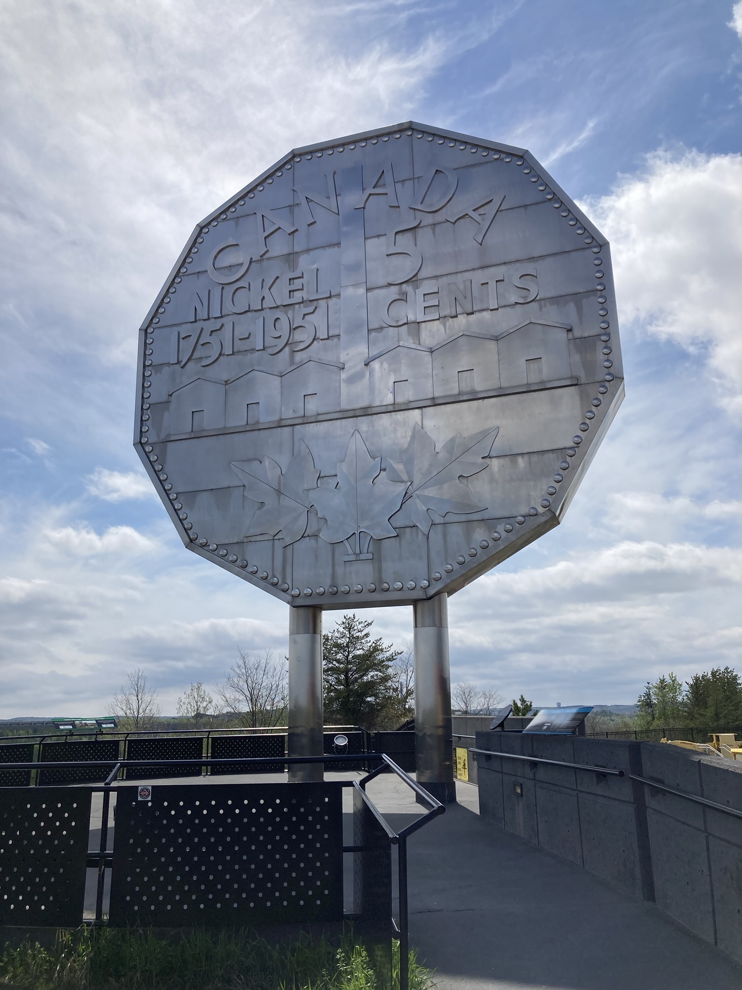
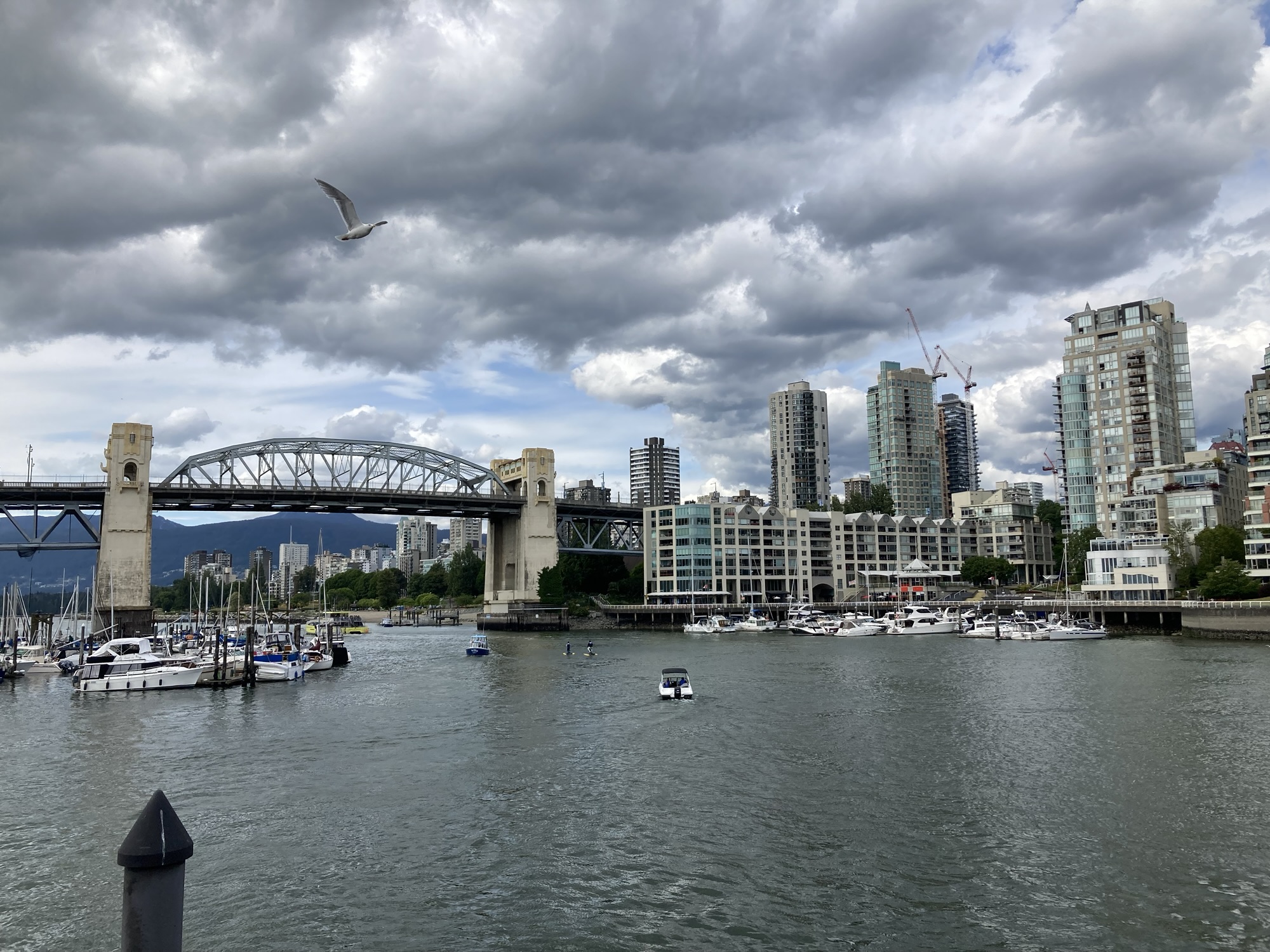
My second destination was far more picturesque — Sudbury’s Big Nickel monument. Getting there from Costco, however, forced to go through downtown Sudbury which was worth a detour by itself. The Big NickeI had already seen (I like the museum next to it, and there’s also a play area for kids right next to it) and I strangely had the entire place to myself. Still, this was my hero shot for the day — the one picture clearly saying “I am on my way west.”
On another level, the Big Nickel is also significant in that it was the farthest I’d ever driven in this direction — anything beyond it would be new territory.
My plan was to refuel “In Sudbury, after the Big Nickel”, which fell apart once I realized that there was nothing after the Big Nickel — the highway swiftly brought me out of town, and there was quickly nothing else. No problem! I thought — there are plenty of gas stations just a bit farther away.
My car, however, didn’t see it this way and soon started hyperventilating and throwing alarms. You don’t understand, it said, I have less than 15% fuel left! I’m thirsty! You monster! You deserve to run out of fuel, venture out of this car‘s safe habitat, be mauled by a bear, drop dead in a ditch and have vultures pick at your bones!
Those new cars really are something.
In any case, there were indeed a few fuel stations along the way. The one I picked was another trucker’s stop, but not quite as upmarket as the Pembroke one: the washroom smelled like washrooms are (not) supposed to smell, its syringe deposit box was full, everything was a bit run down. But there were other upsides too! The slush machine was ready with another exciting flavour blend (Banana and blue raspberry), and a display near the entrance offered exotic meat sticks made of elk, bison, kangaroo or alligator. (I picked Sharp Cheddar. It did not taste much of Sharp Cheddar.)
The way right out of Sudbury is interesting because the highway was blasted through of big rock formations. The rest of it to Sault Ste. Marie mostly isn’t: A bit of farms, a bit of forest, occasional thrilling moments where the highway skirts water. Quite a few billboards. Also many cannabis dispensaries, to the point that I would not surprised to find out that there are more dispensaries along Highway 17 than Younge Street. (Maybe there’s more things to do in Toronto.)
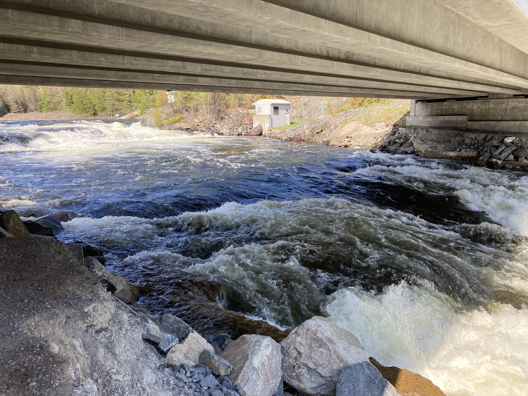
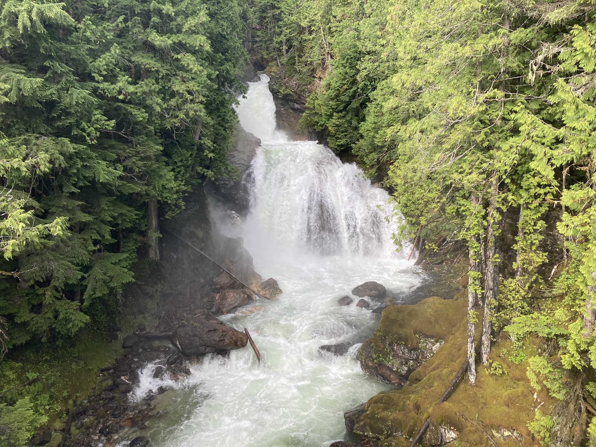
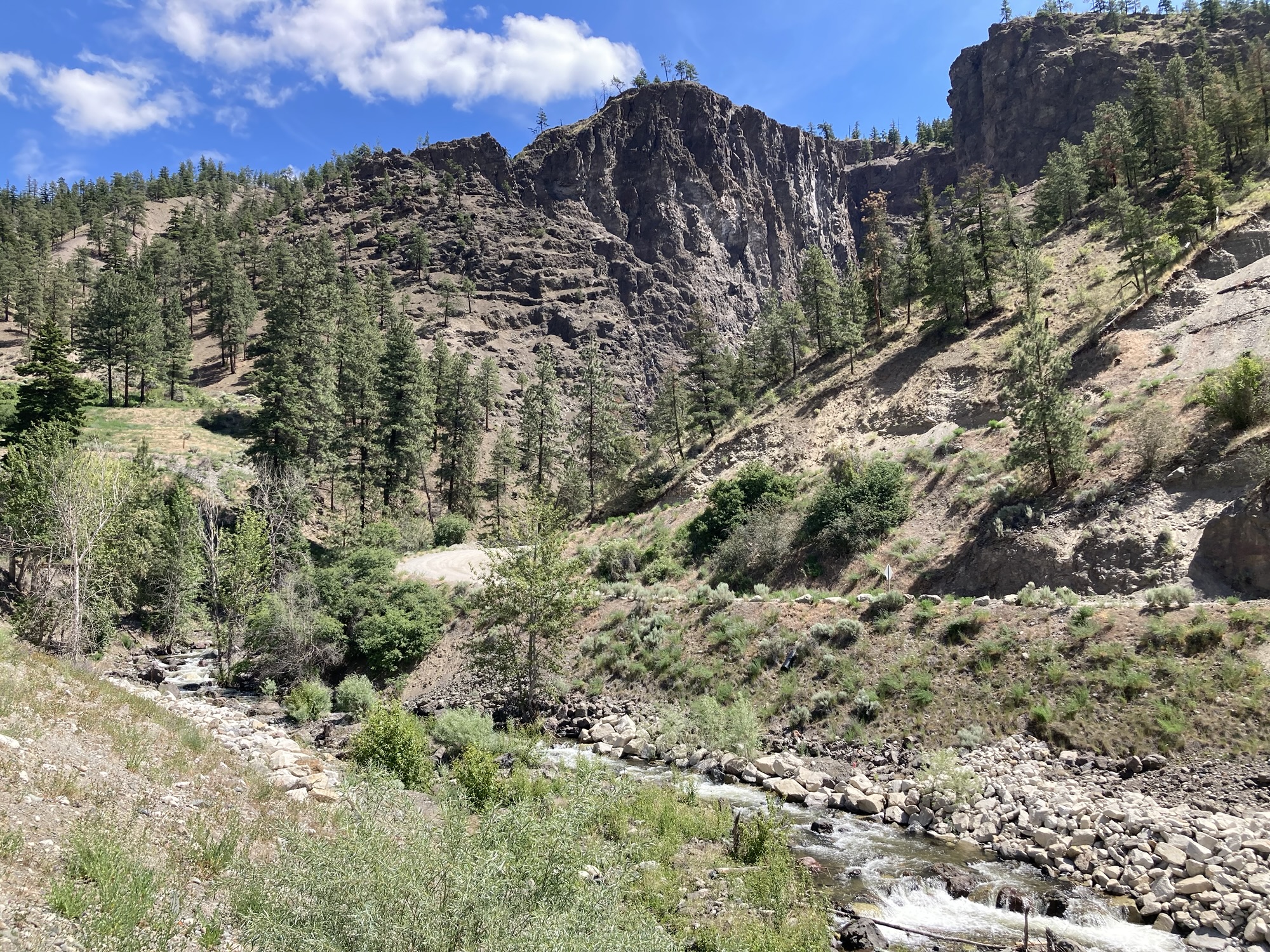
I started feeling fatigued roughly 650 kilometers into my drive — roughly coinciding with the end of the work day. Stopping for a walk quickly solved that: Midway through Sudbury and Sault Ste. Marie, the local authorities have shaped a park around the nearby Serpent River falls. These aren’t very impressive falls, but they’re a nice water feature, and there’s a new solid concrete ramp leading from the small park to underneath the highway bridge so that you can take in the falls. While a good place to stop for the family, it’s missing just a little extra something to make it really interesting. Still, the point was to take a break and I did exactly that.
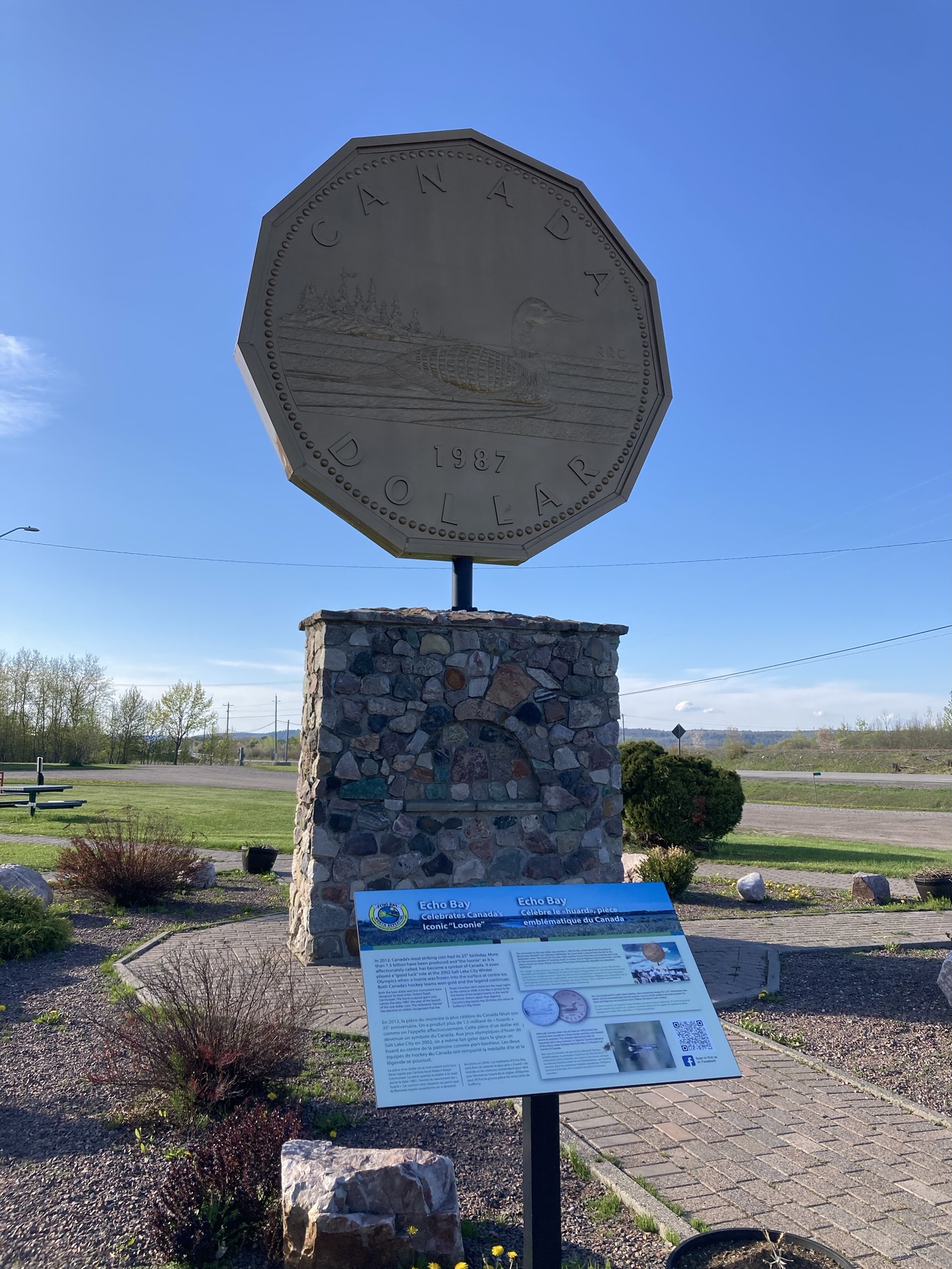
At some point, the highway takes a very noticeable right-angle right turn and heads toward the north — the final approach to Sault Ste. Marie. But I had another stop in mind: The contender to the Big Nickle, which is to say the Big Loonie of Echo Bay — commemorating the local designer of the Loonie, the city has put up, well, a Big Loonie. The park around it is kind of dismal (it’s a nice effort and all, but it’s still just a stop alongside highway 17B) but if you want just a little bit more there’s also a boardwalk taking visitors to a marsh area. It’s not much but again it feels churlish to criticize a good effort — and the walk did help fight the accumulating fatigue.
Then it was off to Sault Ste. Marie itself through highway 17B. Not having big plans for the city nor any destination, I headed for the riverfront, hoping that there would be something there. There was, but barely: a look at the other (American) side of the river, a “Roberta Bondar Marina”, a big tent, a centennial (1967) library, an art gallery with some broken-down and fenced-off art at the back. The bushplane museum was closed for the day (as anticipated), but at least I got a picture of their welcoming attraction.
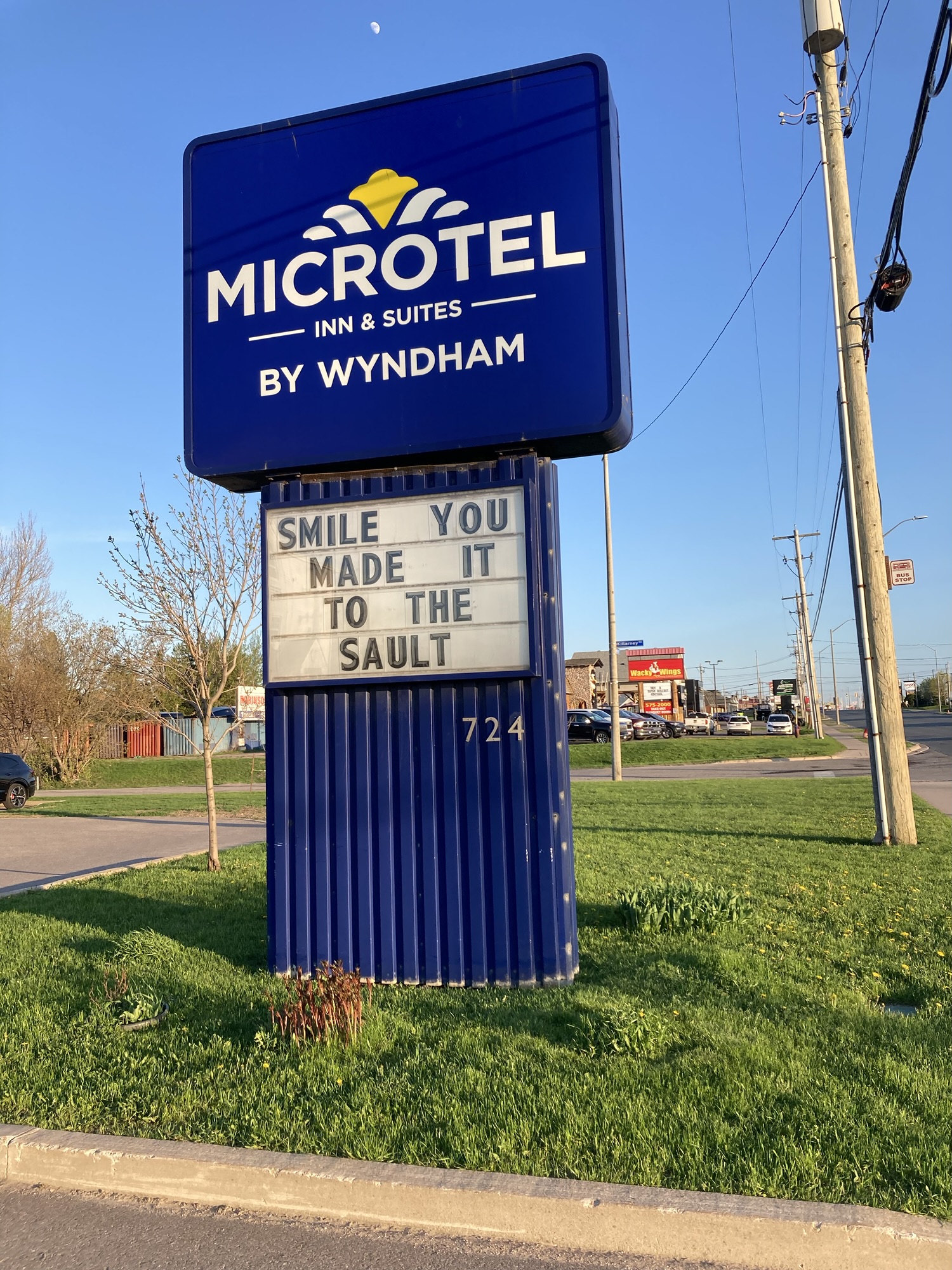
I made my way tot he hotel, which was up to expectations: Modest but clean and adequate facilities. Continental breakfast provided. After checking in, I took a walk around the hotel’s immediate area. It’s not exactly located in a picturesque location — on the highway leading out of town, it’s surrounded by chain restaurants, big-box stores, industrial shops and so on. To prepare for the morning, I cleaned the car and wiped the windshield free of bugs.
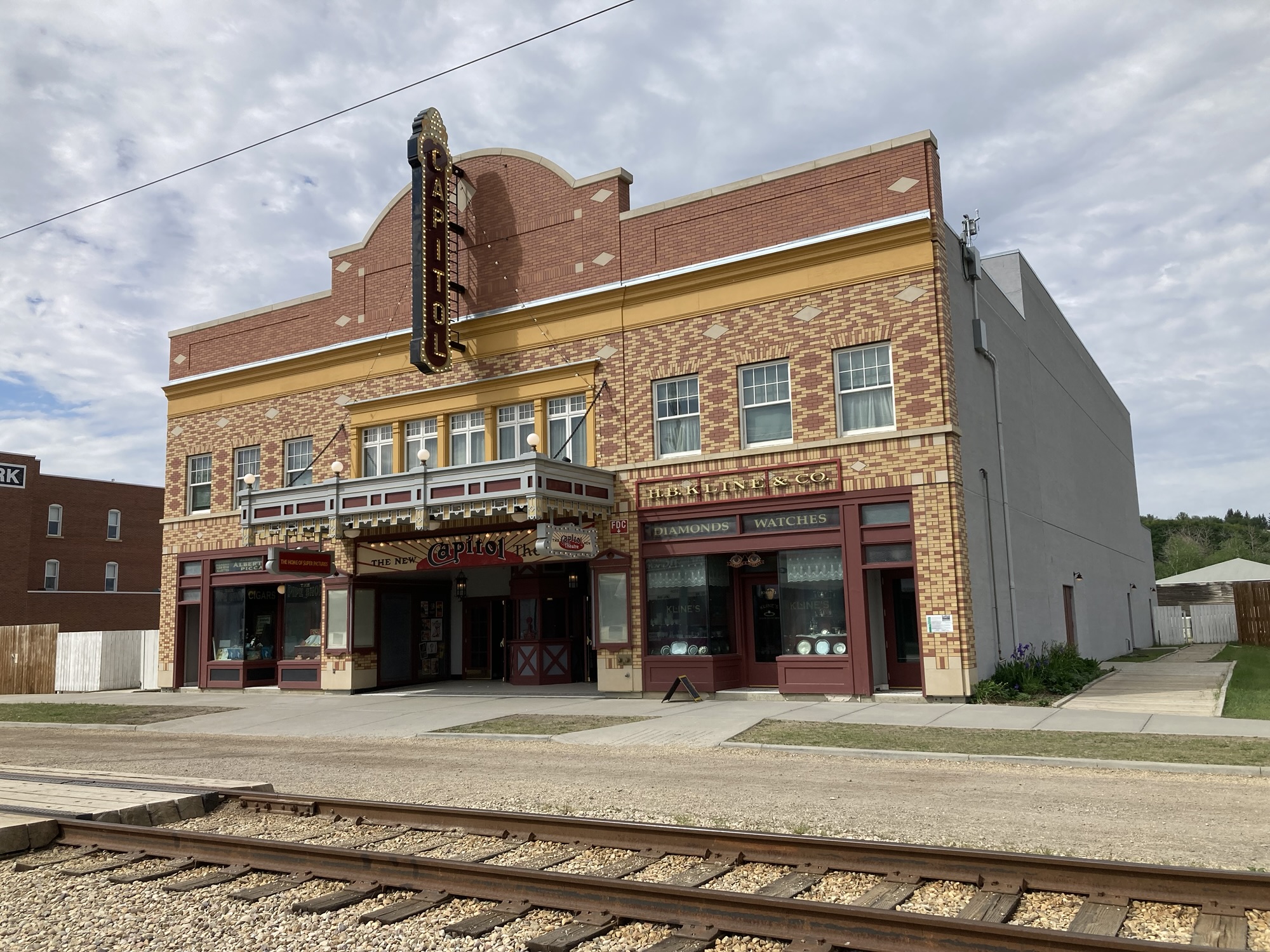
I suppose I should mention that I don’t particularly care too much about Sault Ste. Marie and I refused to spend on anything but lodging here — because Francophones know how to hold a grudge even thirty-six years later. (As a bonus, read the article to learn how one dumb politician ruined his city’s future for decades.)
I started writing up the day’s adventure, but ran out of time. After all, the next day would be another long one, and getting up early meant going to bed early.
Steps for the day: 7,573
Day 2 – Tuesday, May 26 – Sault Ste. Marie to Thunder Bay (700km)
Unusually enough, I woke up at 6:30, well before my 7am alarm. Not willing to dawdle, I quickly showered, got breakfast from the complimentary hotel buffet (surprisingly decent, although being one of the first to self-serve probably helped: I got sausage, egg, an egg muffin, milk chocolate and fruit juice.) and check out. By 7:15, I was back on the road, heading north.
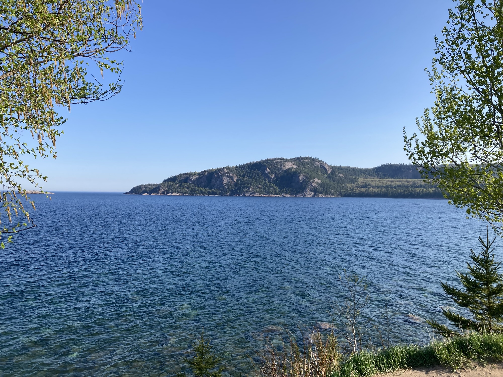
I missed my first planned stop because I was overconfident in my ability to spot the turn-off, but made a spur-of-the-moment unplanned stop at the Alona Bay Lookout, which offered a very good view of Lake Superior. Very quickly, the shape of the day’s travel became clear: A mostly two-lane highway (with occasional passing areas) cutting through rock, with strong curves and changes of elevation following the terrain. It often passed next to bodies of water, whether it was Lake Superior itself, or one of the many smaller lakes or rivers next to it. A particularly weird sight, often repeated, would be to see Lake Superior, then take a turn through the hills and drive next to a much higher lake.
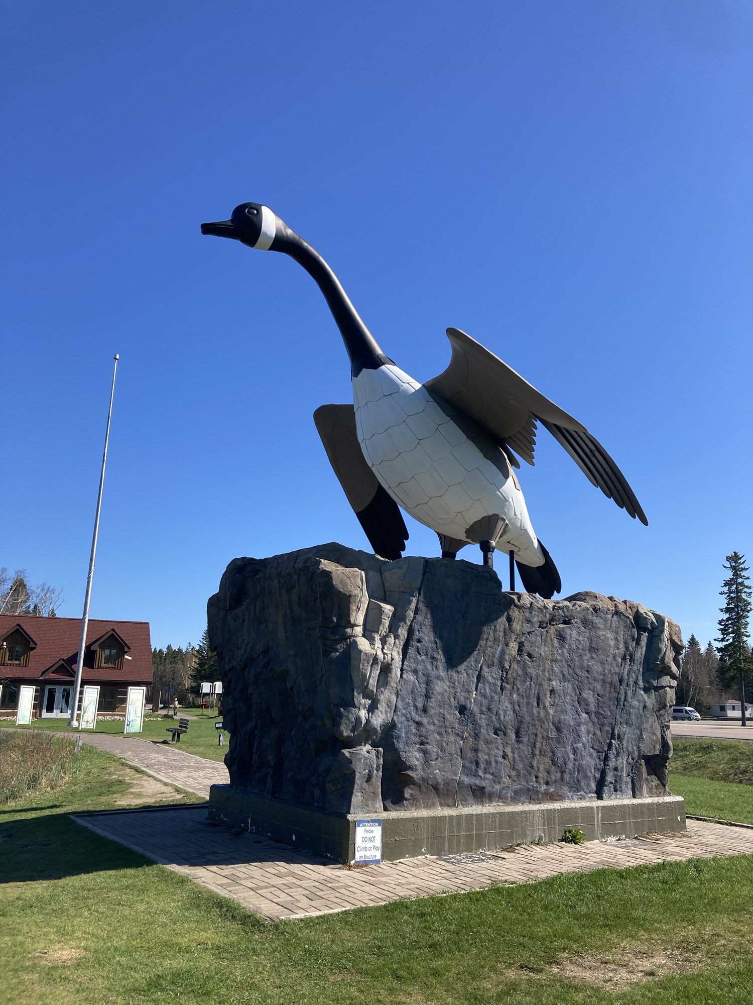
My next stop was a bit of a classic — the Wawa Goose, a monument erected in recognition of Canada’s most fearsome weapon of mass aggression: the Canada Goose. As a kid growing up in Eastern Ontario, Wawa was a bit of a punchline — somewhere lost in the middle of nowhere, known for its goose and nothing else. This is not exactly wrong, as Wawa counts roughly 3000 citizen and is indeed best known for its Goose sculpture. What’s more, the Goose was put up specifically to drive people from the highway toward the town roughly a kilometer away.
But as a monument, it’s a pretty good one. What photos of the Goose miss is that it’s very well located up above the highway, with a pretty good view of Lake Superior. The other, other thing of note is that Wawa is, indeed, in the middle of nowhere: if you want to entertain the kids (or yourself) in this area, the Goose is the most interesting thing around. Fortunately, a very good rest stop is bundled with the monument, so it’s worth a stop. Despite the jokes.
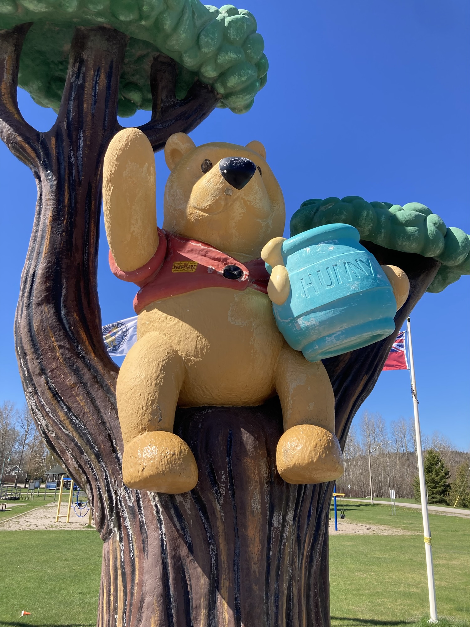
One can’t quite say the same thing about the Winnie the Pooh memorial in White River (45 kilometers north of Wawa), which is available right next to the highway and is surrounded by gas stations. It’s an earnest attempt to provide a statue, a park for the kids and an excuse to walk a little bit, but it really isn’t much — the visitor’s center is away, out of sight and the whole thing feel like the kind of public attraction put up years ago and slightly neglected since then — a few weeds growing through cracks, tired painting, etc. The parking lot is unpaved and unmarked. But, hey, cute statue.
Since I hadn’t gotten my daily slush yet, I visited the convenience store next door to the Pooh memorial and… they had no slush?!? Weird. Well, I’m sure another convenience store will have some.
I said on Day One that I liked the drive up to Mattawa due to the forest landscape, and then the drive around Sudbury because of the rocks, and it turns out that the road around Lake Superior had both of those, often at the same time. It was a day of forest green and dark blue (with a splash of red from the exposed rocks, and brown for the leafy trees just sprouting.)
Driving through this road came with a few challenges. It’s not often rewarding to speed, because every so often (like, 8-12 times total) the road would be partially closed off due to construction (often significant construction) and traffic would be stopped in one direction so that vehicles from the other direction would proceed. This meant some waiting (sometime instant, sometimes minutes — I ate lunch during one particularly long such episode) and it also meant that any progress made passing vehicles and leaving them behind would be nullified by this extended stop. (Although, with the number of stops I made during the day, I passed some vehicles twice, and in one case maybe even three times.)
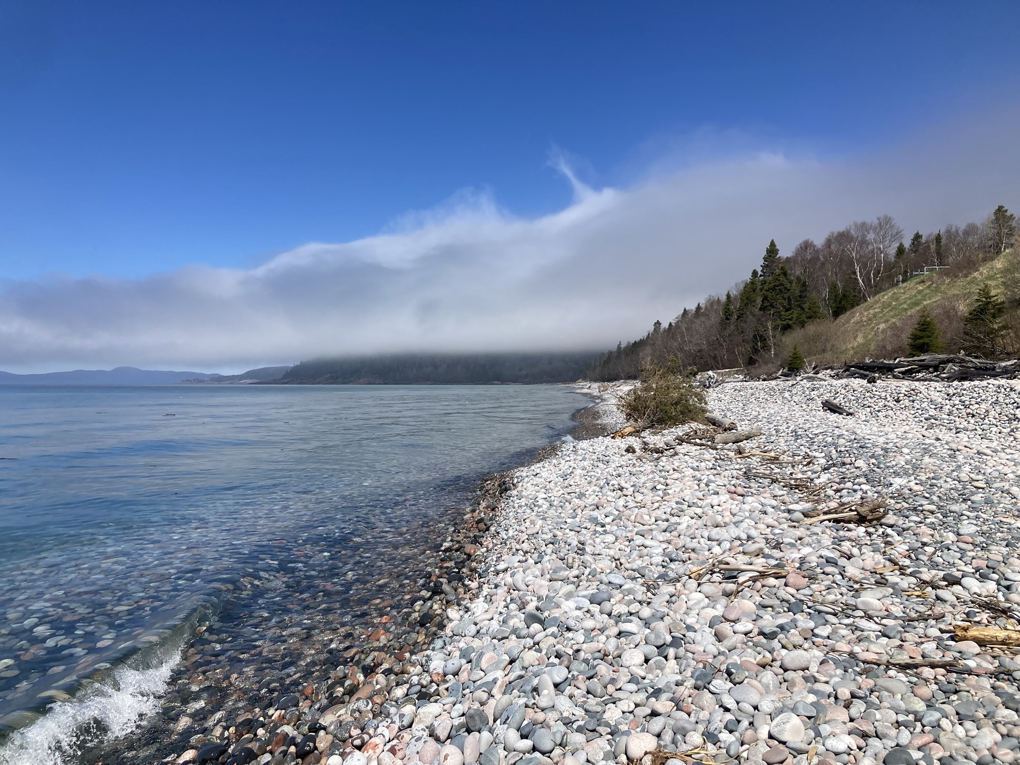
One of the best stops of my day was in Marathon for Pebble Beach. Shortly before noon, I pull off the highway and drove a few kilometers until I reached Marathon, then made my way through the small town to their beach. As the name suggests, this is not a sand beach, but a proto-sand beach, with rocks ground down to round shapes by the actions of the wave. Some of the pebbles are small — others are as big as softballs. Generally speaking (and explaining this requires imagining the lake during winter) the bigger rocks are well above the waterline and the smaller ones are below. In a few ten of thousands of years it will all be sand, but in the meantime it’s a beautiful, unusual beach. And the sound! Walking on those “pebbles” is something so interesting that I took a video just to record the sound. The area was recently redone with good parking, facilities and a lookout, although going down to the beach still requires a steep dirty path. It’s worth the detour.
After such a sight, I really wanted a slush, so I stopped at a Circle-K in town… and their slush machine was broken down. I stopped at another convenience store by the highway and… they had no slush machine?!? I got myself a chocolate milk, but this day was not shaping up well.
I stopped for gas shortly thereafter (there was a sign earlier during the morning, near Sault Ste. Marie, fit to frighten anyone: LAST GAS STATION FOR 150 KILOMETERS) and checked out the convenience store. Still not slush. 0/4 for the day. Bought a milk chocolate instead, which confirmed my ten reasons for preferring slush over pop. Was this turning out to be a day-long quest for a slush?
Trucks are a fact of life in such a narrow kind of highway. They’re usually not a problem (they drive well and they know how the game is played), but they can be an irritant — say, when they have trouble climbing a hill and there’s no way around them for many, many kilometers. Then there’s nothing much to do but drop to their speed and wait for the next passing zone.
Another slush stop in Schreiber. Still no slush. 0/5. Cursed day. Bought Grape Crush, which further confirmed my top-10 reasons.
I made another unplanned spur-of-the-moment stop at an unnamed Lookout just east of Little Pic River Bridge, and it was a great decision — since the area overlooks the bridge, the highway, the lake and the railway, I got some of my best photos of the day from there. It’s almost as if they know what they’re doing when they put a lookout… The price to pay for such a stop, of course, was having to pass all of those trucks again.
I had a big gap in my planned stops between Marathon and Nipigon, and the previous day had reminded me that 100 kilometres between stops was a good rule of thumb to avoid fatigue. It was at one of those stops that I discovered a “Neighbors” convenience store WITH A WORKING SLUSH MACHINE. I made myself a triple blend of Slush Puppy red, blue and green to celebrate — and it lasted me the rest of the day.
I stupidly missed my next planned stop because I had programmed the wrong thing in my GPS, and by the time I realized my mistake I was too far past to double back. But while I may have missed Nipigon’s Bridgeview Lookout Tower, I certainly did not miss the bridge itself — spanning a major gorge and right after the intersection where Highway 11 (the other major Northern Ontario highway) joins Highway 17, it’s a new good-looking bridge that screams modernity in a natural place.
The road got much better after that point, frequently becoming a real graded four-lane separate highway. This is a fairly recent effort (some of Google Street view hasn’t been updated yet, which makes for very funny results around Route 5) and it meant the end of a remarkably beautiful drive in favour of a more sedate highway driving experience.
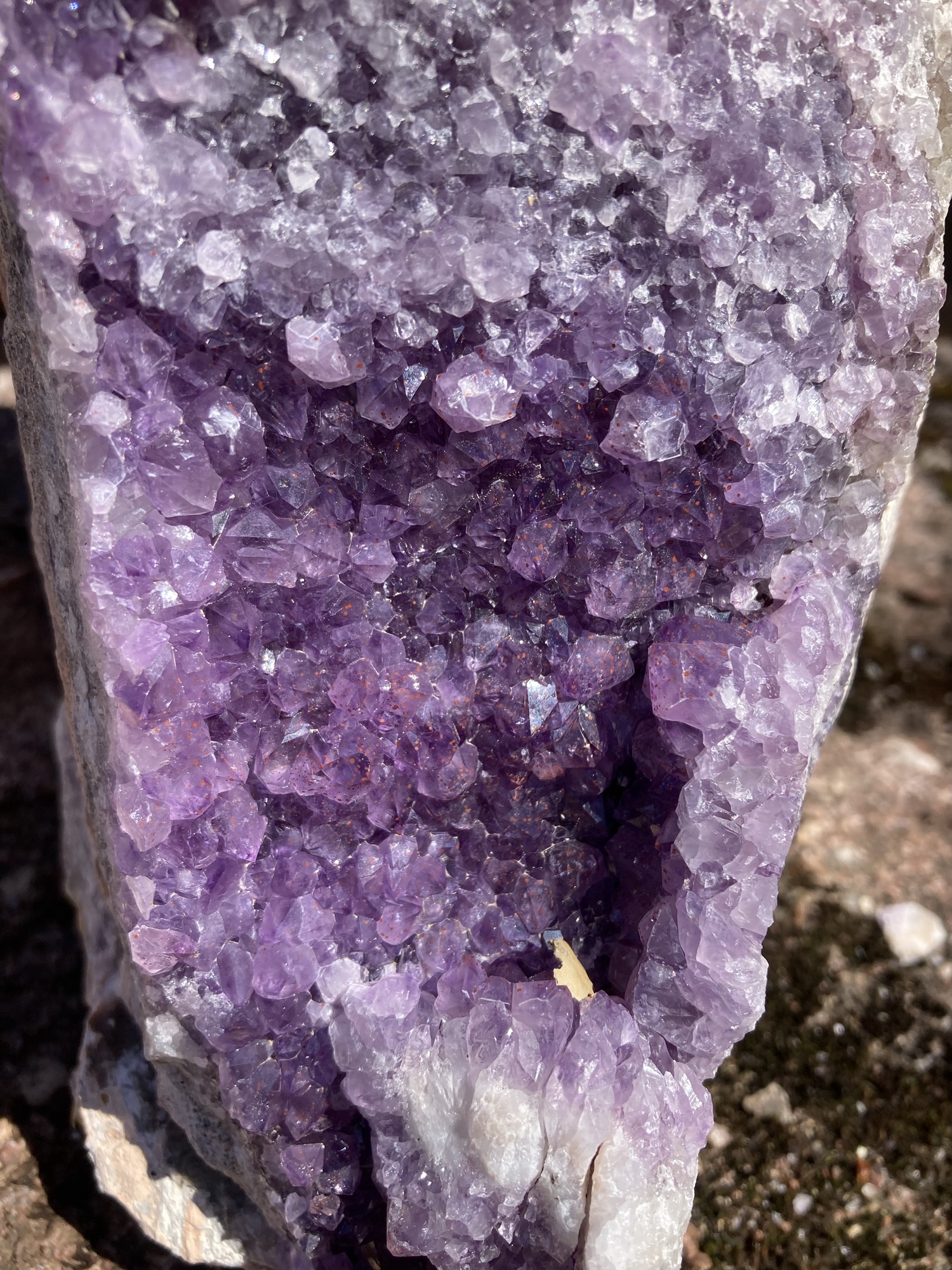
My next stopped was perhaps the one I was looking forward to the most — a five-kilometer-on-dirt-roads detour to a real amethyst mine. There are three of them around Shuniah, but today there was only one of them open — Diamond Willow Amethyst mine. Their site is pretty interesting, and for a fairly low fee you can go pick through raw piles of stones with amethyst crystals. I, worrying about my flight back, went straight to the gift shop and picked a few pieces. Then I looked around their geological information posters put up around their rock garden (every piece for sale!) and had a brief, distant look at the open-air mining operation. It’s a rather charming family affair, and it made for a great break from highway driving. I also saw a porcupine on my way back!
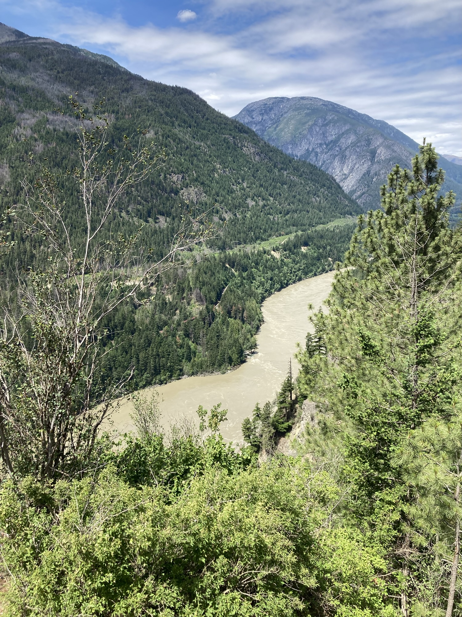
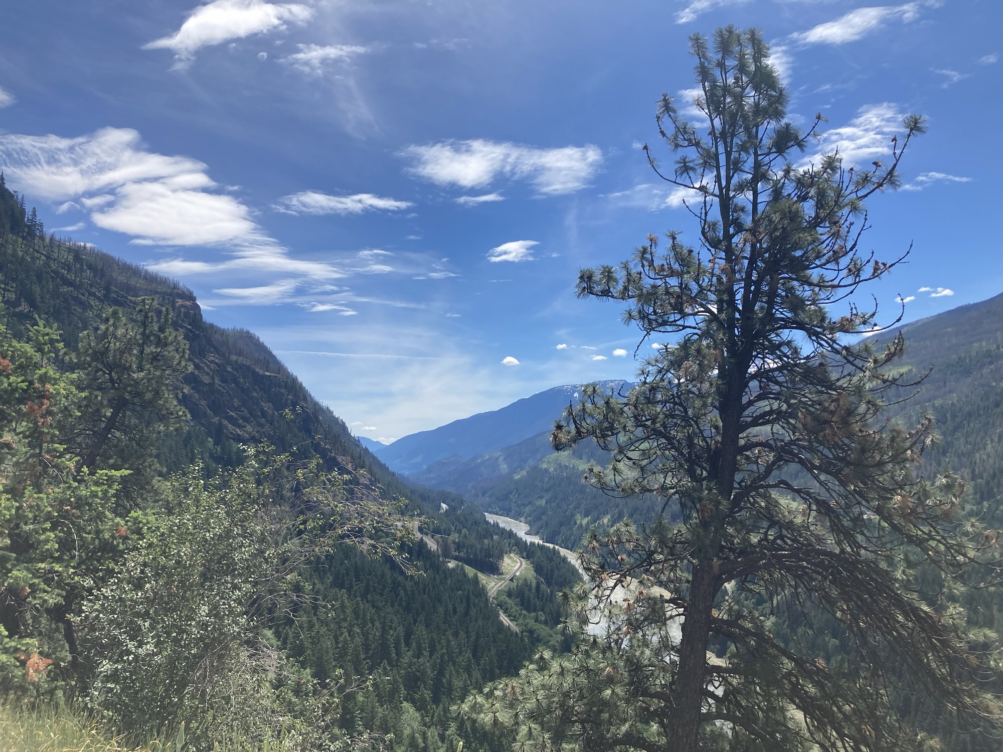
The increasingly more sedate drive to Thunder Bay reaffirmed that, for all of my planned and impromptu stops during the day, my quest for a slush and videogame-like challenges in navigating a tricky road, the real star of the day was the landscape. I has half-listened to those saying that the Lake Superior road was picturesque, but they are right: The colours, sweeping vistas and oft-inspiring engineering prowess it has taken to create a road in such terrain are often breathtaking. Every few minutes or so, the twisty road would reveal a dark-blue lake, or a sweeping view of Lake Superior, or a small incidental waterfall, or a major engineering effort to reshape the highway fit to make anyone go “wow!” I’m sure the Rockies will beat this stretch for impact, but really my point is — this is a beautiful stretch of road and it was far from being as boring as I had feared.
(Speaking of keeping entertained — I ripped through the Hitchhiker’s Guide to the Galaxy series 4, 5 and most of 6 today. I guess I’ll have to review the entire thing elsewhere, but let’s say that Season 1 remains the best, Season 2 was weird enough to be retconned by the following episodes, Seasons 3-5 adapt the rest of Adams’s novels. If you want the best, listen to seasons 1, 3 and 4, stopping 30 seconds before the end of the last episode of Season 4 because the rest sets up a meaningless cliffhanger that leads to the let-down that is Season 5. Although the last episode of Season 5 has the good sense to provide a pretty good wrap-up to the entire series. One more thing: Season 6 is as pointless as the fanfic book it adapts. The Hitchhiker’s Guide to the Galaxy is not ideal driving material — it’s fairly dense, and some of the sound mixing is really not mastered for imperfect driving audio. Some voices are also a bit too similar to readily distinguish characters, although both this and the mastering improve with later seasons.)
My last planned stop of the day was at the very impressive Terry Fox Memorial on the outskirts of Thunder Bay — a respectful, peaceful rest stop with great facilities and a very good lookout point over Thunder Bay and westward points. I saw a deer on my way in!
Since I was reluctant to leave the hotel for further tourism once checked-in, I made a point to head to Thunder Bay’s waterfront to see a bit of the city at around 16:30. Now, Thunder Bay’s skyline is dominated by massive elevators at both ends of the city, and it can’t really shake off its place as the northern gateway between the prairies and the Great Lakes — this is a city that works, not necessarily a pretty city. The waterfront is a case in point: It makes an effort, but it’s rough and disconnected around the edges. There’s barely a central path from one end of the park to the other, some infrastructure is visibly crumbling, and the pieces look thrown together rather than planned. (For instance, there’s a cute lookout at the north end of the area, but it’s absolutely pointless and not worth the walk.) Much of this is defined by an inescapable feature of the city — the railway cutting off the city from its own waterfront. But the rest of it did not inspire much curiosity.
In the end, I got out of there as efficiently as possible, dropped by Best Buy to pick up one piece of electronic that would be important later on, and stopped at the hotel. Check-in was friendly (Since all of my hotels across Canada were booked through the same chain, I’m clearly getting a note in their files) and the room exceeded my expectations: This being a long-stay hotel, my room as a small but functional kitchen!
One last excursion outside after my 17:45 check-in — to Mike’s Roadhouse (a local establishment, honest in delivering a sports-bar burgers-and-steak-and-so-much-alcohol menu) for a bacon cheeseburger (albeit with salad substituted for fries, based on the logic that I’m not getting fiber and vegetable through slushes). This was followed by a quick trip to the next-door Real Canadian Superstore for evening snacks.
After that? Back to the hotel by 19:00, with one hour set aside for a videoconference board meeting. After that — writing my adventures so far, a few snacks, and an early bedtime around 23:30. After all, we’ve got just as long to go tomorrow, and I’m not expecting the landscape to be as interesting as today.
Steps for the day: 8,459
Day 3 – Wednesday, May 27 – Thunder Bay to Winnipeg (700km)
Woke up on my own at 6:45, fifteen minutes before the alarm. I was a bit slower, took my time in getting the complimentary continental breakfast (sausage patties, bacon, mini-omelette and fruit juice) but was on the road by 7:30.
The road out of Thunder Bay from my hotel wasn’t obvious, but within minutes I was on the westbound Highway 17, going through land clearly unfit for human habitation or cultivation — a mostly-straight two-lane road surrounded by wetlands, anemic conifers and such.
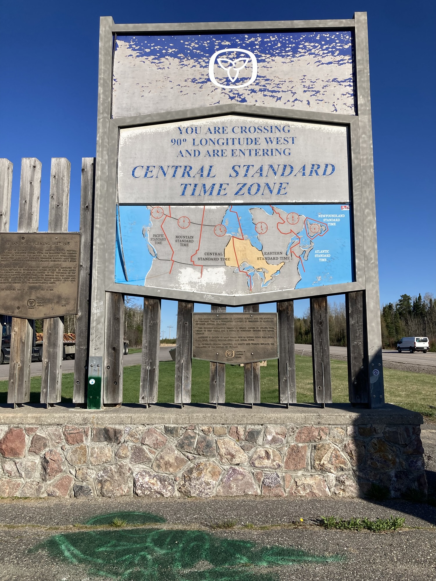
My first stop of the day (10:00, or rather 9:00) was a spur-of-the-moment swerve into the rest stop erected at the Central time zone line. The 90th Meridian park is bare-bones, but I gained an hour back! The sixth and final series of The Hitchhiker’s Guide to the Galaxy also ended at roughly that time, confirming my impression that it was largely useless. I then took on the recording of the two Hitchhiker’s live radio shows.
The second stop was very much planned: Just parking the car next to the “Mosquito carrying a man” sculpture in Upsala — didn’t even get out of the car, given that it adorns an industrial location.
I had one vexing problem in my schedule for the day — no stops for two hundred kilometers between Upsala and Dryden. That wouldn’t do: end-of-day fatigue is largely proportional to stopping early and often, so I kept my eyes open for any occasion to stop. I got two in Ignace.
The first was a spur-of-the-moment decision to stop in front of two splendidly abandoned buildings, remnants of a long-gone auto repair business. Such buildings were not uncommon throughout by trip up North — disaffected camping grounds, stores, restaurants, industrial buildings. Sometimes, they’re just left behind by time, with shuttered windows, broken components and vegetation slowly reclaiming the affront against it. At other times, such as in Ignace, humans actively make worse — the buildings are burnt, broken, heavily graffitied. It’s a harsh life up north, and not everyone makes it as long as they wanted.
I had stopped then partly out of conviction that this was it for Ignace and I wouldn’t get another chance to stretch my legs for a few dozen kilometers, but a kilometers later I saw another chance to stop: A few gas stations. I didn’t need gas yet, but I did crave… SLUSH.
Alas, no go: there was a slush machine, but it was off. 0/1 for the day. Although there was a bushplane exhibited in front of the convenience store, and I still got chocolate milk for my trouble.
The road got slightly more interesting after Ignace — terrain became hillier, lakeier, curvier, Nothing like the way around Lake Superior, of course, but more interesting than just a straight line through bogs.
By 10:44 (Central time), I was in Dryden, having a look at Max the Moose, who stands in the middle of a busy commercial road cutting through the city. In the backdrop, there’s the tall pulp mill and its smoke stacks. (Residents don’t like to be reminded about the mill’s sordid history of mercury poisoning.) Max is not alone! Pictures often fail to include his buddy eagle, or the Petro Canada tanks on the other side of the road.
While I saw but did not stop for the Sheep statue in Minnitaki, I definitely stopped in Vermillion Bay for Bobby’s Corner & Gas Station, which sports a gas station (fill up!), a very charming hunting-and-fishing store, a quaintly folkloric washroom (complete with signs telling truckers to shower elsewhere, and pointedly does not put paper towels inside the washrooms), a twelve-foot-tall inuksuk (You are on the right path) and -ho boy- ONE working orange slush machine. 10/10, would stop again.
“It’s a good day for one of those”, commented the clerk about my slush and indeed, my stroke of good meteorological luck continued today with mostly-clear skies and temperatures in the mid-twenties. This would get uncomfortable soon enough, but for now I was just happy not making this trip in the rain.
By the time I left Vermillion Bay, it was 11:30 and I was recalculating my schedule for the day. My original plan was to get to Winnipeg and maybe visit part of downtown, knowing that I wouldn’t make it there before the 17:00 closing time for the Human Rights museum I wanted to visit. But that pre-trip plan did not account for two things: First, that I would be on the road an hour and a half before 9:00; and second, that I would get an additional hour thanks to the time-zone change. Looking at the clock, at the number of kilometres left to go and my tendency to hurry through stops, it increasingly looked as if I would be able to get to the museum 60 or even 90 minutes before closing time. Hmmm.
That new plan was severely wounded around Kenora. Twice.
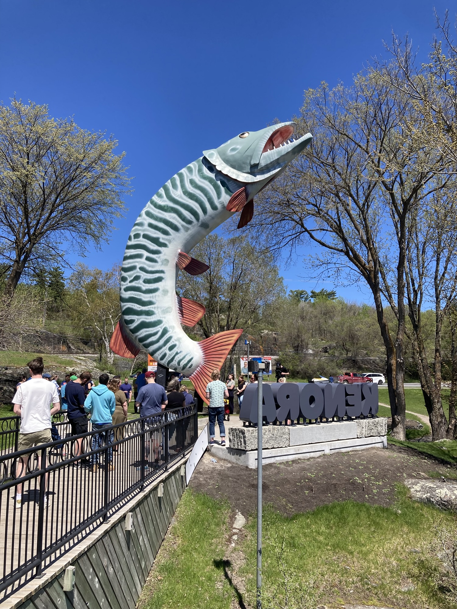
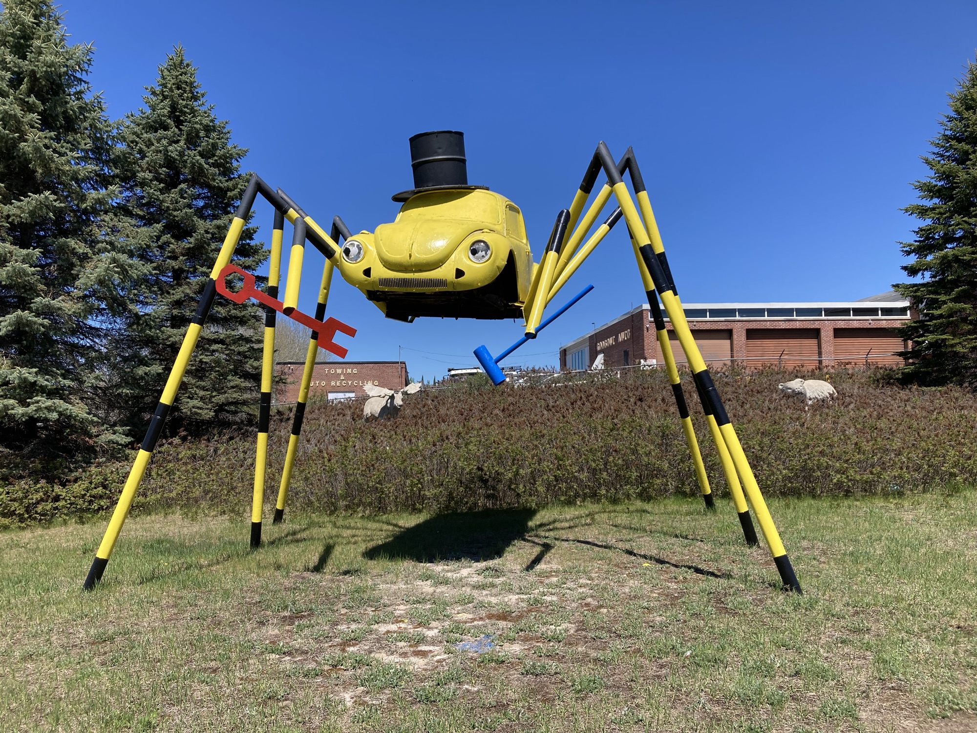
My next two stops were in the Kenora area, but I miscalculated in entering my second stop in the town in the GPS rather than the first. Part of it was because “huskie the muskie” was easier to enter than the cryptic address of my other destination, and part of this was a misplaced conviction that I would see the other landmark well enough. The problem was that the highway splits around Kenora — the main 17 goes around town, and the old 17 goes through town. My GPS, in leading me to Huskie via the highway going around town, never got me to pass in front of my second attraction.
I thought about it as made my way to Huskie the Muskie (who was mobbed by a group on an outing) and took in a picturesque area of Kenora. Would it be worth going back to the second attraction? I decided that I had some time — a ten-to-fifteen minutes detour would cut into Museum time, but would not severely harm things. So I doubled back in search of the second attraction.
I expected to conclude this bit of my travelogue by “the attraction wasn’t all that, but it was worth it for going through old Kenora.” And old Kenora is worth a look — old classy buildings, one wonderfully old-school movie theater, and the feel of a small mid-twentieth-century Ontario town.
But that second attraction? Worth the detour. Oh, sure, you may not expect much from a steel Spider Volkswagen Bug, but that’s because you haven’t seen in live in its magnificent glory. Freshly repainted, it’s glorious. I got my favourite selfie of the whole trip out of it. And it comes with a hidden moose and bear in the background.
My the time I rejoined the highway and sped past my previous exit point, I was feeling pretty good about myself! The Hitchhiker’s Guide two live shows were done (the first episode is overly reverential to the first book of the series, but the second is a great remix of the rest of the series, exactly what I wanted), I was midway through the Album versions of Hitchhiker’s Guide, the schedule was still working in my favour, and — well, what could go wrong? Heck, I’d even stop at the Constance Bay convenience store for another slush.
Then the highway traffic stopped to a standstill.
I was initially behind a truck, so I didn’t have a good grasp on the situation. Surely this was just another one of those one-way closures because of construction, right? I had seen half a dozen of those already today. Just a few minutes and we would be on our way.
But no! The traffic did not move and kept not moving. Traffic on the other way was intermittent. When traffic inches forward, I could see the curve ahead and… it wasn’t good. Nor was it moving.
I checked the GPS. It was bad enough that the “alternate route” it suggested due to “road closure” added three hours to the journey and required going though the United States. No way: I’d rather idle in heaven than speed through hell.
Traffic slowly, agonizingly inches forward. Whatever was happening was happening far ahead that I couldn’t even see what was happening.
At some point, I made my way to the Constance Point Convenience store entrance. I stopped, even if it wasn’t a good idea — re-entering the immobile traffic would be painful, and things probably wouldn’t improve in the ten minutes I would spend in the store.
But I did stop. No slushes, but a really fun eclectic collection of everything a hunting/fishing party would need, including fireworks, in a rather clean and professional arrangement. Also: decent washrooms, and an ice cream cone for the road.
I was wrong: Waiting in line with an ice cream cone was much better than had I not stopped at all. Miraculously, it was easy to re-enter the queue. Even more wonderfully, traffic picked up. But I had still lost another 30 minutes, plus the 15 minutes of doubling back to see the Spider Volkswagen.
My new plan was shaky. I still had two more stops in mind: The Manitoba border welcome station, and the Centre-of-Canada marker. If everything went well, I would make it to the museum with 45 minutes to spare.
I got a few minutes back at the Manitoba border — not only was there no clear “Welcome to Manitoba” sign that I could seen, the tourist stop was closed with barriers when I pulled off the highway to check. Plus, as a bonus, I re-entered the highway and cleared the long succession of 18-wheelers lining up to the weighing station.
All right then — my plan got better!
I finally finished the last episode of the last version of The Hitchhiker’s Guide to the Galaxy right before Manitoba border, which permanently enshrines the theme song of the series (the main bit of The Eagle’s Journey of the Sorcerer) as my theme song for Ontario. I’ll end up making a multi-medium review of The Hitchhiker’s Guide to the Galaxy various versions before long, but the ideal order is something like Fit the First, the LP adaptation of The Restaurant at the End of the Universe, Fit the Third to Fit the Fourth (omitting its last thirty seconds), maybe Fit the Fifth and then probably the second live radio show as a chaser. The movie makes for great casting, but the TV show is much funnier — they’re best thrown in after the LP adaptation of the second season. Then read the first four books, maybe the fifth one. Fit the Second is kept as a particularly weird alternate take.
Not being in the mood for another information-heavy podcast, I then took in the first five of the twenty-some Electro Swing Podcast interviews, which are more interesting for their collective sense of “the scene” circa 2025 than for the music or the artists — although everyone so far are really nice interview subjects.
The road from the Manitoba Border to Winnipeg is notable for three things: For one, it becomes a real-deal four-lane highway a few dozen kilometres past the Ontario/Manitoba border — good for you, Manitoba! For a second, it’s pretty much a straight line for tens of kilometres, only interrupted by an angle that redirects you to Winnipeg. For a third, it’s slightly past that angle that I got a tantalizing hint of the Big Sky prairies feeling I was looking forward to: The forests abruptly disappeared and I could see uninterrupted for kilometres around — a very strange feeling for those used to hilly terrains and omnipresent forests cutting off sightlines. Sure, there are a few distant clumps of trees and enough signs of human life that it’s not nothingness — but I hadn’t seen anything like it before.
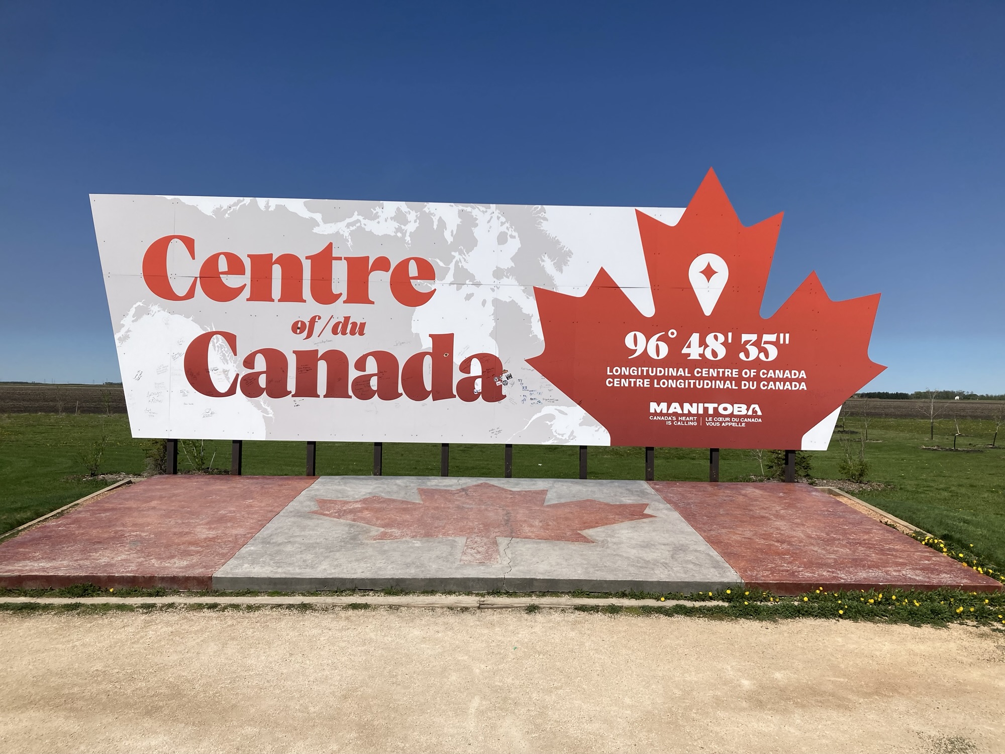
My stop at the Centre of Canada marker, just a few dozen kilometres away from Winnipeg, was both a thrill and a disappointment: Hurray, I had made it to the centre of Canada, and it only took me three days of driving! But the place itself is more an Instagram magnet than a serious rest stop: It’s barely off the highway, through two dirt roads, stands next to a fields with nothing else around and looks as it it could be blown away by the next budget cutbacks. It looks much cheaper that it should. I hope it becomes a more substantial attraction eventually.
I was progressively getting used to big-city traffic once again when my new plan to go visit the museum got another serious blow. Traffic stopped solid for… a train. 12 minutes of a train. (At four seconds per car, because I counted, and taking out 30 cars because of measurement uncertainty, that should be roughly a 150-car train.)
Add to that a lot of last-minute rush-hour downtown traffic and we were back to very thin margins — 35 minutes to park the car and visit an entire national museum. Impossible! you say. Except for three things:
- It’s not that big of a museum
- You have no idea of how quickly I can take in a museum
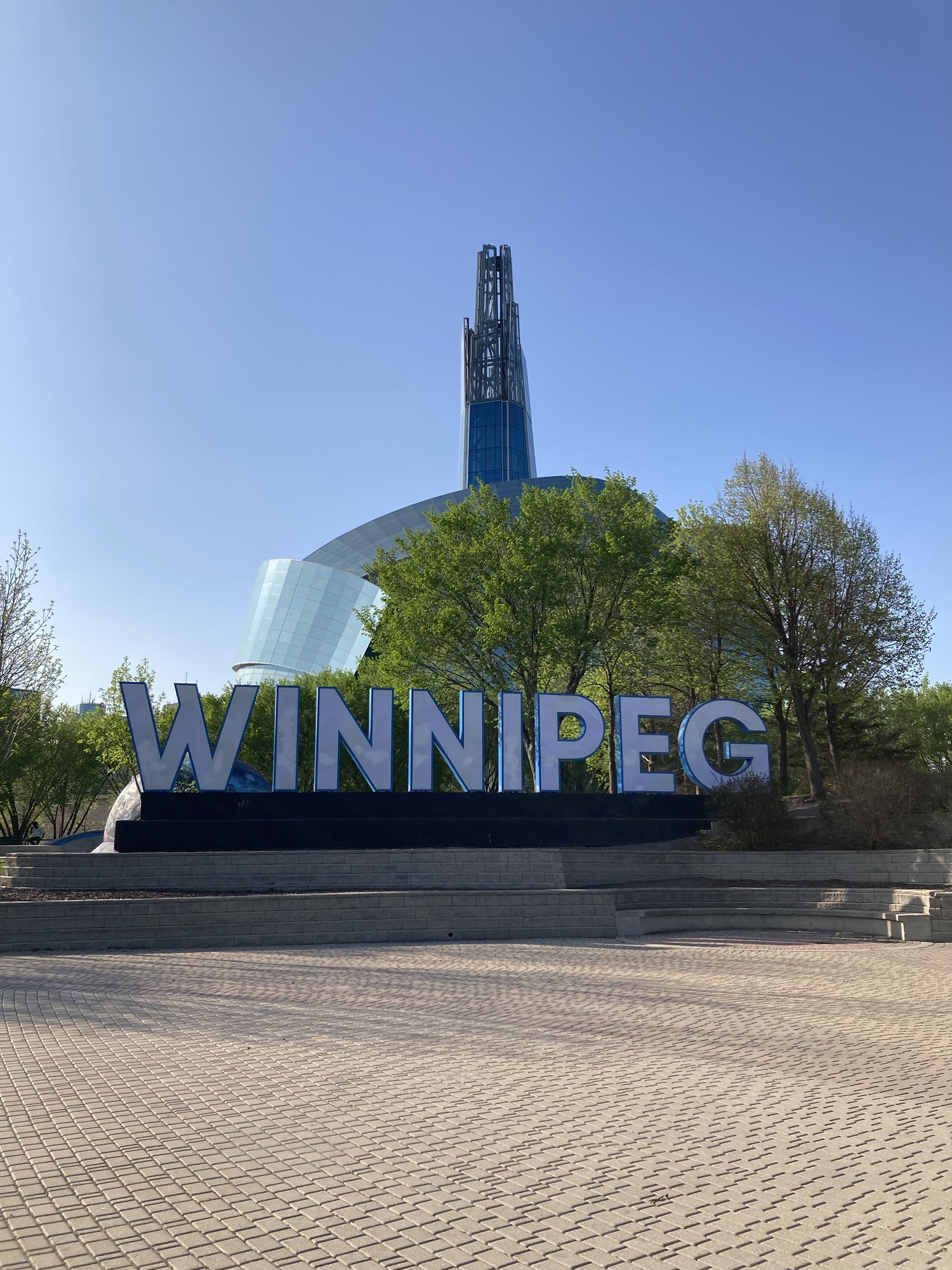
- Impossible n’est pas français.
I found a parking garage next door to the museum, didn’t see a way of paying for parking, decided to take a chance, and made it inside the museum by 16:27. I was the only person in line for tickets. “Vous savez que le musée ferme dans trente minutes, n’est-ce pas?” Yes, I did. “Un conseil pour visiter: prenez l’ascenseur vers le huitième étage du musée, ensuite descendez.”
That was a great tip. Wonderful tip. Very sensible tip. I ignored it, and started climbing the museum’s eight floors.
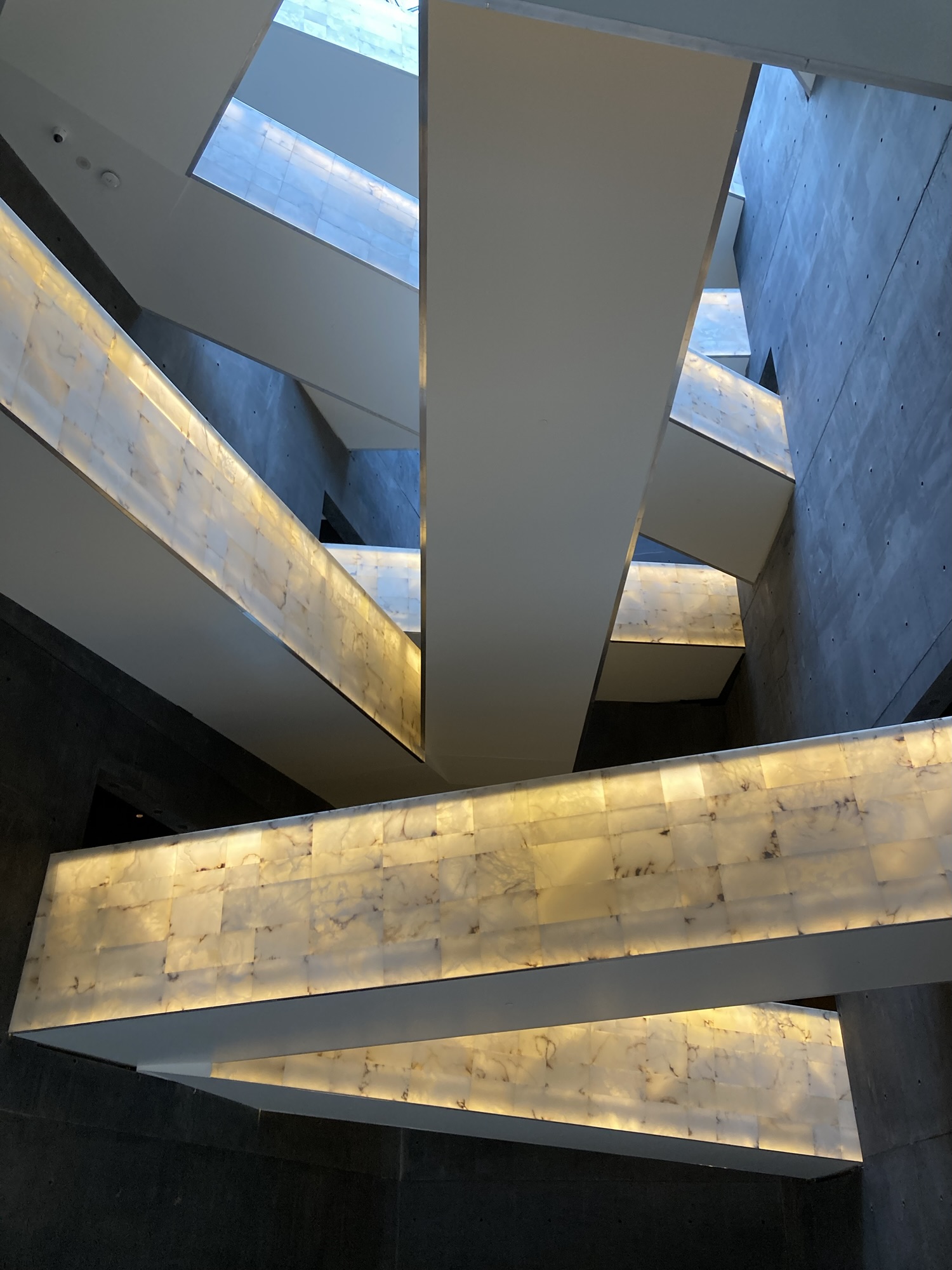
You have to know that the Human Rights museum, one of two national museums not located in the Ottawa area (and the last one I hadn’t visited, which explains today’s maniacal obsession), is a taller-than-wide building that spreads its exhibits over eight floors, with twisted ramps allowing visitors to climb up (or down) the entire museum. It’s quite linear as museums go, and the ramps criss-cross the vertical and horizontal space, probably taking up as much space as the exhibits itself. In other words, it’s a museum almost custom-made to rush through.
It’s not as if I needed to be convinced about the museum’s righteousness — taking a refreshingly idealistic position that “all human beings are born free and equal in dignity and rights” (as per a gigantic banner hung for all visitors to see), it details efforts to enshrine and protect a variety of human rights. (I’ll add more about its founder’s influence on the museum in the full version of this travelogue, but in the meantime, have a look at this.) Amazingly enough for non-Canadians, it’s a museum that’s incredibly harsh on the country’s human rights record: Galleries detail discrimination, violence, persecution against marginalized populations and encourage us to do better. There are exhibits on genocides, Indigenous rights issues, Japanese interments, discrimination against LGBTQ+ individuals and other not-so-glorious moments in history.
I like that a lot. It says a lot about this country that it can build a national museum that acknowledges the issues of the past, the problems of the present and encourages us to do better. Even as other countries do their best to erase, deny or minimize their history (as I look southward), it’s a real strength to be able to be honest about where it went wrong.
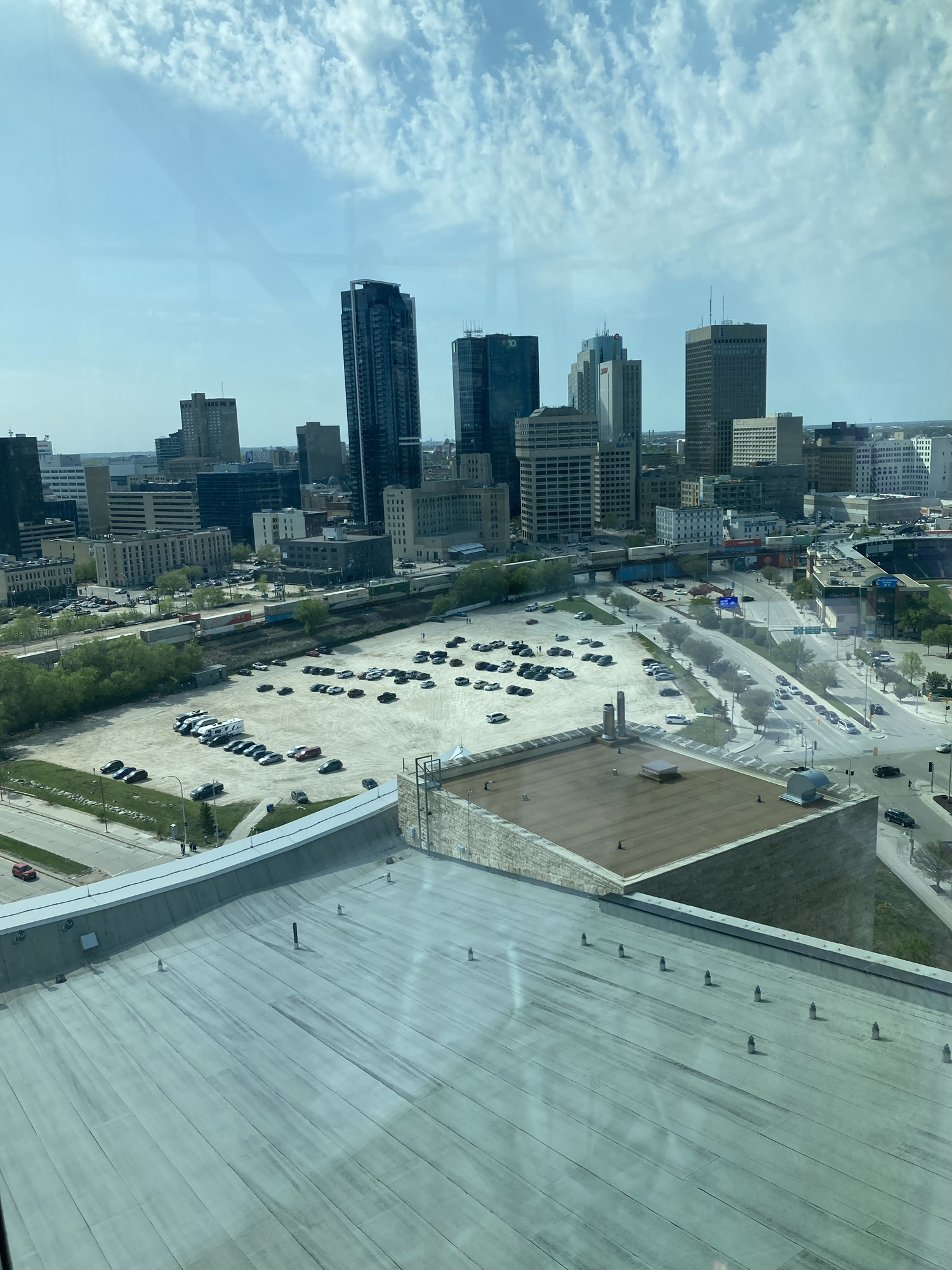
The other thing about the Human Rights Museum is that architecturally, it’s nothing short of incredible. The audacious conception of the building is a wonder, and it keeps extending into the bold use of vertical space, the really cool “Garden of Meditation”, the glass-clad spire that gives an amazing view of Winnipeg, and the alabaster ramps criss-crossing the building. As a national museum building, it stands next to its brethen with pride.
Where I’m not so sure is about the content of the museum. Even allowing for my breathless visit, it seemed a bit thin on substance. It’s all very nice (and I know better than to expect actual education from a museum), but the density of exhibits and information seemed low. Yeah, I get the argument that it’s a space for contemplation more than substance, but even then I expected more.
In any case: I made it to the top of the tower (eight floors!) after twenty minutes, took in the view from downtown to Saint-Boniface, took many pictures, got back to the first floor to take in the temporary exhibit I had missed, and got out of the museum as it closed at 17:00.
Which meant that I was in downtown Winnipeg with hours to go before I had to get back to the hotel, with plenty of opportunities to visit landmarks.
After regularizing my parking situation (turns out the parking machine is on the other side of the building, away from the entrance — go figure!), I set out to visit The Forks. A park, a meeting place, an homage to First Nations, a nexus for cool shop and restaurants, a showcase for public art and photo opportunities — that’s The Forks for you.
I should probably add that this wasn’t my first visit to Winnipeg, but that visit in 2009 had set the bar on the ground. I frankly disliked Winnipeg the first time around. The full story (partially told elsewhere) is too long to write a few minutes before bedtime, but I went there to attend a “world” genre fiction convention that was organized by a (now deceased) egomaniac who could only pull fifty people; it was miserably cold; Winnipeg is not always fun; and there was so little to do there that I pay a few hundred dollars extra to come back home early.
So, my expectations for this time in Winnipeg were… measured. But it was sunny, it was hot (27 in the shade) and I was in a better mood. The Forks set a really good example to follow: the public art is interesting, the little facets of the park are well integrated in a way that (say) Thunder Bay isn’t, and even being too late to visit a few places didn’t harm the visit too much.
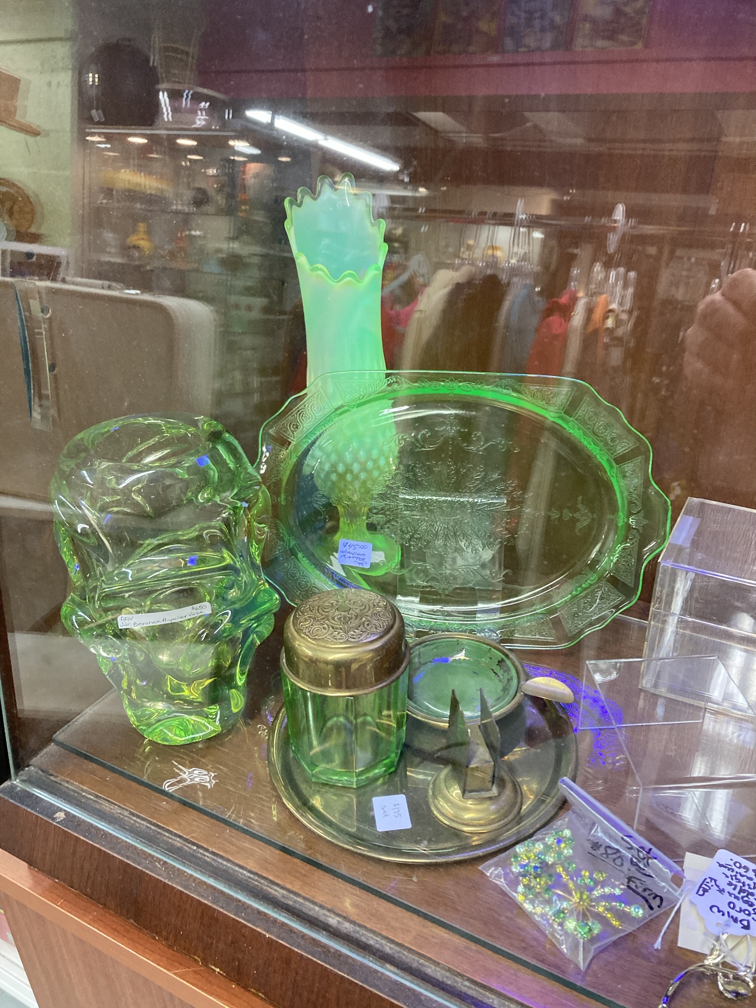
I’ll recommend the indoor stores building — cool shops there, the most interesting of them being a basement bric-a-brac with thousands of objects to contemplate and buy– including uranium glass. If I have my facts rights, this is a place where several vendors can show their wares and sales are handled centrally, which explains the incredible, eye-popping variety and volume of stuff, souvenirs, tchotchkes, trinkets, ephemera, toys, books, comics, and other things in there. Even I, not usually prone to childhood nostalgia,I was gobsmacked to recognize a owl hand-puppet straight out of my youth. Among so, so, so many things. Worth the detour downstairs.
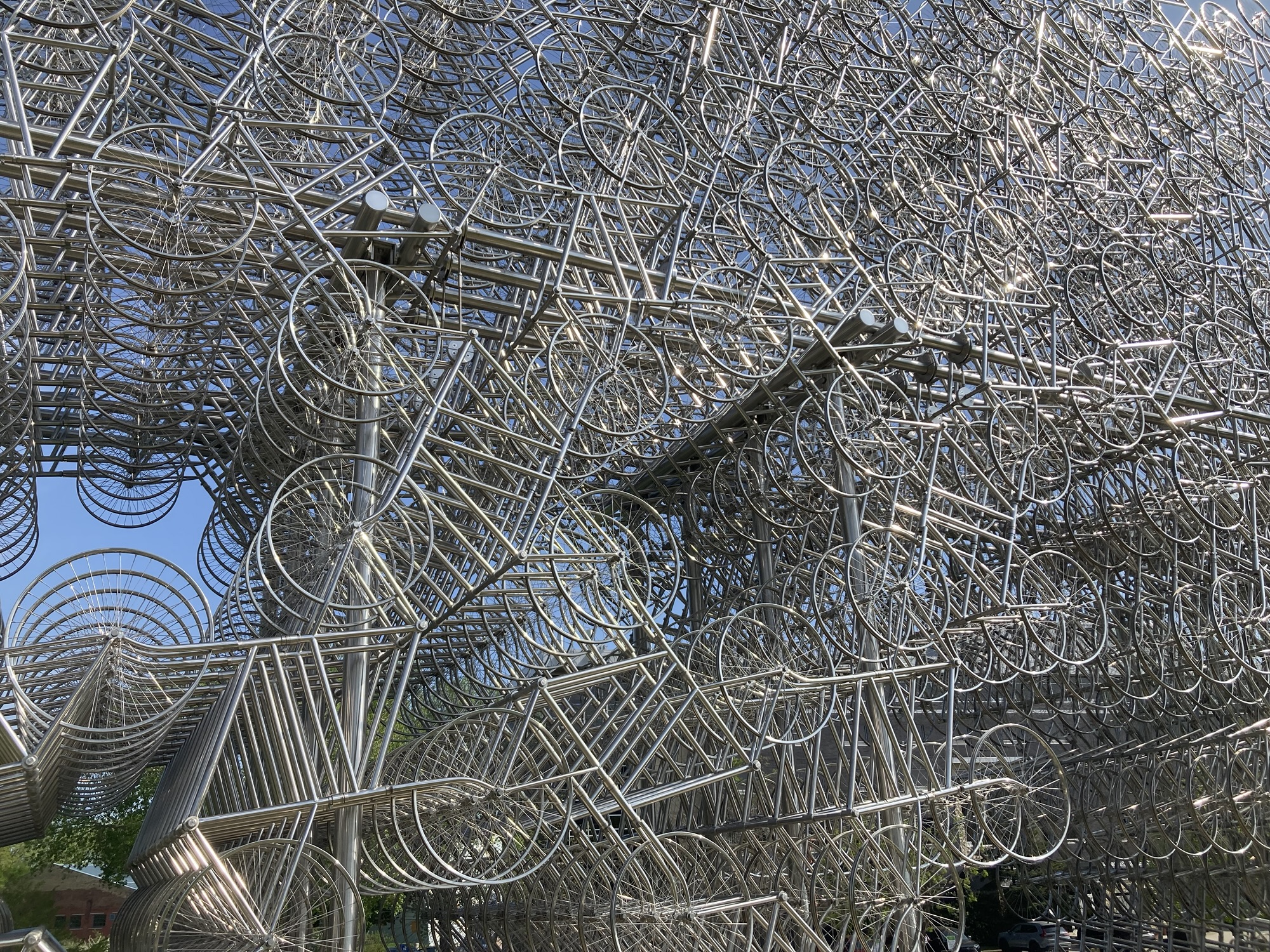
Otherwise, there’s a really good dining hall experience next door, a really cool public art with hundreds of stacked “bicycle” forms, a great shot opportunity with the city’s name and the museum in the background, a pedestrian bridge leading to Saint-Boniface, a Statue of Mahatma Gandhi, a symbolic curved paved path cut by a straight (but more difficult) path, and so on. The Forks were one of my unqualified good memories of my previous trip to Winnipeg, and they were a highlight of this one.
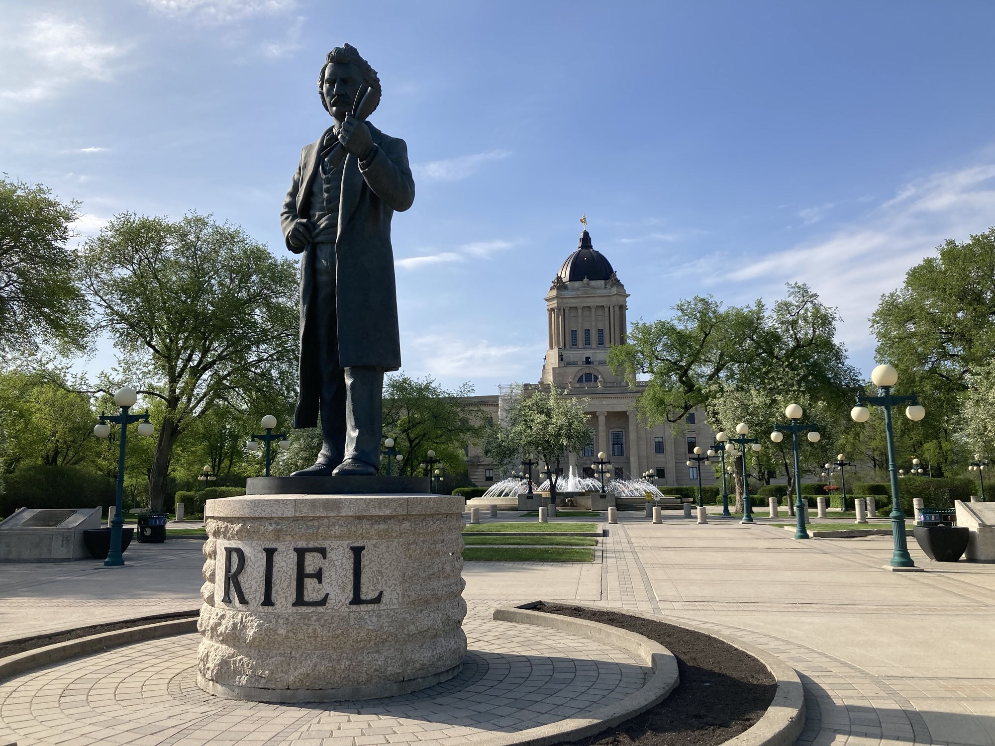
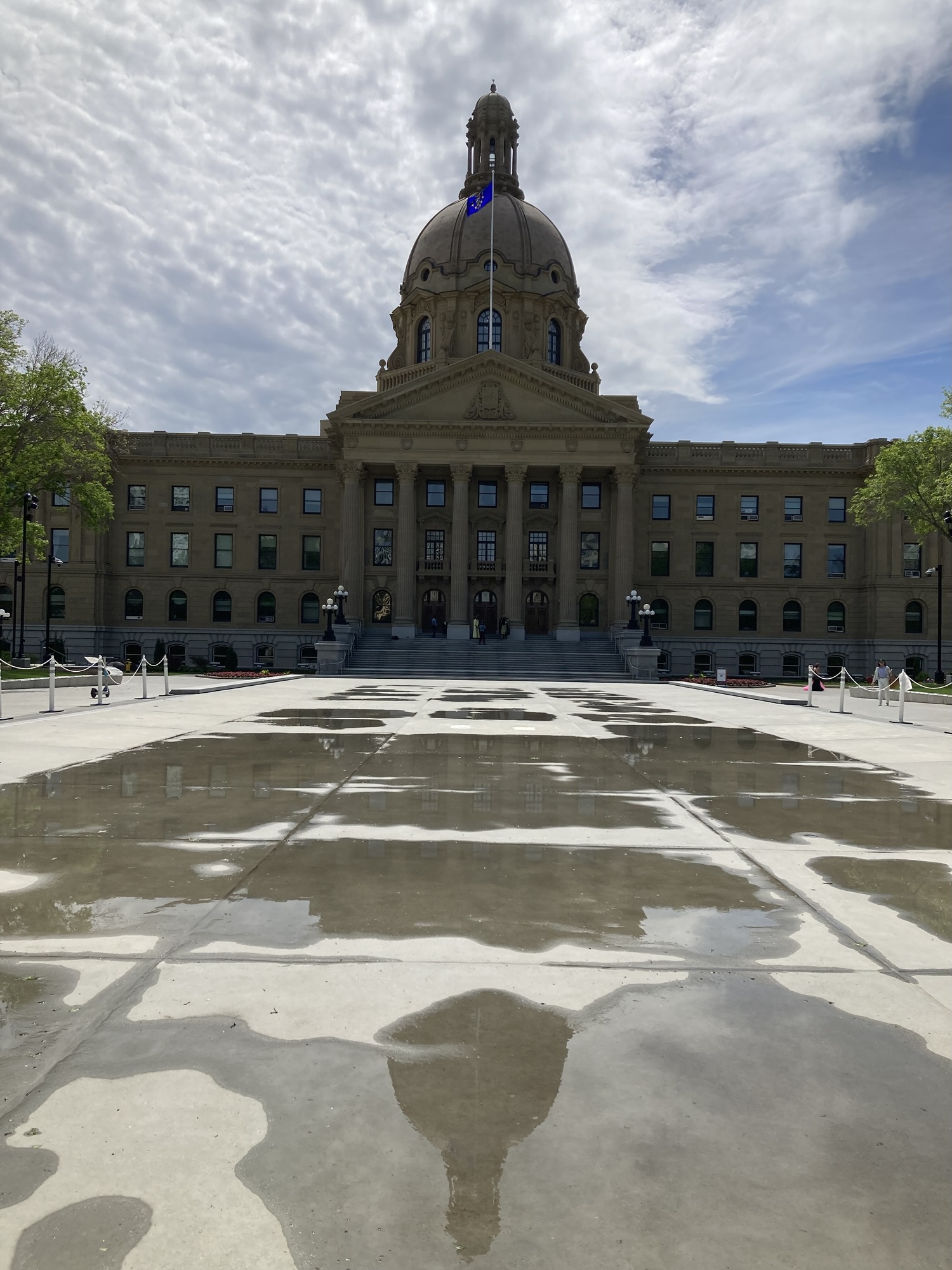
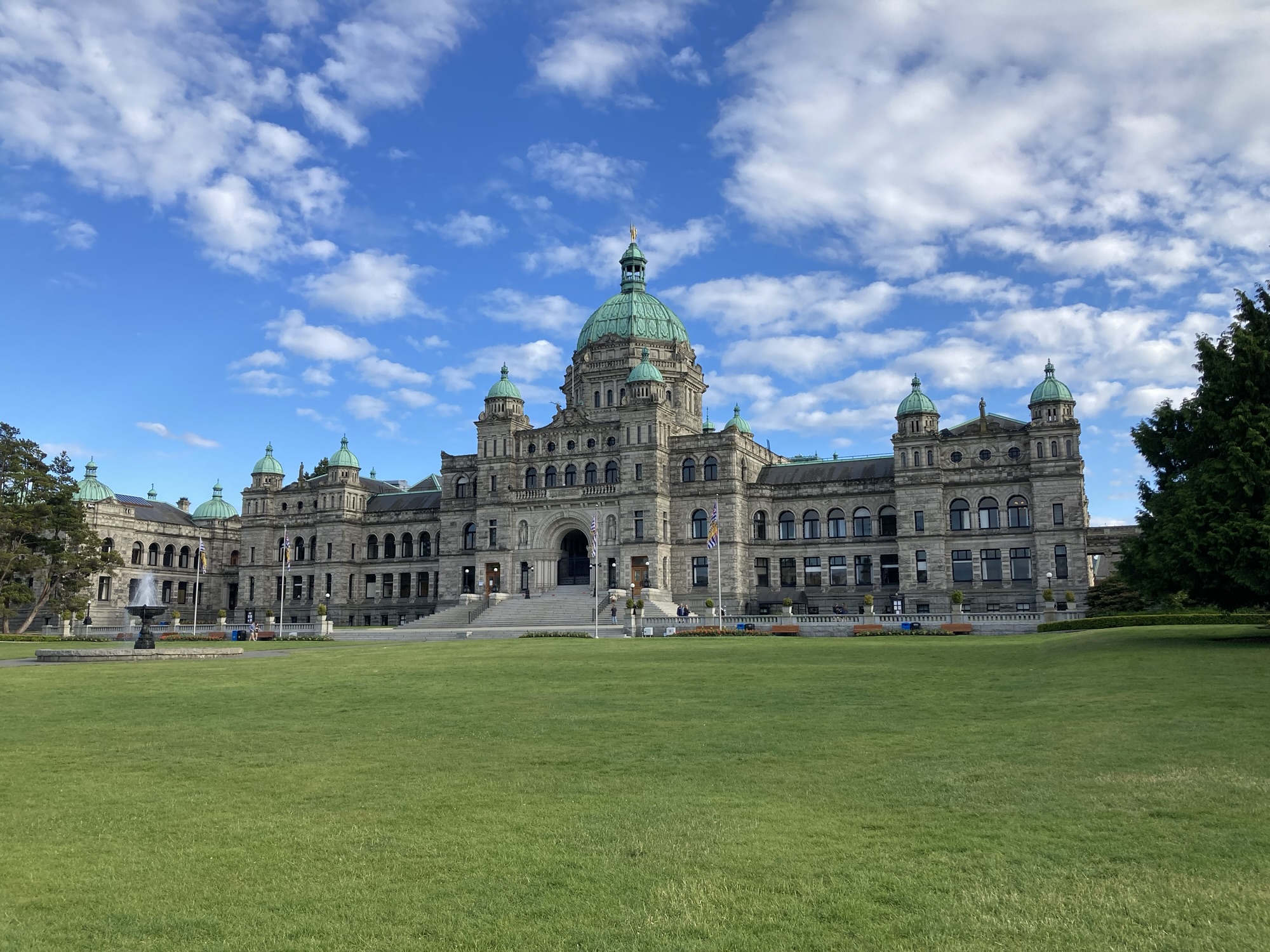
Taking a look at the time, I decided to go for a stroll and advance one of my side-quests for the trip. Taking a short hike, I walked the kilometre-and-a-half to the Manitoba legislature (majestic building, surrounded by a lot of parkland), then went north to the main Portage street, then came back to the car.
Winnipeg has, since my last time here, considerably improved its appearance — new buildings, refurbished main street, more focused downtown. But it still has issues: it frequently smells of urine and cannabis, often features cast-offs (or the cast-offs’ cast-offs, such as the bra offhandedly lying off the city’s main street) and people are not all well around downtown. I cross a young woman in a dark passageway near the boarded-off Hudson’s Bay building and just as I had convinced myself that young women were usually less dangerous than young men, she sat down on her bag and screamed “I HOPE YOU DIE” in her phone.
Ah, Winnipeg. There’s a whole song about it.
But I may be exaggerating for effect. I certainly like Winnipeg more than I did before visiting, even if I only saw a very small and non-representative part of it.
Once my brief downtown tour, I got back to another side-quest and made my way to the Costco closest to my hotel to scarf down my Manitoban hotdog (2/5!) The store itself felt more like the Sudbury store than any of the Ottawa-area ones, but let’s see if this holds up.
I finally made my way to the hotel by 19:30 — another unassuming edge-of-the-town temporary destination. I got assigned an accessible room, which has interesting features I don’t usually see elsewhere (especially in the bathroom).
Once checked in, I made my way to Smitty’s Restaurant/Lounge for my sit-down meal of the day (Fettucine Alfredo with Salad, in a switch from my burgers so far). Smitty’s reminded me a lot of Perkins for its unassuming family fare — although the separate lounge is not for the families. In any case –satisfying supper.
I chased that with a visit to the neighborhood 7/11, which meant an entire row of slush flavours and a line of people are jostling to use the machines. MY PEOPLE! Half the flavour were broken down (which seemed to be the rule for this specific 7/11), but I still had myself a lemonade/grape blend. (even if, thinking back, I really should have gotten a root beer slush. Maybe tomorrow.)
I capped off the day with another walk along the hotel’s immediate surroundings. Charming neighborhood: while heavy in chain stores and restaurants, it hosted a large motorcycle enthusiasts’ get-together in the Home Hardware parking lot, and many families out and enjoying the weather. My opinion of Winnipeg keeps going up. I’m sure I’ll like it some day.
Otherwise: more writing and an early bedtime. Now that I’m pretty much done with Winnipeg, my original plan for tomorrow (which was to start the day at 10:00 with a visit to the museum) changes: Should I leave earlier than 10:00 but sleep in later than 7:00? Can I now justify the hour-long detour to see the Souris walking bridge, or spend more time walking in Regina? Does this solidify the Qu’apelle scenic detour? Stay turned for tomorrow’s exciting adventures!
Steps for the day: 16,980
Day 4 – Thursday, May 28, Winnipeg to Regina (600km)
Not much went according to plan today, but I’m in Regina and it was still a pretty good day of tourism despite the unusual heat.
I decided that I would cash in yesterday’s time dividend in two ways — I would get up later than the last few days, and I would explore more of Regina. Accordingly, I ignored myself waking up at 6:45 and waited until 7:30 to finally get up. Showing and packing up are becoming a habit, but the wrinkle that slowed me down was making use of the free breakfast coupon received upon check in. Not a continental breakfast buffer, mind you — a real honest eggs-and-sausage-and-fruits-and-toast-and-jam sit-down breakfast. Delicious, but it did add at least 15 minutes to my departure time.
After cleaning my windshield and filling up at a nearby gas station, I go on the road to Regina shortly after 9:00. After clearing the ring road traffic, I settled on the four-lane highway west. I was struck at how quickly the outskirts of Winnipeg disappeared, replaced by the almost-infinite vistas of the Prairies. While the effect was inconsistent throughout the day, as patches of trees, human habitation and slight terrain elevations broke up the horizon, there were times when I was astonished at how far I could see, all the way to hazy shapes near the horizon.
One thing that took some time to accept is that the Transcanadian highway in Manitoba (and Saskatchewan, as I’d find out) are built differently than highways one othe other side of the Lake Superior. It’s not significantly elevated above the surroundings, and there are no access ramps — streets simply cross the highway. Most of the time, someone wanting to get on the highway better be patient and wait for a gap in traffic — and trust that the acceleration of their vehicle can deliver. Some major intersections have traffic lights. A railway isn’t too far away most of the time, and seeing a fully-loaded 150-cars-long train pass is like seeing a wall appear on the Prairies.
Otherwise, I got to find out by myself what other people were talking about when they discussed just how dull the drive is from Winnipeg to Regina. It’s certainly not difficult: The road is generally straight, the traffic is light, the speed limit goes up to 110km/h, and it’s four lanes all the time. But there is nothing to do and not much to see.
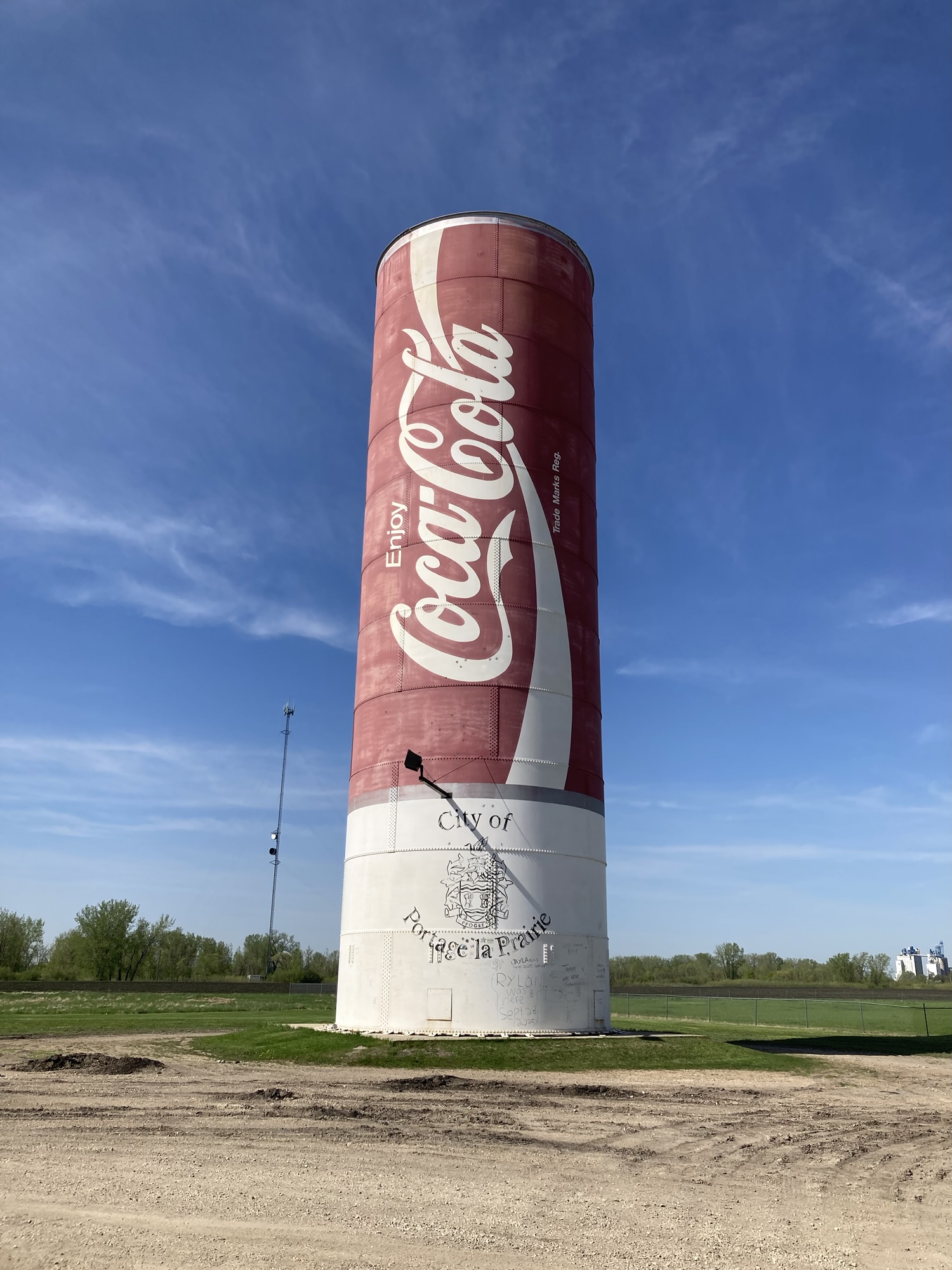
My first two planned stops were in Portage la Prairie, a small town that the highway helpfully avoids. I dove right in, saw a 7/11 and stopped for my promised root beer slush, then made my way to the much-ballyhoed “World’s Largest Coca Cola Can”. It’s a silo painted like a coke can, and the paint is turning pink from sun exposure. The biggest surprise is just how much it isn’t a tourist attraction: it’s located in a gravel parking lot at the back of a store and not necessarily welcoming. I’m not sure I’d call it a disappointment, though — what else to expect?
My research had turned up something called “Canada’s Largest Great Grey Owl” not too far away, so I drove to have a look and saw… what appeared to be a large sculpture of an owl, but clearly on private property, behind a few bushes. I did not get out of the car. Nice owl, though.
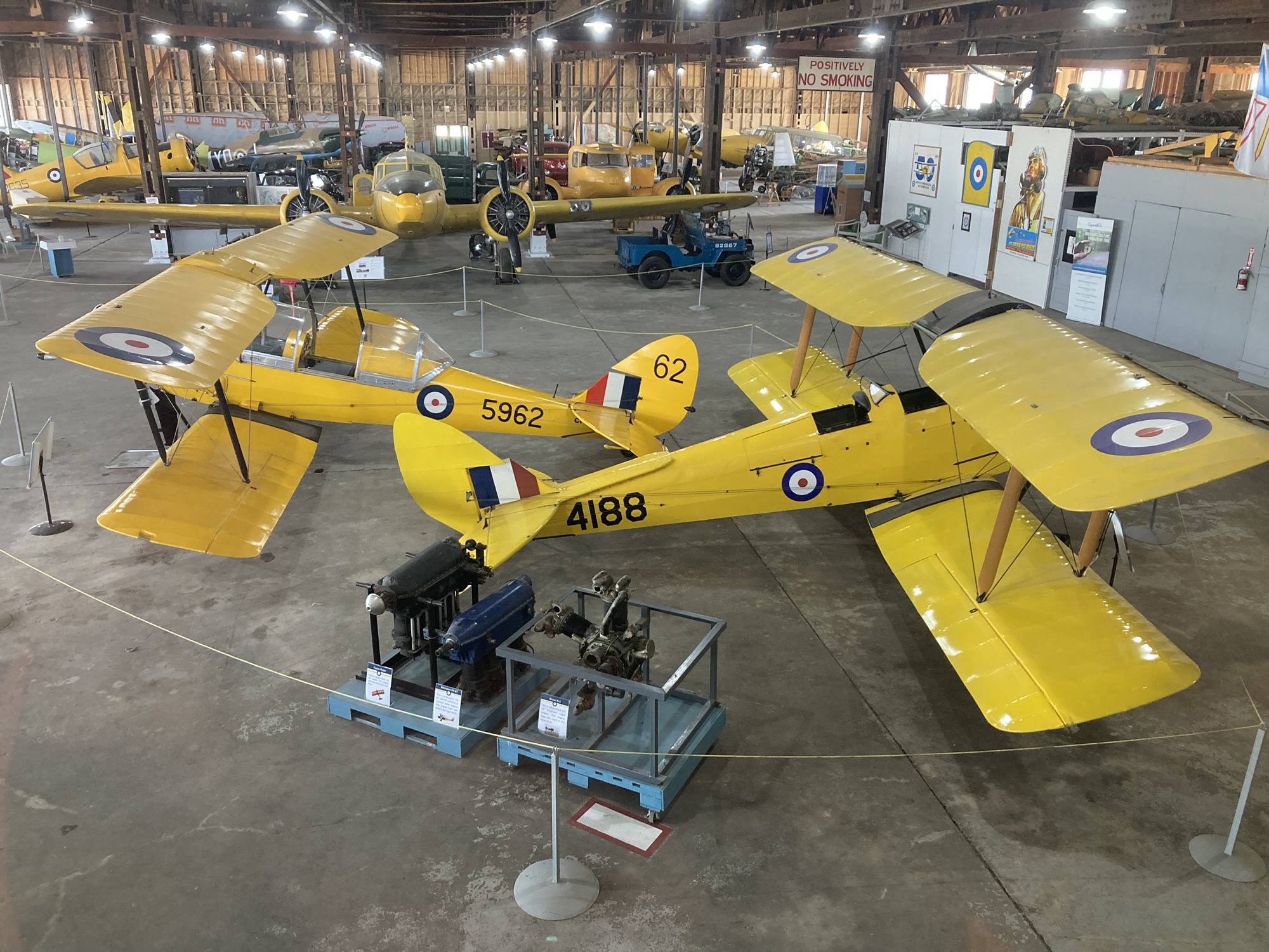
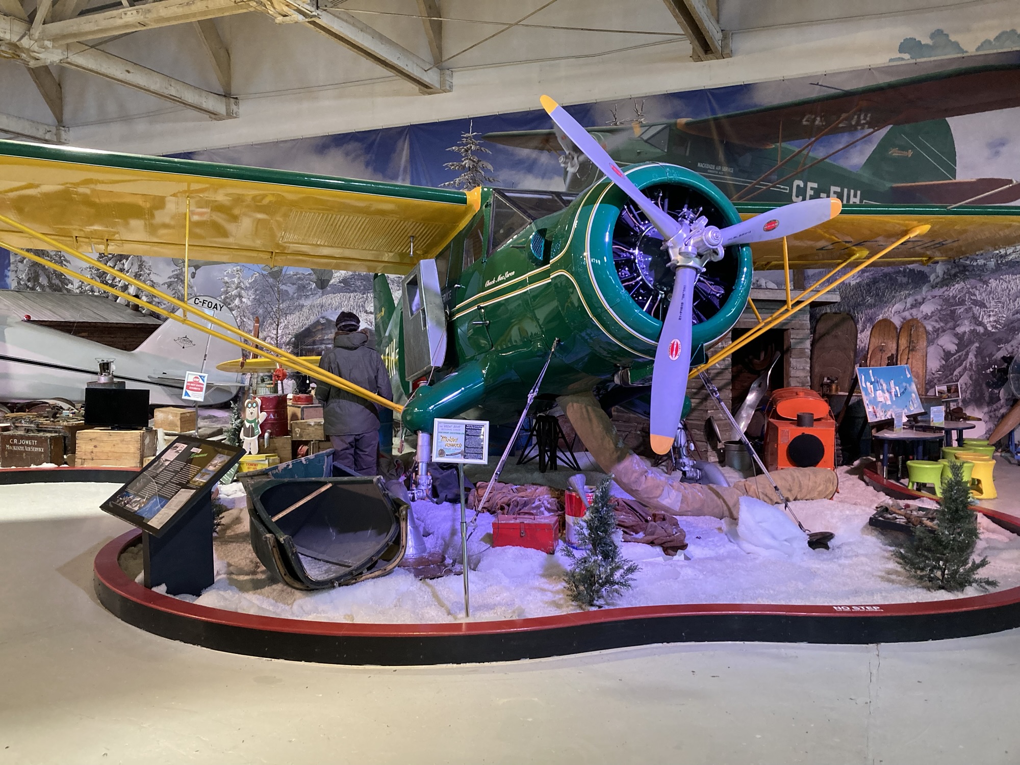
It took me an hour of uneventful driving, binge-listening to the Electro Swing Podcast, to get to my next destination: Brandon’s Commonwealth Air Training Plan Museum, which focuses on the extensive pilot training given to young men during WW2. The museum, located a bit north of the Highway, is near an airport and is located inside a working hangar. There you’ll find three room of WW2-era artifacts and narrative about the program, as well as a hangar containing many, many vintage planes, engines and vehicles. Among the artifacts is “Stubby”, a vintage plane you can climb into to experience the feeling of sitting in the pilot’s seat. (Of course I did.)
While the planes themselves are impressive (and there’s a fair amount of place and exhibit notices to show just how painstaking the rebuilding process can be), perhaps the best thing about the museum is found in bits and pieces in the notices, as they describe a training school attended by young men prone to the usual young men follies: daredevil flying, silly questions, marriage proposals, and haircuts. There’s a good movie to be made about this, and the material is all in the museum.
The plan for Brandon was to go from historic machines to high-tech nature — my research had turned up something called a “Holographic zoo”, although it felt more like a trend-chasing exhibit than anything seriously educative. After fifteen minutes of Brandon city traffic and sight-seeing, I finally made my way to an unassuming building on the southern outskirts of town announcing HOLOGRAPHIC ZOO and VR ESCAPE ROOMS. “One for the zoo!” I asked. “Oh, we don’t have the zoo anymore.” Ah.
So I got back on the road again. Time wasted by going through town, or time gained by not having to visit the zoo? I shrugged and looked at the time: if everything went well, I could make two or three more stops and still get to Saskatoon before the closing time of the Royal Saskatchewan Museum. But it would be close.
I stuck to my plan and skipped the hour-long detour that would have been the Souris Swinging Bridge, reasoning that there was another, much close Swinging Bridge along the way.
I was clearly tired on the way from Brandon to Moosomin — a combination of accumulated fatigue, having gone to bed too late in a bid to finish writing up the previous day’s adventures, the straightforwardness of the road and probably, I realized too late, not having drunk a can of caffeine during the day. (I say “too late”, because by the time I realized it, I was getting into the “disrupting tonight’s sleep” time of day for drinking caffeine.) By the time I crossed the Saskatchewan border, I was really looking forward to a burger at the famed Red Barn restaurant.
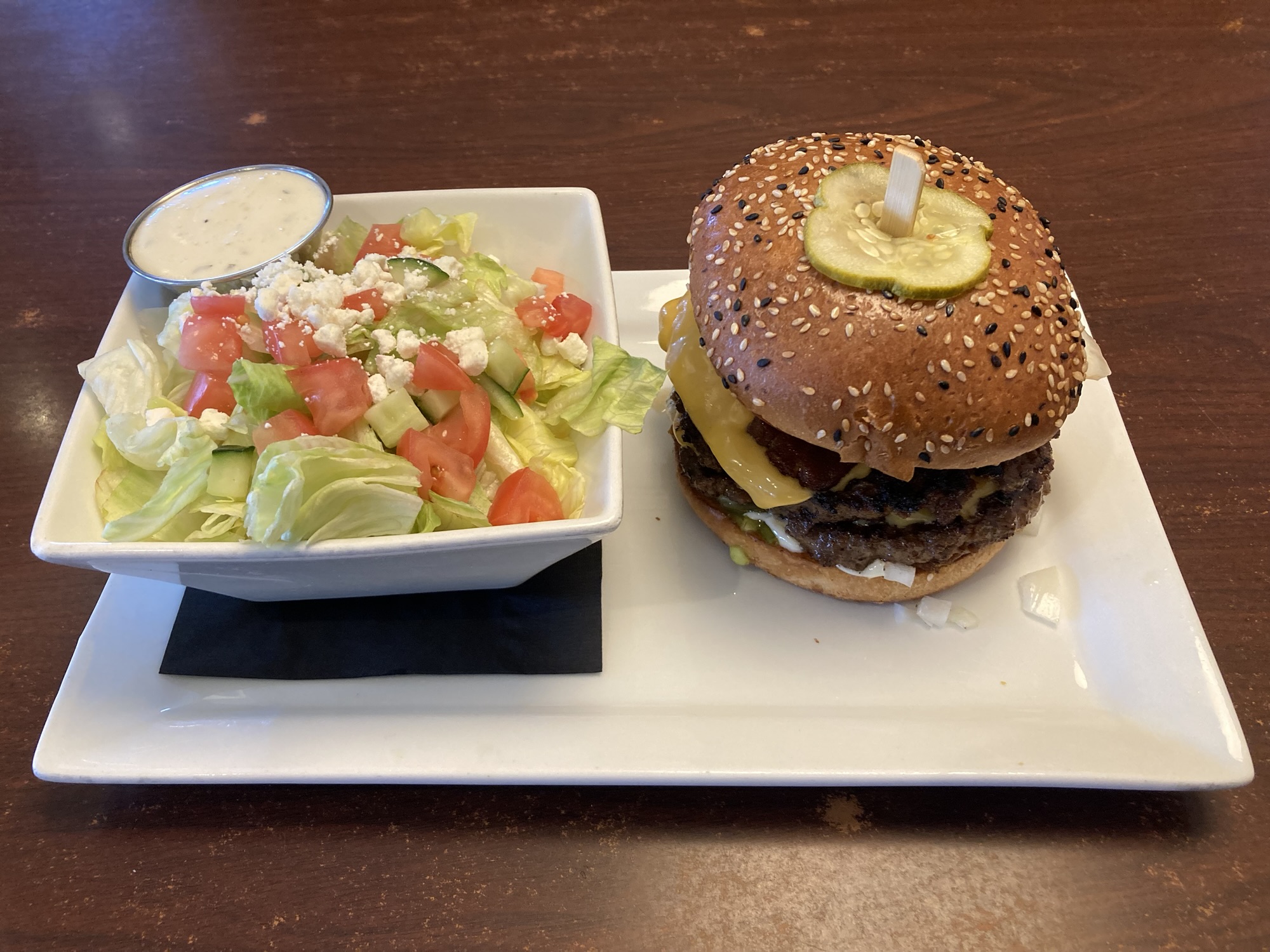
In my research on things to do between Winnipeg and Regina, there had been one unqualified winner: Red Barn, especially for its Bronco burger. When in Moosomin… And wow, did the reviews get it right: That Bronco is a mega-burger: two patties, fully loaded. The kind of burger you eat with the toothpick in the middle and still make a mess. (I also asked for a side of salad.)
The other thing I realized while sitting at Red Barn was that I had crossed into another time zone — I thought it would happen at the Alberta border, but not! That SK/AB time change is true during the winter (because SK doesn’t play with time changes) but not during the summer! So, hey, another free bonus hour today!
Recalculating…
That made the Qu’apelle Scenic Route barely possible. But even a sit-down Bronco burger couldn’t quite wipe out my accumulating fatigue. I decided to stick to the first revision of the plan and head for the Royal Saskatchewan Museum anyway — any additional time would be invested in going to bed early.
I still had two stops to make beforehand, though:
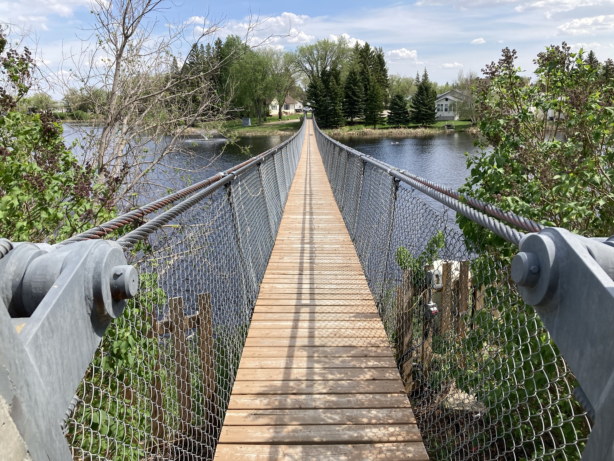
The first, in lieu of Souris, was to take in the Wolseley Swinging Bridge, a pedestrian crossing over a river that was built before the city got a bridge, then was kept as a folkloric attraction. It’s actually pretty near — solidly built with thick braided steel cables and enough fencing that your phone probably won’t fall out if you drop it while on the bridge, it’s not particularly useful but rather pretty — and they’ve built a nice memorial park at the other end of the bridge. Walking on it is strange, because you generate the swinging motions of the bridge. And if there are more than one pedestrians — make sure you hold on to that cable. But the interesting thing is that I found, on the return trip, that I go used to the swinging motion: it’s possible to adjust one’s walking cadence to counteract the effect of the swinging and have a near-normal walk. Cool practical experiments in resonance!
The other stop was closer to Regina itself — it was the Costco nearest to my route through the city, where I got my Manitoba hotdog (3/5!). Floor arrangement? Closer to Ottawa than Sudbury or Winnipeg.
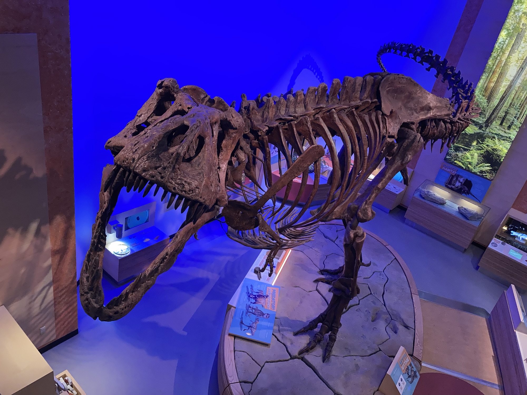
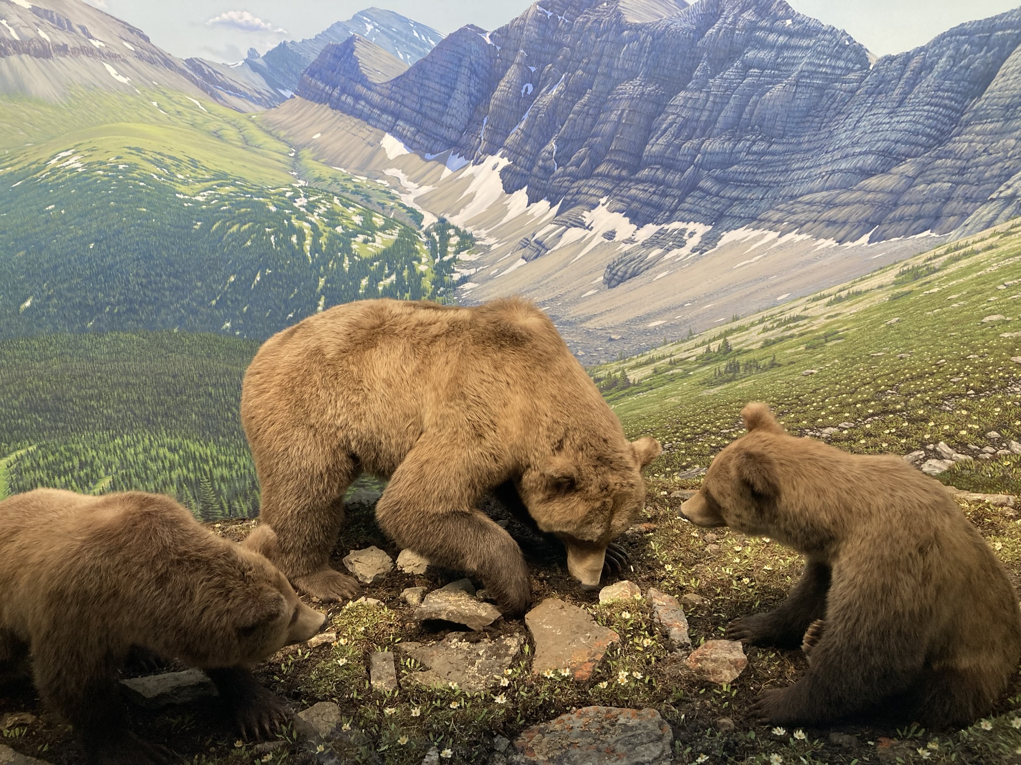
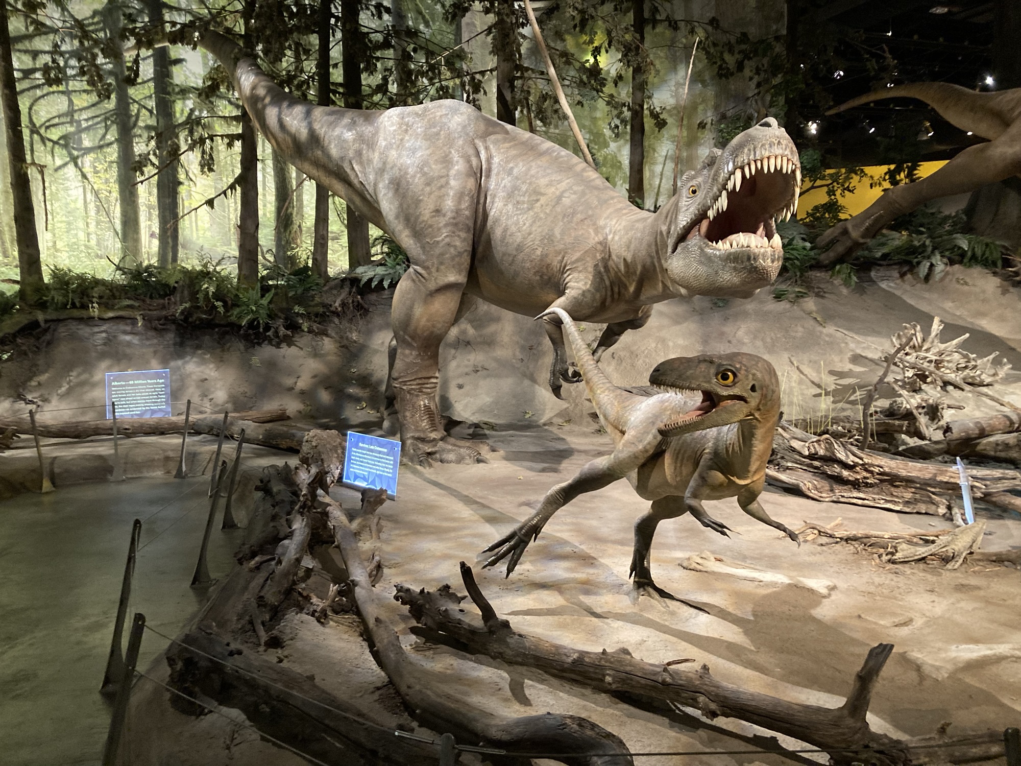
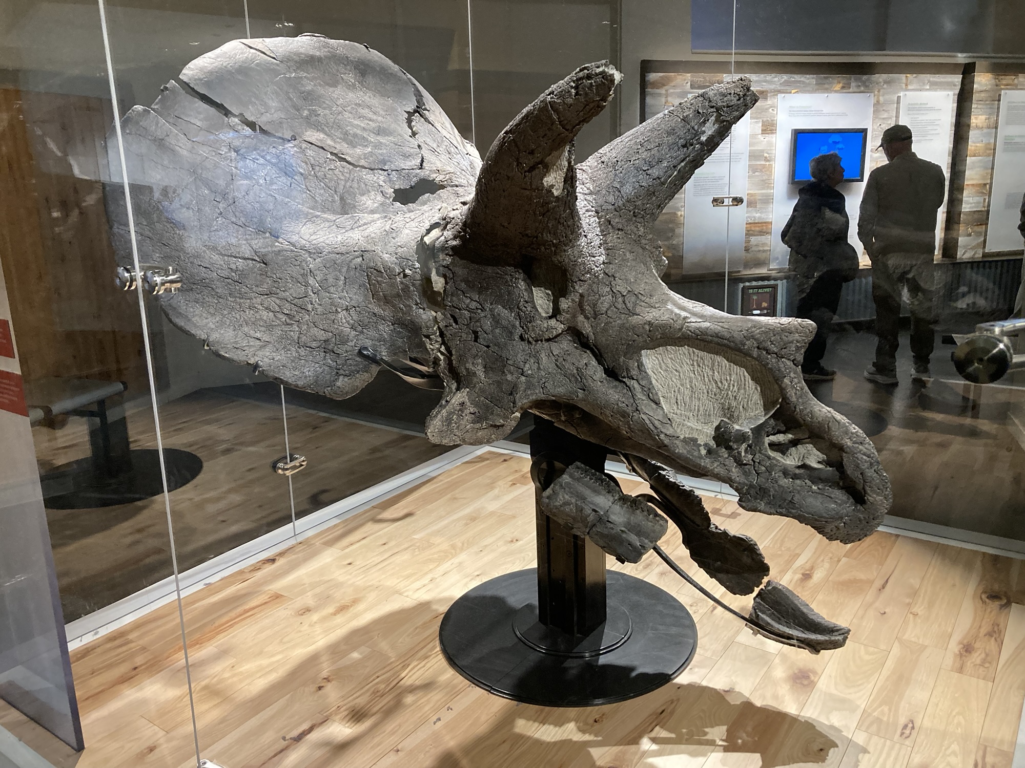
This brought me to the Royal Saskatchewan Museum (free parking!) at 16:00, more than enough time to visit. It’s not a big museum: There are only two floors. The top floor is an exhibit with dioramas explaining the various geological zones of Saskatchewan and showing the animals living there. The bottom floor starts as a dinosaur exhibit, then switches to a First Nations explainer. Both are of very high quality — I was particularly impressed at the dioramas and how they captured scenes with a clever mix of stuffed animals, natural re-creation and expansive backdrops often very well integrated. The highlight of the museum, however, is “Scotty”, the largest T-Rex around. I was happy at the depth of information and the level at which it’s pitched — this isn’t necessarily a museum just for kids.
I had plans for Regina. I had plans to get to the hotel, check in, then leisurely walk south for the Science Museum (open until 20:00) and take in the Legislative Building before hiking back home, all the while enjoying beautiful downtown Regina from a pedestrian’s perspective. Great plans. Plans that I stuck to until I got out of the hotel after checking in and realizing that it was 35c and unlikely to get much cooler before dusk. (This late-May heat wave, with temperatures 15c above normal, was so noteworthy that it made it in the weatherCAN application as a special article) Heat is deadly on walking plans — what’s fun at 23c becomes dangerous at 35c, in ways that can impact the following day as well. So I ditched the walking, got in the car and drove until I reached the Saskatchewan Science Centre.
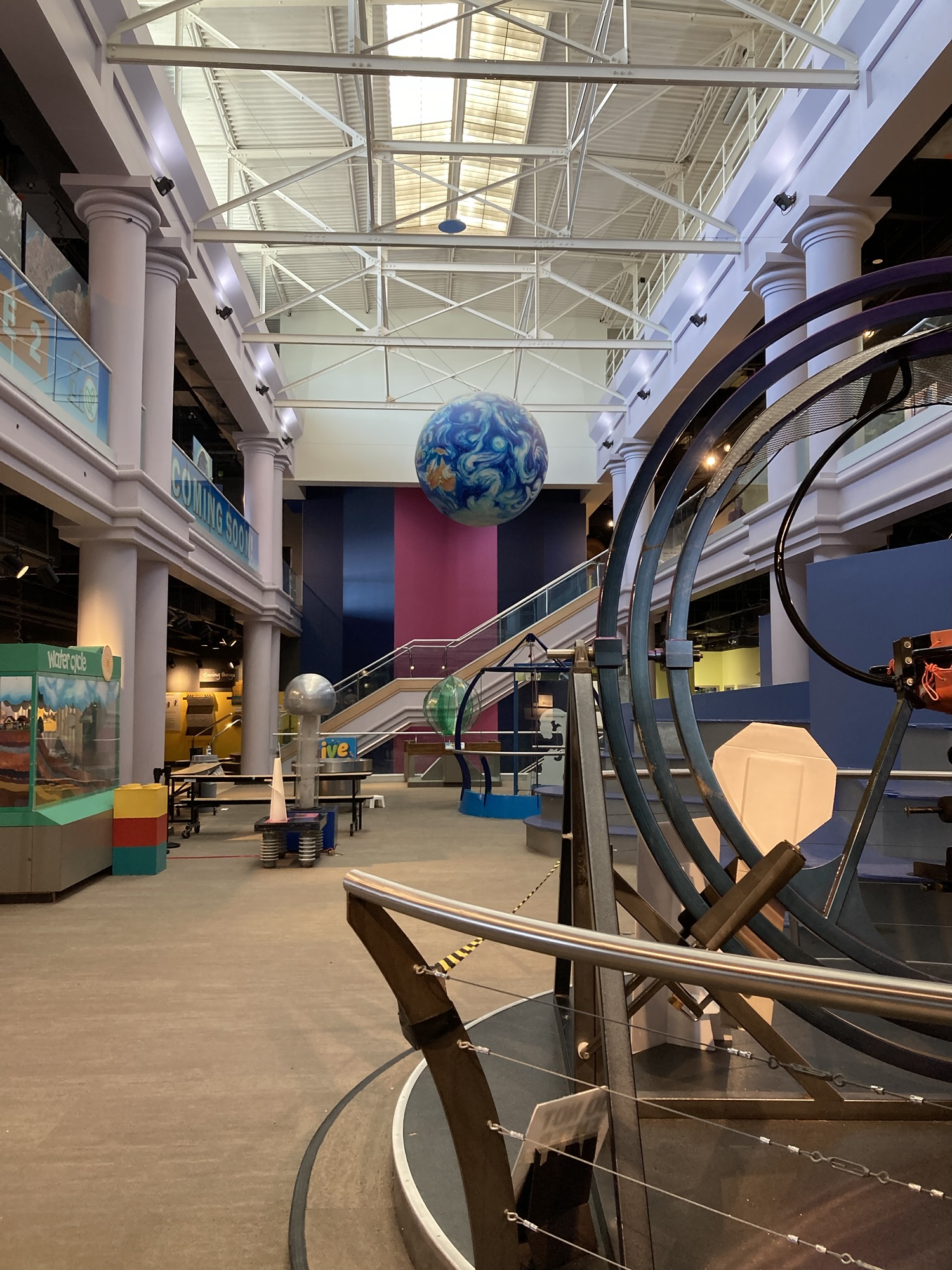
I wasn’t so impressed by that museum. It shares a common issue with many other science museums (including Ottawa) in that it’s largely aimed young. Sure, it does have a few interactive exhibits and some of them are even great fun — but it’s still a lot of space in a small museum of uncertain interest to adults. Or maybe I’ve visited too many science museums. Not that it was completely uninteresting — I particularly liked the parts where the museum affirmed itself as a Saskatchewan-focused museum, talking about things of specific interest to the province — the small exhibit about potash mining was fascinating, for instance, and I would have liked to learn more.
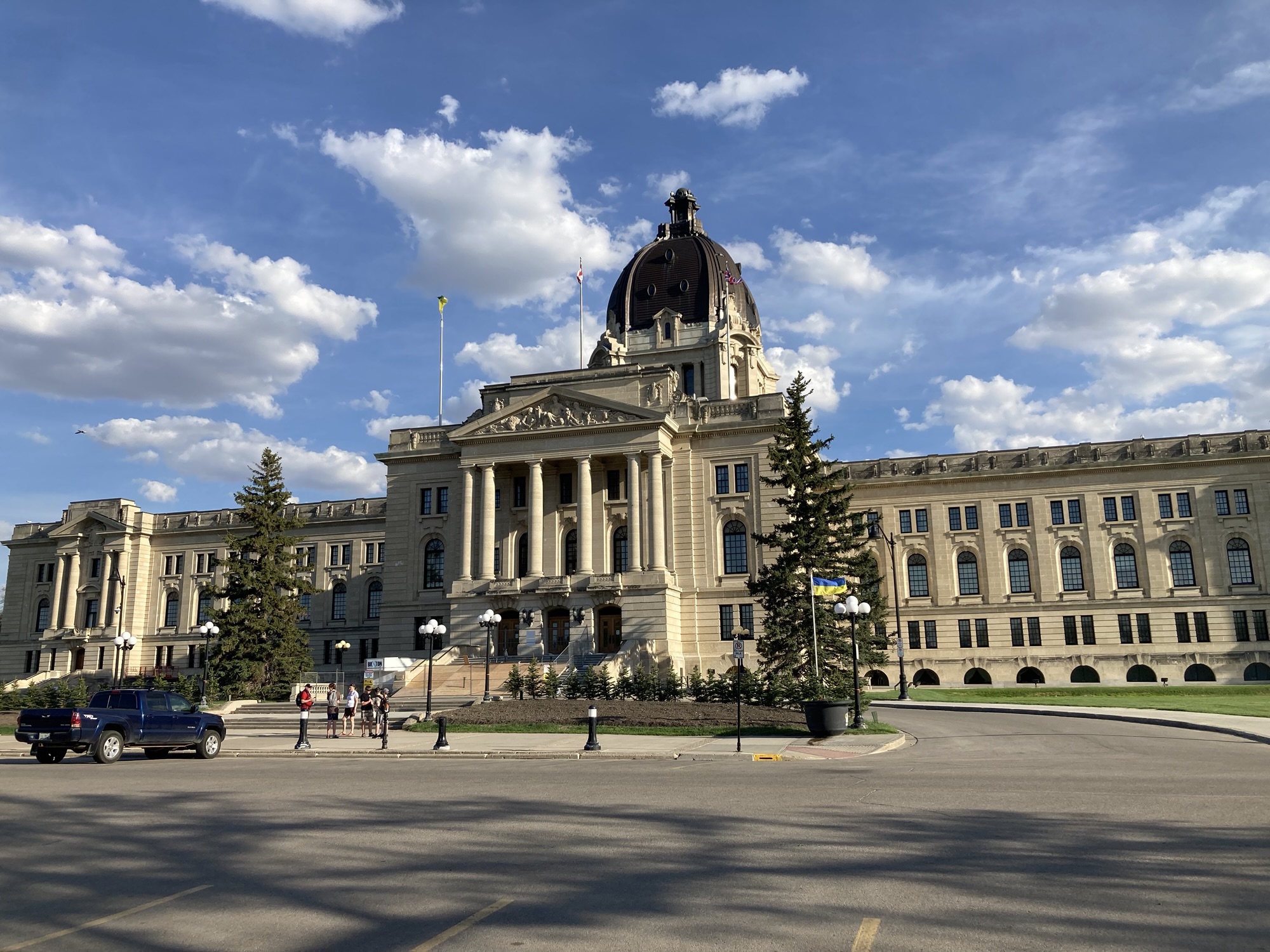
The temperature still being well above 30c when I got out of the museum, I did not even attempt the two-kilometre walk to the legislature — I took the car, parked in front of it, got pictures of the building (3/5!), a few Canada geese with their goslings, and a particularly large rabbit. On my way back to the hotel (still visiting a chunk of downtown Regina along the way), I stopped to refuel and get myself another slush (peach/blue/green blend) for the evening. No plans for supper beyond a few snacks in the hotel room — after two sit-down meals for the day, I did not need a third one. (In fact, I should probably start cutting down on snacks — but not the slushes.) I did my now-daily-habit cleanup of the car (gathering all the trash accumulated during the day, and cleaning the windshield of bugs) and went to my room.
Normally, that would mean an end to the day’s adventures, a quiet evening writing up the day, and an early bedtime.
But not today. Not with The Laundry War.
But I think I’ll finally go to bed early tonight. That story will need to wait for another day. After all, tomorrow is another 800km ride, with several stops along the way.
Steps for the day: 8,325
Day 5 – Friday, May 29, Regina to Edmonton (800km)
Whew — long day of driving, dumb mistakes, disappointment and prairie weather.
I first woke up at 5:30, which was way too early — so I went back to sleep and woke up again at 7:00, a few seconds before my alarm went off. It hadn’t been a completely restful sleep — being woken up at least twice by a train horn can do that.
I had been given another complimentary breakfast voucher by the hotel, so I used it for my sit-down meal of the day. Eggs, sausage, toast: exactly what I needed to fuel the first few hours of the day. By 8:30, I was back on the road.
The weather was back to warm but tolerable temperatures (20-25c), although the weather forecast called for isolated thunderstorms along the distance I was to cover to Edmondon. Would I see prairie storms? Would I be in a prairie storm? What was more worrying to me was that this would be a very, very long day of driving, perhaps even longer than the first one.
To prevent driving fatigue, my plan called for regular stops every hundred kilometers or so, and at least two lengthier stops at fully-featured museums. The first of those stops was in Chamberlain, where the famed Twisted Sisters Ice Cream parlour was located. I found the place without trouble: Chamberlain is, as much as I can determine, a chaotic road stop with a few house at the back. Twisted Sisters is the first thing of note, and it’s right next to the town’s grain elevator, Esso station (which comes complete with a convenience store that has a Subway inside), two chip wagons and a small park with the “Surveyors” metal sculpture. Except that Twisted Sisters was still closed for the season. I got myself milk chocolate and a Grape Crush from the convenience store and went on my merry ice-cream-less way.
What’s interesting about the road from Regina to Saskatoon is that it’s a major highway, but not the Transcanadian. As a result, it feels far closer to the business and infrastructure of agriculture. I, who was complaining that I hadn’t yet gotten a good look at a grain elevator, saw many of them along the way. Agricultural equipment stores were plentiful, and I could see farmers at work, planting seeds or plowing fields. (Speaking of which: It struck me that at this time of the year, I’m not seeing the Prairies in their full glory — for that, harvesting season would be much better.):
My second stop was just a hop outside the car: Keniston, in an obvious bid to get drivers to get off the highway and into town, has built a snowman sculpture next to their grain elevator, a kilometer away from the highway. You have to drive through town to see it, and a few stores are clustered around the snowman, begging for tourist change. It makes for a good photo opportunity, though, so go and have a look.
I completed my binge listening of the Electro Swing Podcast’s 24 episodes some time before Saskatoon. For someone who listens to music through FLAC/MP3s rather than Spotify and doesn’t really pay attention to “the socials”, it was bizarre to hear artists obsess about The Algorithm or just how many views their releases gets — but that’s the nature of the game these days. Nobody likes it, but no one questions it. At least the binge clarified a few relationships in the business, confirmed my understanding of who were/are the major artists, put personality next to familiar names and even gave me a few things to check out. Then I drove the rest of the day in the company of Pam Grier — not the real Pam Grier, but a detailed and well-produced podcast by Turner Classic Movie giving an overview of Grier’s life and works. That it’s hosted by Ben Manciewicz and includes such fun and interesting notable guests as Quentin Tarantino, Jacqueline Stewart and Racquel Gates was a bonus.
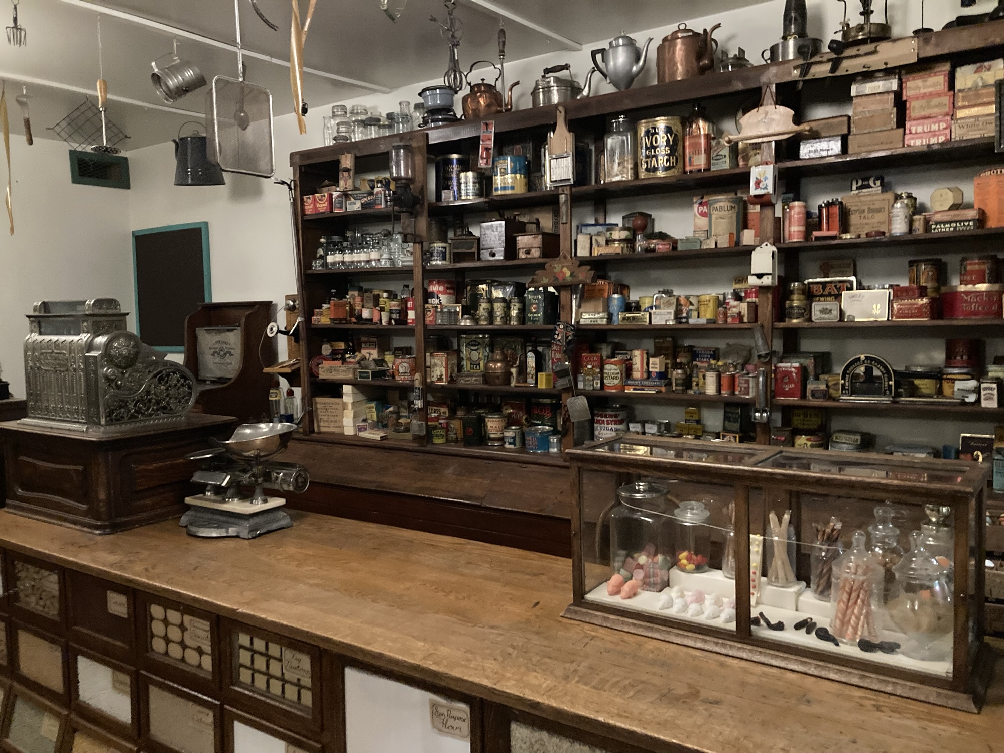
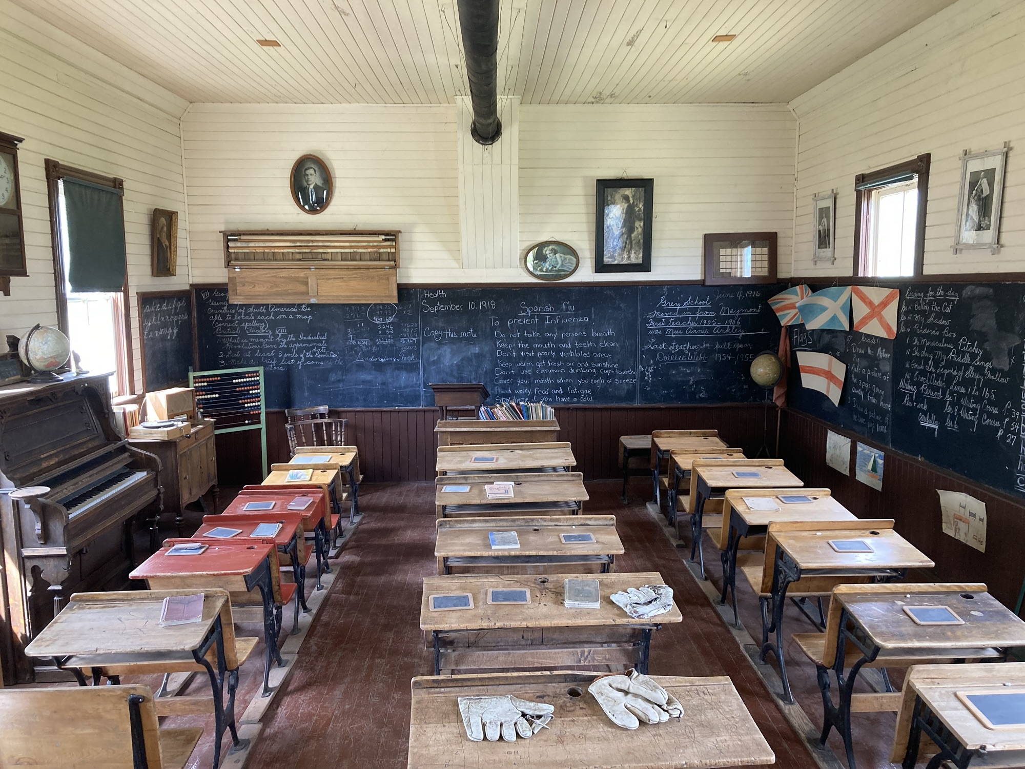
Around noon, it was the urban snarl of Saskatoon that provided the entertainment. My first stop in the area was the Western Development Museum, or rather the Saskatoon branch of that museum. (It has four, scattered across the province; I would visit two of them today.) I have seen the WDM unanimously recommended, but I hadn’t investigated why. This became obvious once I entered the main area of the hangar-building in which the museum is located. That’s where you’ll find a painstakingly-detailed recreation of a 1910s Boomtown main street, complete with all sorts of specialty establishments common to small town of that time. You can enter every store to take in an impressive accumulation of artifacts from that era, arranged in a way that convincingly evokes how it could have looked at the time. It’s a really impressive display of quasi-time-travel, and it’s an exhibit that rewards curiosity: Some sights are only available if you climb stairs and make your way to the balcony of one building.
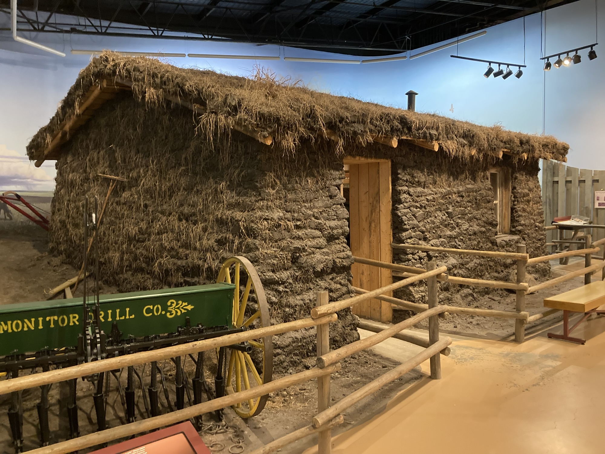
This is impressive enough, but there’s more! The area at the back is filled with gigantic farm equipment from the early 20th century — 20-40HP behemoths that evoke military equipment more than the agricultural tractors of today. (Some of them have fuel tanks saying KEROSENE ONLY) To the left side, there’s a display of older cars and alternative-energy vehicles, while the right side (starting from the back) will give you an overview of Saskatchewan’s agricultural history, including a mesmerizing full-size recreation of the kind of “sod houses” that once dotted the prairies.
It’s a really, really interesting museum — there’s a lot to see, many photo opportunities, and the place shows the depth of its multi-decade history.
Then it was off to a series of disappointments in Saskatoon. I had promised myself that I would have a look at where my web site is supposedly hosted and did exactly that, although I came away from it even more convinced that it’s hosted somewhere else. The “Giant Metal T-Rex” promised by web sites and Google Maps was gone, and my patience ran out before I could visit my last planned stop (a store, so maybe it’s better if I didn’t). I did chance a quick look at downtown Saskatoon and got myself a 7/11 slush (orange/cream soda/root beer blend) before resuming my way toward Edmonton. (But I easily could have saved myself 30-45 minutes and plenty of traffic jams by being more selective.)
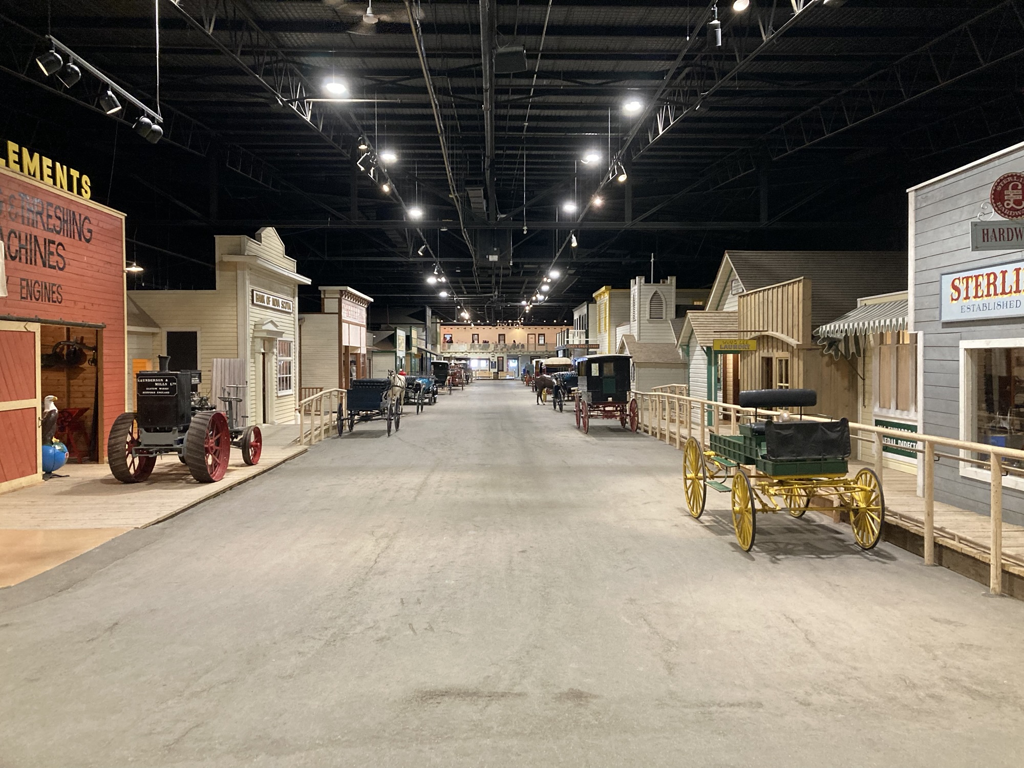
There was more to see in North Battleford. Not the “World’s Biggest Baseball bat”, which was a disappointment that cost me about twenty minutes of driving, but the Battleford branch of the Western Development Museum. Somewhat analogous to The Upper Canada Village in the Ottawa area, this branch of the museum has two or three dozen historical buildings on display, arranged outside over a fairly large park area. Compared to the warehouse display in Saskatoon, it’s not as dense either in arrangement or in content. But it’s a big more convincing that being under spotlights hung from a metal roof, and it gets to show off by having a full-size grain elevator, houses, churches and stables. The museum was sparsely populated today, which meant that I got to open doors, peek inside and meet absolutely no one other than the admittance ticket vendor. Many of my outstanding questions about elevators got answered by actually stepping inside a grain elevator.
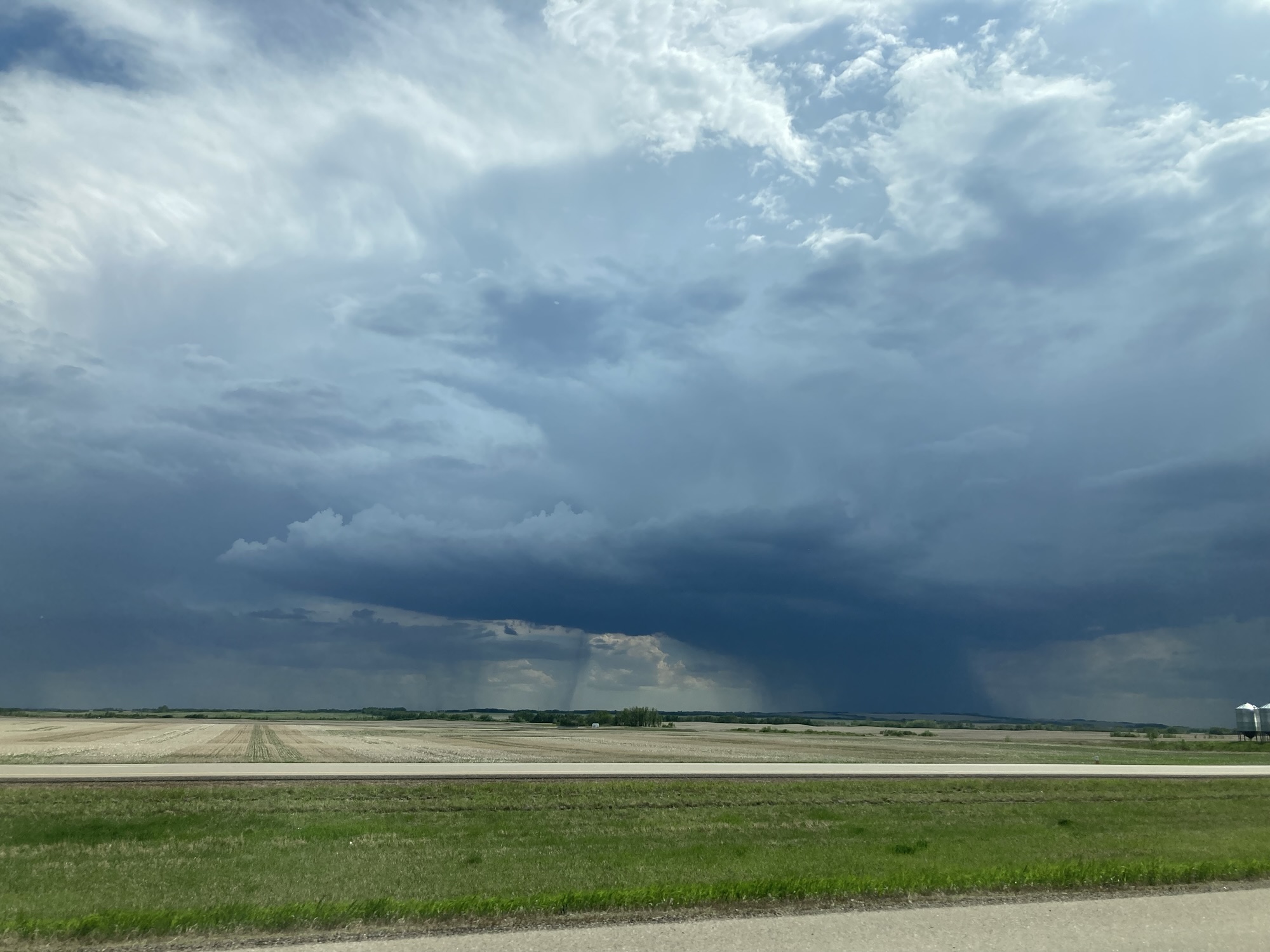
After that break, it was time to get back on the road, to Edmonton by way of Lloydminster. I never got tired of how far I could see in the flat landscape of the prairies, but today that took another turn as I headed deeper and deeper into stormy weather. The forecast called for thunderstorms, and my luck held for a long time as the road passed in-between dark storms that could be seen from very far away.
Lloydminster is unusual in that it’s a single city split across two provinces (with special taxation status — go read Wikipedia for more). I didn’t get to see much of it except for its main road. The border between the two provinces is very well marked, and most of the stores seem to be on the Alberta side (lower taxes…). I stopped at the Real Canadian Superstore to see if they had anything unusual. This is usually an exercise in futility, but this time I found two local artisanal sodas: Minha Root beer and Black Cherry soda. Then I stopped at Best Buy to upgrade a troublesome cable that sometime stopped charging my iPhone. Thus having gotten a few more steps in, I resumed my way toward Edmonton.
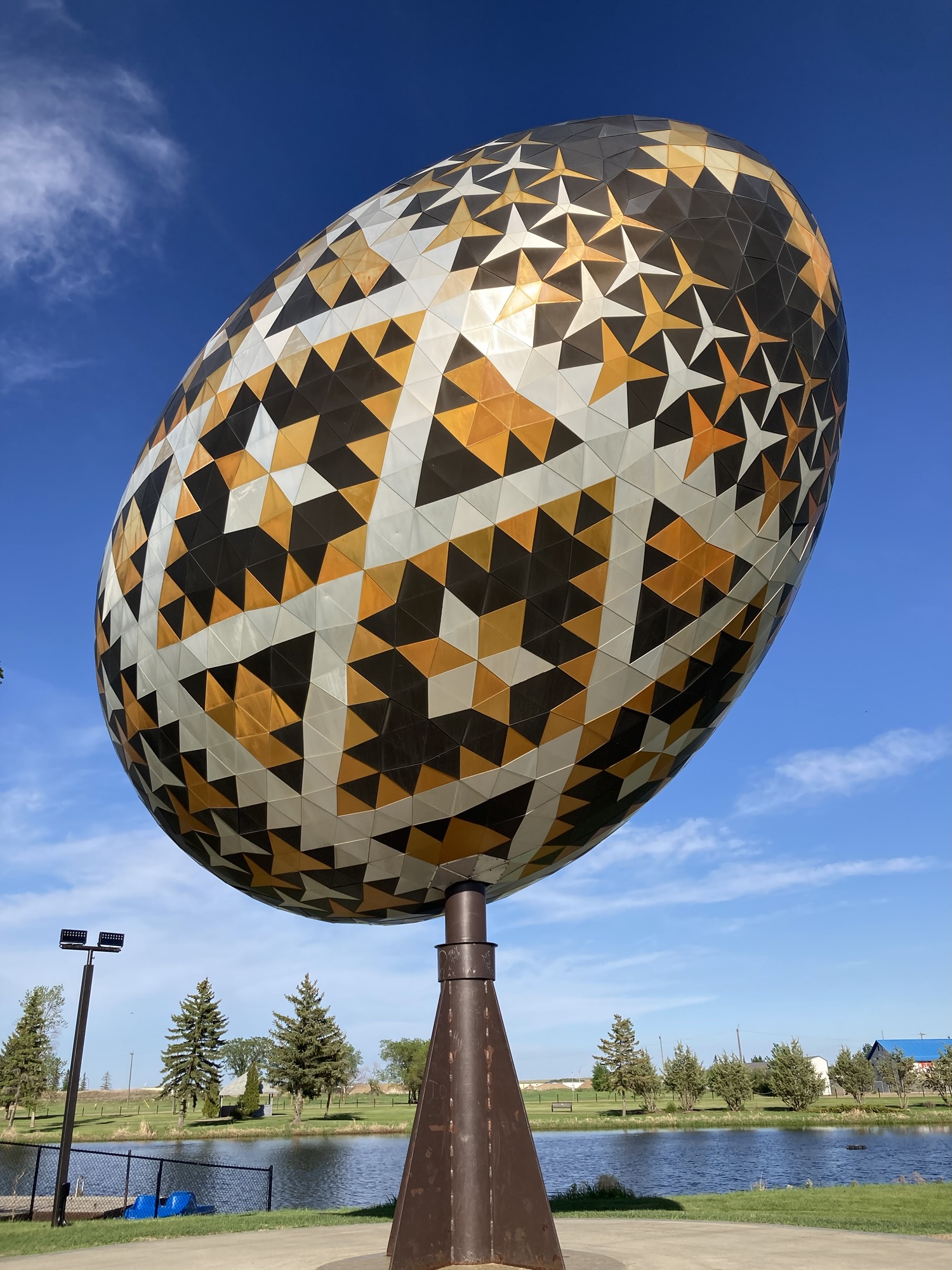
But there was one more stop before the capital. Being incredibly lucky in dodging between clouds, I got a brightly-illuminated shot of the Vegreville pysanka, a big easter egg metal sculpture that shined in the sun. (Better yet: It actually moves slightly, something that’s not emphasized in descriptions of the object.)
Despite the very long distance, today wasn’t particularly tiring: I stopped fairly often despite not there being much to do along the way, and extended stops at the two branches of the WDM did help a lot. I made a few move driving mistakes today (as in — missing an exit and having to loop back to where I wanted to go) but nothing that driving on unfamiliar roads can’t explain. I didn’t drink my can of Dr. Pepper for the second day in a row, though, and while that’s not strictly bad, it means I’ve got leftover can to manage before the end of the trip.
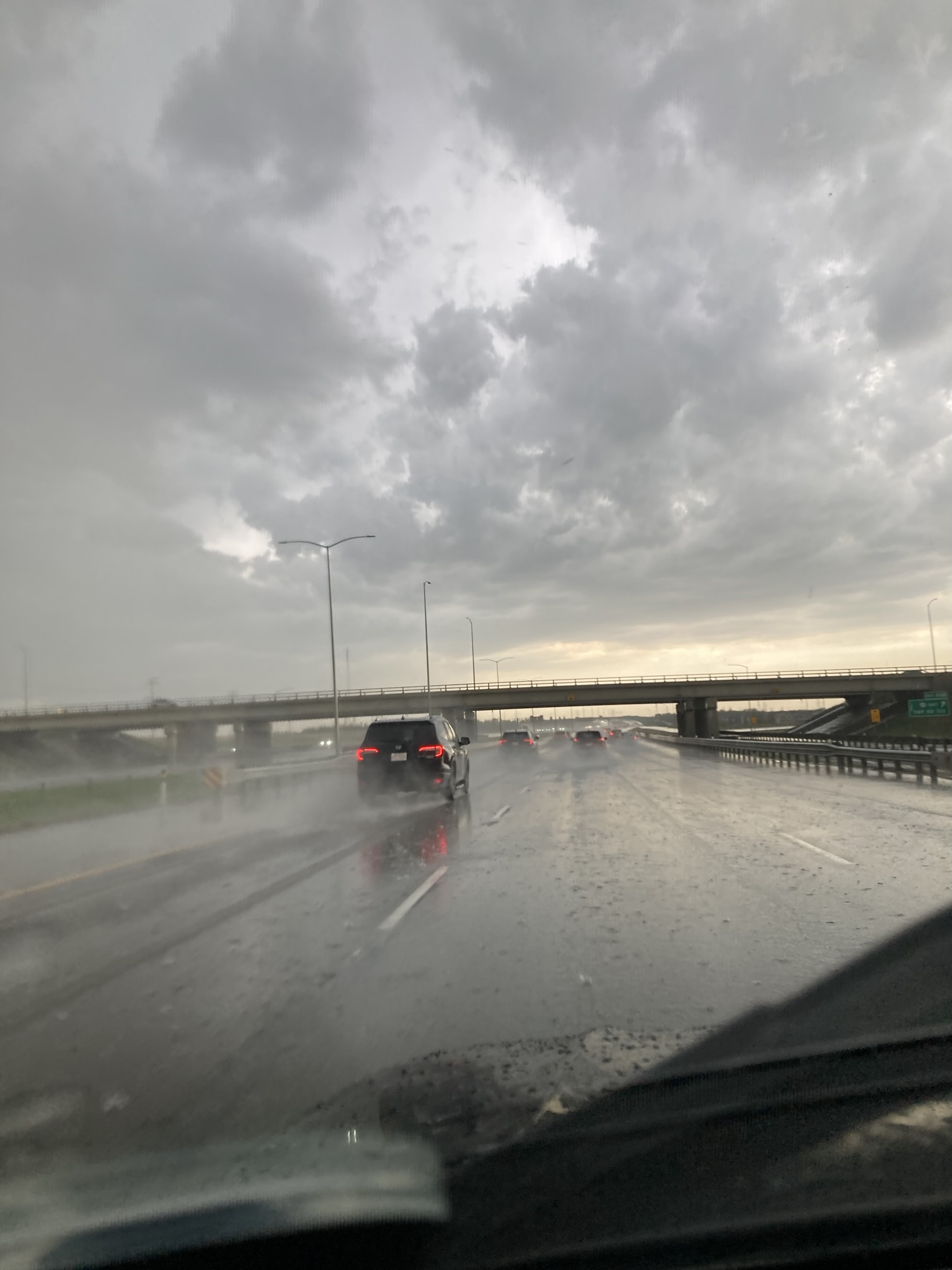
Then it was off to Edmonton. It was obvious that I was headed into a rainstorm. As bad luck had it, it started raining heavily right before I switched to the ring highway, then I got a good ten minutes of a torrential downpour — the kind of rain that even the windshield wipers’ fastest setting can’t clear off. It wasn’t extremely dangerous — everyone slowed down and kept to their lanes — but it was still the kind of white-knuckles driving experience I’d rather avoid.
The sun came back right on time for my arrival to my hotel near Edmonton Airport, some fifteen kilometers south of Edmonton itself. I took the opportunity of a nearby Costco (layout: similar to Regina) to get myself my Albertan hot-dog (4/5).
Then I showed up at the hotel and provided my identification. The clerk was puzzled not to find my reservation, but before I could get worked up about not having a place to stay, the system explained everything: You see, I was at the Fairfield by Marriot Edmonton Airport Hotel, not the Four Point by Sheraton Edmonton Airport Hotel. “By Sheraton” repeated the clerk, as if that explained everything. In my defense, both are hotels by the same chain, and they’re barely a kilometer and a half apart on the same road. (This has happened to me before, and it was the same thing: Same chain, same street) As far as mistakes went, I could live with this one.
In any case, I eventually checked into the hotel. A walk outside was quickly cut short when it became obvious I was in the middle of an industrial park with no sidewalks and nothing really interesting within safe walking distance. (The hotel is next to a major road, but there’s no pedestrian passageway or signalization at the traffic light.) Heading back to my room was a good idea considering that my daughter soon called to talk about her week.
While I typed in the day’s adventure, there was one more puzzle to figure out: the two bottles of soda I had purchased in Lloydminster required a bottle opener, which I don’t have in my kit. After a few very entertaining experiments with various tools (and the hotel room’s safe door), I gave up and went back to the car, where my emergency toolkit provided both a hammer and needle-nose pliers. What won in a battle with a bottle cap? Both, actually — the hammer’s claws took a few tries but pulled off the cap cleanly, while the needle-nose pliers did a quicker job, but with more destructive result on the cap. Was the soda worth the effort? Eh. At least it stays sunny until past ten o’clock here up north.
Tomorrow — luxury! I get to spend the day gallivanting around Edmonton and return to the same hotel! (The right hotel!) I’ve got 12 potential stops: let’s see how many I’ll manage to do. I’m not liking the forecast calling for several days of rain, but I suppose that this is a return to normal after the past few days of sunny, sometimes excessive heat
Steps for the day: 10,223
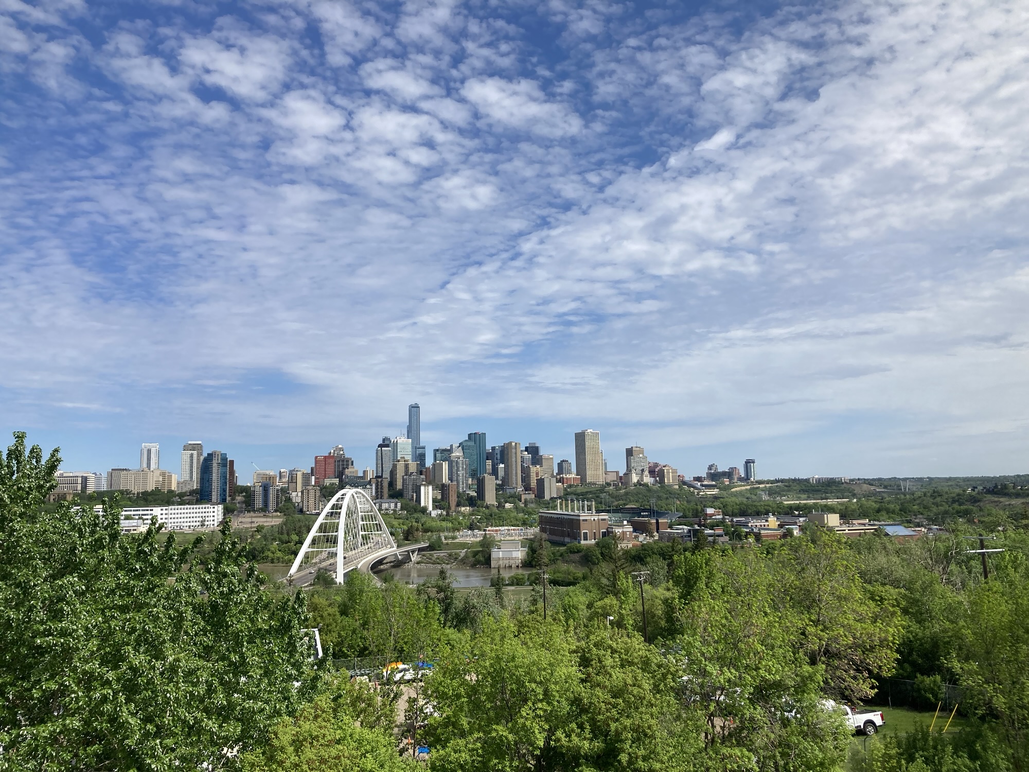
Day 6 – Saturday, May 30 – Edmonton (60km)
We’re now at the halfway mark of the trip: six days out of twelve, and it was a busy, busy day of pure tourism rather than getting from one place to another and stopping en route. Today’s topic: Edmonton.
I had a very ambitious plan for the day: 12 destinations scattered around town, trying to figure something about Alberta’s capital city. I took a lot of pictures today, so much so that easily could have doubled the 20 pictures showcase above and still found new interesting things to show you. I also have too much material to write down before an early sleep, so I will definitely revisit this section once the trip is over.
After what was a pretty good night’s sleep, I woke up relatively late at 7:30 and (not having any complimentary or continental breakfast provided) was on the road by 8:30. Let’s see those twelve destination one after another, like stations of the cross:
1. My first stop of the day was the Edmonton Science Centre, a medium-sized science center that had a few neat things in store. While the only permanent exhibit of note is their above-average space exhibit (once upon a time, this was known as the Edmonton Space and Science center), there were a few other exhibits to see: A small but entertaining section on health, a temporary exhibition on dogs, and a few other scattered exhibits. I suspect that the Science Center has a bit of a scope issue in that many other scientific topics are also showcased at the Royal Alberta Museum, preventing this from being a true multidisciplinary science center.
1a. The dogs exhibit was clearly made for log-lovers, sometimes to hysterically funny extremes: One exhibit says that owning and walking dogs contributes to the sense of community and asks visitors to choose a path: with or without dogs. Picking the “with dogs” gives people chatting, having fun and connecting. The “without dogs” has people silent, turning their backs, or absorbed by their phones.
2. I was very, very confused when I arrived at the Alberta Aviation Museum a few minutes before opening and found the parking lot overrun by bikers. (And not weekend-traveler bikers: bikers-bikers) Turns out there was a biker event (“Edmonton Swap and Ink Meet 2026”) in the hangar next to the aviation museum. “One for planes, not bikes” I said to the admission desk. Much of the museum is within a single hangar, where the curators have packed an incredible number of planes going from historical bush-hoppers to more modern police helicopters. It all comes with an Alberta spin (often blaming “the federal government” for interference, base closures and such). It’s a petty good aviation museum: at the very least, there’s a lot of stuff in there, and the Alberta focus distinguishes it. A few exhibits are outside, sometimes in not-so-good shape: Some of the plane tires are flat, for instance, and there’s no real effort in sprucing it up.
3. I wanted a hero shot of Edmonton — the kind of picture you can show as say “Yep, that’s the most picturesque view of the city. So I did my research, found a few pictures of the city I liked, and found out that they were taken at the Laurence Decore Lookout. There isn’t much parking at that lookout, so I had to do this in a hurry — find a spot, exit the car, point the camera, get back to the car, leave before making too much fuss. But it went out without a hitch, the sun angle was good (which is why I did that mid-morning) and the picture is great.
4. One of my highlights of the day was the Muttart Conservatory, a horticultural establishment presenting three biospheres of plants with a really clever architectural conceit: Five glass pyramid with deep roots into the soil mark the establishment. You enter the central pyramid, where there’s a very welcoming atrium, and then make your way to one of the four other pyramids. Three of the pyramids offer specific biomes: temperate, arid or tropical plants. (The fourth is for special exhibits — right now it’s rhododendrons) It’s really neat! While the temperate and tropical biomes are nice, the one that really impressed me was the arid pyramid, filled to the brim with cacti and other plants not very well known in Canada. I was impressed at the density of the plants, and how the conservatory is willing to let them grow in sometimes non-picturesque ways, showing the bark or the dead leaves. I saw an overgrown pear cacti, a banana plan, a pineapple plant and a “corpse flower” thankfully not blooming. I was very, very happy with the Conservatory — and that place must be a lifesaver during Edmonton winters.
5. The Old Strathcona Antique Mall had popped up in my research as a potentially fun thing to do and wow — does that understate matters. Very similar to that basement in Winnipeg’s The Forks, it’s a mega-mall where 190 vendors show their used wares. Books, CDs, tchotchkes, toys, cards, etc. The result is a magnificent two-storey bric-a-brac, often segregated by neighborhoods of common items. Spread over two floors, it’s about three to four times as big as even the expansive place in The Forks. There are some wonderful areas he — it stood and laughed when I discovered two areas of the place that had been converted to a reasonable facsimile of an old-time vinyl record store. I walked through the place thinking myself bulletproof to anything in the store — after all, I’m coming back by plane, have only so much luggage space, etc. What would it take, I thought, to convince me to buy something? It would probably be a book, I thought, heading to the library section of the store. Maybe a first edition of a beloved book, or maybe one of my white whales: One of the four legendary Terran Trade Authority art books that I’ve been trying to get, on and off, for decades. And then I saw it: Spacecraft 2000 to 2100 AD, the first of the series, in pretty good shape at a pretty good price. I’m not kidding. Yeah, I’ll find a way to bring that back home.
5a. I discovered something that wasn’t in my plan in front of the Antique Mall: AN oversized replica of the Stanley Cup. Very photogenic!
6. One neighborhood often mentioned as a destination in travel guides to Edmonton is Whyte Avenue, the nexus of the Old Strathcona and today a place of bohemian/geeky boutiques, cafes, bookstores and other nice places. Since it was only two blocks north of the Antique Mall, I went on a little like, beginning at the preacher shouting (and heard from blocks away) that “The Wages of Sin are Death” and ending two blocks east at the anti-choice activists. So that’s the neighborhood for you: a rather charming bunch of fun little liberal businesses braced by people who don’t like that. Recommended, if you can find parking. (Psst, park at the Antique Mall.) I stopped at a new-to-me supermarket chain on my way back and found a brand of local-ish root beer I had to try. Alas — not a twist-cap opening.
7. After driving from old Strathcona to downtown, I parked in the City Centre Parkade and hiked to the Alberta Legislature for the mandatory side-quest photo (4/5!) This gave me a chance to walk through downtown Edmonton and — wow is there a lot of construction. Like, a lot — to a ridiculous extent, blocking lanes and streets and making a complete hash of everything. I think I understand why there’s a lot (the summers are short her, might as well do as much as possible while it’s not winter) but even as someone used to the amount of construction in Ottawa and Montreal, I was impressed. As for downtown Edmonton, they clearly have issues (I passed by two police officers rousing someone from sleep) but it’s reasonably fine to walk through even despite the construction. I even crossed two special events along the way — a street celebration with stalls of vendors, activists and hobbyists, and no less than Edmonton’s Drag Festival. Everyone was having fun!
8. I’m going to mention Rogers Place (the ice rink where the Edmonton Oilers play) and the Edmonton City Hall in passing, because I did see them in passing. I barely broke stride while passing the rink while walking through “The Ice District”, and the angle I had on City Hall wasn’t photogenic… but I still saw them.
9. Don’t miss the Royal Alberta Museum if you’re in town: It’s a great museum with two really good exhibits on Alberta History and Alberta Natural history. Excellent dioramas, a neat exhibit on bugs, a great minerals collection (arranged in themes) and a special exhibit on death (biological, social, emotional) made the place a pleasure to visit. Some of the dioramas a pretty brutal, though — this isn’t your standard fluffy museum.
10. On the other hand, temper your expectations when visiting the Alberta Art Gallery: It doesn’t focus on any kind of permanent gallery, but rather has rotating exhibits from Albertan artists. It still liked it (wow, that Sleeping, Hudson Bay Blanket painting by R.F.M. McInnis hits hard if you interpret it as a post-colonial work — which it probably isn’t) but it’s not a very large gallery.
10a. My time in downtown being completed, it was time to get back to the car and drive to my next destination. Easy stuff, right — get to the car, open door, program GPS, drive away. Except that… the parkade in which my car was located was closed and locked. Entry and exit doors shuttered by heavy metal blinds. All doors locked, with a nagging little sign asking people to “enter their code”. What code? I padi and wasn’T given a code. I could exit easily enough, but the way back in was forbidden. A call to the number of the parking lot gave me a weekend get-lost message. I circled the parking, tried every door, found that all were locked. I tried the above-ground passageways — also locked. My plan became to wait next to the exit door to walk inside the moment someone went out. Then someone approached me — fully dressed up in KISS-like regalia (studded dark clothes, white facepaint, black horns, etc. Actually probably not a KISS fan, but people my age only know that reference) and asked if I was trying to get inside. Stuck in the same predicament, we exchanged what we had tried so far. His situation was worse than mine — he had medication in his car. We started strategizing — he had called and gotten an answer, but no immediate solution. We we determined to get in the building my any means necessary. Then he spotted a car leaving the parkade a few dozen meters away and we ran (me faster than him in full garb) to catch the door before it closed. No dice — the door had closed. We strategized some more — would asking the security guard inside the mall help? But then another car showed up and triggered the sensor to open the parkade door. We were in! We wished ourselves a good day, and I made it to my car. The kicker was: On my way out, I deliberately stopped my car under the exit door to leave it open a while longer, and two middle-aged women ran inside, with me waving them in and raising my thumb. That parkade has some serious issues. Don’t park there!
11. After so many urban troubles, it was a relief to get to Fort Edmonton and go back in time to explore Edmonton’s history. By good luck (or bad parking), I made it right before the train running circuits inside the fort left. Train ride! But better than that, because the train takes people at the other end of the park, where they can disembark and take in the first and oldest of the Fort’s three time periods. There is a full-sized colonial-era fort built there, and it’s fascinating to go around and take in the perido atmosphere. Fort Edmonton is the beefy version of the Western Development Museum’s historical villages: while many places can be visited freely without guides, other places have actors/tour-guides to tell you about their specialties. The colonial era leads to 1905 Edmonton, with period-appropriate shops: some duplication with the WDM (or, indeed, places east such as Upper Canada Village) but a credible recreation. Then you keep going into Fort Edmonton’s zig-zag path and you end up at 1920 (post-electrification) Edmonton, which has a few really interesting buildings on display. My absolute favourite was a recreated 1920s cinema — I could have rolled in that exhibit for hours. Alas, the Fort was closing soon, so I finished my way back to the entrance (stopping by the fair exhibit, most notably taking in their frightful oddities haunted-house) and got out just before the place closed. Fort Edmonton ranks as a don’t miss — it’s very evocative of past history (wow, did I get a few great ideas and sensory details for my next novel!) and it’s fun to visit.
12. West Edmonton Mall was my last stop of the day for a good reason — unlike most other places on my list, it closed well after 17:00. Known as the largest mall in Canada (and second-largest in North America), it’s a mind-boggling place. Consider that it has 800 shops. And a food court. And a second food court. And a themed “street” in moody lighting for more than a dozen sit-down restaurants. And a near-regulation ice rink. And a second smaller ice-rink. And a go-cart track. And a movie theater. And a dinner theater. And a T&T supermarket. And a shooting range. And a water park. And a theme mini-putt for kids. And the largest Lego store I’ve seen so far. And a casino. And a second casino (well, bingo). And a hotel. And pedals-swan rides in an indoor lagoon. And a a full-size replica of Christopher Columbus’s Santa Maria. And… well, if you went insane somewhere the middle of this paragraph, let me reassure you that this is normal. The mall is an incredible place with stores both expected and not expected (including a wonderfully dark gothic “The Den”), an incredible number of entertainment options and seemingly endless things to discover. You can easily spend an entire day in here — it took me an hour to walk around the place (using the right-hand trick not to get lost in a labyrinth, although the mall is simpler than one thinks at first — it’s just an upper-case T with a few curlicues.) and then another 35 minutes to do the second floor. Incredible. Worth the trouble to visit.
After that, it was a stop at a restaurant for a meal (when in Alberta…) and back to the hotel. Opening up my new root beer with the needle-nose pliers. Laundry without war. Writing up the day’s adventures and an early bedtime.
Tomorrow won’t be easy: I’m slated to drive from Edmonton to Calgary, but there’s a meteorologic alert in place for the entire area warning people of “heavy rain… up to 100 mm” from now until Wednesday. The forecast gets much better up in the mountains, but I have to make my way there first. In any case, tomorrow’s trip to Drumheller is still a GO, but I may stick to the highway as much as possible and do a longer detour. I’ll be leaving too early to visit the Reynolds Museum, but tomorrow’s rainy drive will be a pain.
Steps for the day: 34,095 (roughly 24kms!!!)
Day 7 – Sunday, May 31 – Edmonton to Calgary (500km)
late arrival at hotel, bad internet connection. Check out photos. Summary: entire day was windy and rainy. Drove from Edmonton to Drumheller without problems: saw a moose! Royal Tyrell Museum terrific due to depth and variety of items. Walked up 105 stairs to be inside the mouth of the world’s biggest t-rex. Disappointment driving around to see hoodoos and Wayne. Drive from Drumheller to Calgary long and annoying due to no stops, rain and wind. Crossiron Mills is a great mall but not as much as Vaughn Mills. Had a great time visiting Calgary tower: no problem at the parkade. Sentry box now a world class gaming store. Had terrific dinner with friends. Back at the hotel late and internet connection is not good. Tomorrow: into the mountains and let’s hope the weather will be better.
Steps for the day: 9,541
Day 8 – Monday, June 1st – Calgary to Salmon Arm (500km)
It was a day of great photo opportunities, lousy weather and incredible good luck.
In figuring out when to wake up, there’s a trade-off between being early and being rested. In today’s case, it was more important to be rested: I only had 500 kilometers to go, but 500 kilometers of mountain roads, potentially treacherous… and much of it in the rain.
Because, yes, I first woke up to the sound of rain pattering on my window. A lot of rain. I snoozed the 7:30 alarm, but got up anyway at 7:40, prepared, ate a quick-but-good continental breakfast and was on the road by 8:30.
There isn’t much to say about the way from Calgary to Banff except for the rain. But the rain was everything: it made the drive annoying and it especially reduced the visibility to next to nothing. Curiously, it wasn’t the first time I was making that drive — back in 2005, I rented a car to drive to Lake Louise and Lake Moraine. From that experience, I knew that the way from Calgary to the Rockies is usually one of the greatest experiences in Canadian driving: seeing the mountains grow from silhouettes on the horizon to their full majesty is unforgettable.
But it was imperceptible today, thanks to the lousy weather. The rain lowered the visibility to practically nothing (even worse in the wake of 18-wheelers raising a little cloud around them, blown into the passing lane by the high wind) and prevented the full spectacle of the Rockies during most of the day.
Not that it didn’t have a little bit of atmosphere to get occasional glimpses of the surrounding mountains, like monsters shrouded in fog. From time to time, you’d peer above the clouds and see a mountaintop, and that just put everything into perspective. Lousy pictures, through.
I stopped in Banff out of curiosity and a need to change the pace a bit after the drive from Calgary. I was debating stopping and ultimately didn’t: Banff must be one of the most expensive cities in Canada, and it was jam-packed even on a Monday mid-morning. Banff has managed to strong-armed every chain store into being discreet and tasteful (and uniform) in their signage — if you want to see the most upscale Dollarama in Canada, I’m pretty sure it’s the one in Banff. Parking spaces being either unavailable or requiring a third mortgage, I finally rolled through the main street until the end (unable to see the mountain that looms over the town), then got back on the highway.
I didn’t even try to visit Lake Louise and Lake Moraine. The latter is closed-off to private traffic, and parking at the first is reportedly either extremely busy or eye-wateringly expensive. I had no desire to slow myself down by an hour or two even trying to get there (by unpleasant coincidence, June 1st was the first day of the summer season, meaning that it was packed. I saw it from the highway, just by seeing an entire line of cars take the Lake Louise exit.) No, my objective was somewhere a bit farther out: Emerald Lake, in Yoho Park, perhaps not as pretty but still a destination for its green-coloured lake and mountain backdrop.
I had been obsessively consulting weather reports, and I had gathered that the rain would slack off slightly after Banff, and it did — the explanation has to do with clouds hitting the mountains and such, but the impact was that the heavy rain considerably diminished after Banff, and by the time I was at Emerald Lake, it was pretty much stopped — although the cloud cover was still thick and occasionally low.
I didn’t really like Emerald Lake. Oh, the place is pretty — but since Lake Louise and Lake Moraine as so busy, it’s now a prime destination for tourists even on Monday mornings. I got incredibly lucky with a parking space near the entrance, but there were so many other tourists that it was difficult to either move, or find a good place to take a picture. I got something half-way interesting, saw that there was nothing more to be gained from my presence, recognized that I was part of the problem (“You’re not stuck in traffic, you are the traffic”) and did the right thing — I left after a few minutes, leaving the parking place to someone else. I’m not sure when Emerald Lake doesn’t have a ton of tourists, but I would recommend going at that time.
I crossed a time zone by crossing from Alberta to British Columbia — ONE EXTRA HOUR BONUS!
I took a lot of photos today, but not many of them are great despite the subject matter of the Rockies: It rained a lot, the cloud cover was low, and I was stuck in the car, often unenthusiastic about getting out.
My next stop was at Golden, a small town sandwiched between incredible mountains that has one more distinction: It’s essentially the geological end of the Rockies. Yes, yes, I hear you — there’s still hundreds of kilometers to go before Vancouver and the coast. But, see, technically the Rockies are that band of mountains sandwiched between Calgary and Golden, while the rest are the Interior Mountains or Interior Plateau — I’ll let a geography teacher explain the rest, but the upshot is that by the time you’re in Golden, you’re generally on the downhill from the Rockies peak, and I was specifically away from the rainstorm system hammering much of Alberta until Wednesday. Interesting enough, Golden was also pretty much the mid-point of my day’s mileage — except that my stops were nearly all back-loaded on the last fourth of the trip. (Not a bad idea! More stops toward the end help a lot in mitigating driving fatigue.)
By the time I stopped at the Golden Kicking Horse Pedestrian Bridge, it was sometime drizzling but no longer raining. The bridge is nice, but perhaps more noteworthy for giving an excuse to drive through Golden rather than a destination by itself. I declined to stop at the Golden Museum after seeing that it was essentially a glorified house. But I picked up a slush along the way (grape/cream soda blend), so it wasn’t a wasted trip.
Part of the reason why I didn’t stop a lot during the first three-quarter of the day’s drive can be explain by how much of it went through three national parks in rapid succession: Banff, Jasper, Yoho and (after a short Golden-shaped pause) Glacier. Other than the Parks Canada-approved rest stops, there isn’t much more to see. Thing being said, I did stop at two really nice boardwalks in Glacier — Hemlock Grove, which is short and fun and has a small picturesque creek, and Cedar Grove, which has old-growth cedars. Neither of those were on my plan, but they seemed like good ideas along the long way — and you rarely go wrong taking a look at recommended scenic spots.
The other stop I made along the way, and an incredible stroke of good luck, was at the Spiral Tunnels in Yoho park. Some background: trains are powerful but limited machines. They can’t really climb even modest degrees of elevation, and railway engineers trying to connect the west to the east were faced with a vexing problem near Kicking Horse river: the elevation difference between the two sides was simply too great. So what they did is that the made the track loop on itself twice, thus adding the distance required for a workable grading. I had seen this in my research about interesting things in the area, but had rejected the idea of stopping there: After all, it’s best seen when there’s a train spiraling down (or up) the loops, and train schedules aren’t exactly predictable to the casual tourist. Except that, in one incredible stroke of luck, I saw a train while driving, THEN saw the sign for the spiral tunnels lookout. I quickly pulled over and hurried to the lookout — and there was a very very long cargo train, lazily snaking through the spirals. Wow!
It started raining again once I made my way to Revelstoke. There, I has two destinations: The railway museum and the hydroelectric dam.
I wasn’t expecting much from the railway museum, but it comfortably exceeded my expectations: It’s a really nifty little museum that coherently explains the history of railway construction and operation in the area. It answered a lot of questions I had about how railways were built in the area, and how a small town that wasn’t much more than a glorified train stop was able to thrive as such. The museum has a fascinating gallery, a central area with a few showcased trains and cars, and an exterior display of “rolling stock” dating from all ages of the railway. It really hit above its weight for a regional museum, and it pretty well-designed.
My next stop, at the Revelstoke Hydroelectric Dam, was originally planned as a rolling stop: See the dam, take a picture, go on. But it turns out that there was a security checkpoint at the dam, they took down my ID and plate, and gave specific instructions on how to proceed to the visitor’s center. never mind the rolling stop: I was committed by then.
Turns out that the Revelstoke has a really good visitor’s center, terrific self-guided exhibits, excellent displays. By another stroke of good luck, I arrived a minute or two before the last guided tour of the day, so got to slow down a little and take in the entire hour-long tour. Sure, I would have zoomed quicker through the exhibits by myself — but it was fun to take a small break and let someone else read the panels for a while. The tour talks about the construction of the dam, the mechanism through which power is generated and distributed, and the hydrography of the Columbia River basin. It turns out that “The Columbia is the most dammed river in the world” is a perfectly factual sentence.
Back on the road, I wasn’t expecting much from the “Three Valley Gap Heritage Ghost Town” — it’s part of a hotel property, and pretty much everything about it screams tourist-trap. But if all tourist traps were like this one, we’d have to retire the expression. Yes, it’s a recreation of a historical village using a mixture of built and moved buildings, plus an immense brick-a-brac of historical objects to decorate the buildings. It has its points of similarity with the Western Development Museum or Fort Edmonton. But it’s also endearingly its own thing: The density of buildings and artifacts is quite nice; it doesn’t care at all about education value; it takes chances in illustrating things that other government-sponsored historical sites won’t show (such as a Saloon, and the two upstairs rooms suggesting bawdy activities) and it occasionally has a pretty good sense of humor about things. There are mannequins rather than paid actors/explainers, so the Ghost Town thing is reinforced. This has existed for several decades, so there’s an accumulation of stuff (often displayed fare more organically than the government museums, giving a real lived-in feel: fans of environmental storytelling will get a kick out of a few places) that just keeps on coming even if you go ” oh, I wonder if there’s something there?” — there usually is. It’s larger than I expected, and better than I expected, and I spent more time than expected (taking more photos than expected) as well. Recommended. If you’re going westward, there’s a rest stop maybe a kilometer after the Hotel that has a few great photo opportunities — including the red hotel against dark-forest green backdrop.
Next up: A private-built-and-operated nature attraction: Crazy Creek Waterfall & Suspension Bridge. It’s exactly what it says: A suspension bridge over a waterfall. It takes a lot of climbing to get there, but the fall is really nice — especially at this time of the year. There’s an upper portion that’s not quite finished (planned in the next few months, I was told) but give a really interesting view of two areas in which the stream of water has carved circular indentations in the rock. Also: the sun came out while I was visiting the waterfall!
My penultimate stop was something of some symbolic value on this trip: The Last Spike, which finalized the Canadian coast-to-coast railway link. It’s not much of a rest stop: a monument or two, a nicely landscaped rest stop for tour buses (indeed, one stopped right after I arrived) an a gift shop run by the Revelstoke Train Museum that had closed at 17:00. But as a symbol, it mirrored the purpose of this trip in linking together (by road) all the bits and pieces of Canada I had flown to.
The last top of the day was a treat: The D. Dutchman Dairy is not just an ice cream parlour — it’s also a store of everything Dutch (including several foodstuff imported from the Netherlands) and a working dairy farm that you can visit, and maybe even pet a few calves that will grow up to make the milk in future years’ ice cream. There’s also a kid’s playground, so really it’s the perfect stop for the entire family.
My last stroke of good luck for the day was during the last leg of driving: the sun came out, I was alone on the highway, and the road got curvy. In other words, I had fun driving that last stretch. Generally speaking, other than this last bit, I was a bit disappointed in the overall drive today. With the rain and clouds, the segment was far less impressive than it usually is. Then there’s the road itself: While I wholeheartedly support efforts to make highways safer, broader and straighter, this (absent the sights of the mountains) felt like just another highway — no challenge, no need to pay much attention.
I finished the last of the TCM “The Plot Thickens” podcast about three-quarter into the day, with season 5 on John Ford being followed up by season 6 about the making of Cleopatra. Surprisingly enough, I then switched to music — and the “unheard music” USB stick, filled not with favourites but with recently-obtained music I’m not as familiar with. Somehow, new music fit the setting more than information shows. I still have a lot of “You Must Remember this” podcast episodes to listen to, but I may want to save those for my walks closer to home — especially since the next two days may be challenging driving.
After that I arrived at Salmon Arm, probably the most mysterious destination city in my entire itinerary. I picked Salmon Arm because the hotel room prices were more reasonably than in Kamloops, but then I got fascinated by this little city. Turns out that the fascination is even bigger on the ground: For a 20,000-people town, it has extensively cultivated its downtown area — complete with interactive outdoors signage, a coherent graphic identity, fresh-from-today concrete curbs (I didn’t sign my initial) and more cool small-town amenities than you can imagine. Either their tax base is incredible (quite possible, considering the nature of the properties I saw while walking downtown) or there’s fun shenanigans at city hall. It punches considerably above its weight, and the whole downtown vibe is that of a small cool progressive city.
After checking in at the hotel (a surprisingly decent hotel in a small town), I walked to the famed wharf, looked at downtown, got frustrated at the single-street chokepoint separating the waterfront from the rest of the city due to the railway, and generally enjoyed my stroll through the lower city. Finding a restaurant, unfortunately, was far more complicated than I expected: Most of what was there was closed on Monday evenings, and what was open didn’t inspire. In the end, I got back to the highway, and was tempted by the unfamiliar-to-me Triple O’s burger joint. The burger was pretty nice for a restaurant inside a gas station convenience store, and so was the BC blueberry milkshake.
After that: back to the hotel, peaceful laundry and writing up the day’s adventures. Tomorrow, we go downhill all the way to the south-of-Vancouver area, and I will race against time to (virtually) attend a special event despite the time zone difference. Five hundred kilometres, eight hours: tic-toc.
Steps for the day: 19,672
Day 9 – Tuesday, June 2 – Salmon Arm to Vancouver (500km)
Great drive, disappointing stops, two side-quests completed and we are finally somewhere near Vancouver for the next three days.
I woke up on my own half-an-hour before my alarm, then decided to not move until the alarm at 7:30, which was much nicer that waking up half an hour after the alarm. After the fine continental breakfast, I was back on the road by 8:30 — although a quick stop for gas and slush meant that I was really driving only by 8:40.
I scrapped my first planned stop of the day: The BC Wildlife Park east of Kamloops only opened at 10, at it was 9:35 when I rolled past. I didn’t want to wait nor double back from Kamloops, especially since I had a deadline to meet: One group for whom I administer a web site met today at 20:00 (Eastern), which meant 17:00 (Pacific) — ideally, I had to be in my hotel room by 16:30 to prepare the computer and attend. That was the deadline looming over the entire day — unlike my other days, there was a limit to the number and length of my stops.
So I went to me second planned stop: having a look at lakeside Kamloops. I aimed for the public park on the riverfront, and let the GPS guide me through its weird streets. Now, Kamloops seems like a strange beast to me: overstuffed, overpriced, yet unfriendly and tough to navigate. Yes, I hear you say, I only saw a tiny piece of it and probably let my frustrations with the driving overtake the rest of it. Fine. But even the waterfront park seems designed to be people-hostile: Exhibit one are parking signs making a big fuss about parking places being RESERVED (and then in tiny print:) for hours before and after the local sport team games. What? Exhibit number two: Instagram-magnet lock-sculpture HOPE being only photographable from the middle of a parking laneway, where vehicles pass over the photographers. Who thought those were good ideas? I left Kamloops as soon as I could, clearly not being welcomed. (I have a feeling this is intentional.) Clearly, Salmon Arm is way better than Kamloops. You can quote me.
It’s worth noting that I took “the scenic route” today: There are two ways to Vancouver from Salmon Arms, and one of them, the “new, fast and easy” route, goes south to Kelowna and then west to Hope. The “old, slow and scenic” route goes west to Kamloops, then south to Hope. Since this was a trip about the spaces between the places (and trying to follow the Transcanadian highway as much as possible), I picked the picturesque route.
I immediately got my money’s worth: The landscape changed very quickly after Kamloops. You see, there is one semi-desertic region in Canada, and it’s in BC’s central plateau, in a geographical bucket isolated by mountains on each side. This area receives less than 200 millimeters of precipitation every year, and so qualifies as a desert. The landscape clearly shows it: The bright and forest tones of green are replaced by greenish browns, with arid-landscape vegetation, tough and spiky, dominates everything else. This was a shock — I expected the prairies, I expected the mountains, but this was something new.
The third stop of the day was also a conscious Instagram-magnet taking advantage of the harsh landscape: Deadman Junction Ranch is a burgeoning ghost town — the owner is recreating the kind of main street you see in western movies. While most of it is simply facades for now (although the saloon and the general store are fully furnished — and there’s a cantina under construction), it has a very different intention from the other ghost towns and historical recreations I’ve visited during this trip: All entertainment, trompe-l’oeil, humour and atmosphere. It’s a short visit, but it’s fun and the ticket price is low. I got to chat a bit with the owner about my trip, about the climate specific to this region of the country, about the work required to create a western town street out of scratch and I learned a lot. The owner is an ex-architect for Disney, and it was fascinating to hear about the tricks required to weather new constructions so that they look like vintage buildings. He also warned me about the way to Vancouver: “Don’t speed because the cops are everywhere, and expect a sh-tshow once you drive past Hope.” (ominous music)
Many of my stops today were unplanned spur-of-the-moment exits to lookouts — I wanted better pictures of the landscape, and break up the monotony of a drive with few attractions. A stop right after Kamloops gave me a great view of the arid terrain. Another stop on the way south to Hope had an incredible view of the Fraser River. One of the lessons I’m keeping of this trip is “Stop at every lookout”, especially if you want good pictures. The only reason why I didn’t stop at more lookouts was being conscious of time: my drive was slower than usual due to the landscape, and I wanted a good buffer in case the promised sh-tshow proved as bad as foretold.
On the other hand, my planned stops were often busts. We’ve discussed Kamloops, but it turns out that “Nicomen Falls” was just a stream if mildly-inconvenienced waters going past a few rocks, while “Flood Falls Trail” was a trickle of water not even voluminous enough to hydrate the creek under it. This is probably due to anemic rainfalls lately — not necessarily a bad review of the places themselves… although Nicomen was badly signed enough that I went up a mountain road before realizing “what am I doing?!?” and turning back in search of the rapids under the bridge. Meanwhile, Flood Fall trails is a 15-minutes hike with some serious elevation before seeing the fall and confirming what was already obvious from the highway and the dry creek bed: Yup, that waterfall has been turned off.
But the day was about the journey more than the stops. Since this was the old highway, now a regional route more than a serious traveling passage, I saw in today<s stretch of driving all of the drama and excitement that I was complaining not getting in the Rockies stretch of the road. Highway 1 between Kamloops and Hope is what I was expecting from the Rockies pass. It twists and turns so much that you feel like a fighter jet pilot in a dogfight. It requires constant attention, some brake work, patience when stuck behind a slow-moving truck and restraint when you’re not. It’s even more thrilling that beyond simply needing to pay attention to the road, it regularly stuns you with beautiful landscapes — but don’t go beyond “Oh my-” because the road demands attention. Some areas do not have the nice concrete barriers that protect travelers along the Rockies pass — one mistake and bye bye. Add the Fraser River, the trains passing by, the mountain peaks, the complications brought by the constant construction and it’s a thrilling stretch of road. (If that doesn’t sound like fun, try the other highway like everyone else.) It’s a shame the stops along the way couldn’t compete, but in this case the road is the main attraction.
Fortunately, when nature fails, you can always count upon synthetic calories obtained in large warehouses. In other words, I exited the highway at Abbotsford and, within minutes, got my British Columbian Costco Hot-dog, thus completing that specific side-quests.
I frowned when I looked at my GPS in planning my next stop. I only had seventy kilometers to go and that would take me… an hour and twenty minutes? That couldn’t be right. And why was Waze so insistent on making me avoid the highway? Sure, traffic from Hope to Abbotsford was heavy, especially for a Tuesday mid-afternoon, but would it be as bad?
Minutes later, as I was not moving in the middle of a long line of vehicles on a two-lane rural road, I checked the GPS again. It mocked me. “Oh, you think you know better, don’t you? Here’s the map. It would take you at least ten more minutes if you take the route I’m NOT suggesting to you. You were warned this would be a sh-tshow.”
Meanwhile, we were idling on a country road. Worse yet — at some point, I watched a school bus make its way past us on an entirely separate road and it dawned on me that “0 avenue” was named as such because it ran parallel within a meter or two of the US border. That’s right — I was within easy littering distance of the United States. Egawd.
Eventually, the traffic (which included me) moved on. I reached the hotel a mere thirty minutes before the AGM I wanted to attend began.
This is the hotel I’ll be spending the next three days in. It’s in the middle of absolutely nowhere: I can see agricultural fields right outside my window. How does it survive? Well, it’s attached to a casino. And (more significantly for me), it’s the major hotel closest to the ferry terminal I’ll be boarding tomorrow for my day on Vancouver Island.
I attended the AGM, fulfilling another side-quest. I checked gas prices and found, improbably enough, that they’re lower on Vancouver Island than around the hotel. I have enough snacks that I don’t need to go out of my room. All great news, since I need to go to bed very early because I’m getting up very early. I don’t have to go out!
So there we go: For once, an evening in which I’m not arriving in my hotel room at 21:00 and writing until bedtime. My room has a bathrobe (an irony, considering that my Laundry routine of previous hotels could have used a bathrobe — except that this hotel has no Laundry) so I’m living the luxurious life of a bathrobed writer tonight, with snacks (half of them healthy) and a tall glass of water to avoid caffeine.
I’m half-worried about tomorrow, though — it’s a very long, very ambitious itinerary and while the weather looks fine (cloudy, 23c), I can’t predict the traffic along the way or how freely the roads will flow. There aren’t a lot of driving options on Vancouver Island, and the slightest delay could have significant repercussions on the day’s schedule. I have some slack but not a lot of it. Accordingly, I’m already trimming some fat and minimizing risks. We’ll see. Fortunately, I’m booked for the last ferry out of the island.
Steps today: 4,786
Day 10, Wednesday, June 3 – Vancouver Island (600km)
Whew, what a day. It was my last day of long-distance driving (6,400km on the odometer), the longest day (left the hotel at 6:15, came back at 23:00) and if not the day with the most mileage, then certainly the day in which I spent the most time in the car, due to the non-existence of the concept of “highway” on Vancouver Island. I was racing against time from the moment I left the ferry terminal this morning, and I sacrificed much of the marginal stops in order to complete the essentials.
It’s too late for me to provide a full recap, but in general: I’m very impressed by the ferry services between the mainland and Vancouver Island; I bought and ate Nanaimo bars in Nanaimo (side-quest completed); the road to Tofino can be exhilarating or infuriating depending on you is in front of you — but I had moments of pure driving bliss along the way; made it to Tofino for a rolling look-see; but the first stop of the day was to touch the Pacific at Incendiary Rock (or rather the ocean touched me, with a high wave soaking me to the shins) (main quest completed); idem comment on the road back from Tofino to Nanaimo; road from Nanaimo to Victoria is intensely frustrating with a red light every three kilometers (often less); the Malahat skytower is expensive but very well designed — I climbed up, went into the glass skybox, then slid all the way to the bottom of the tower; I made it to Transcanadian Mile 0 (side-quest completed); I photographed the British Columbia legislature (5/5; quest completed); I used the 45 minutes of free time to roam downtown Victoria; visited the very impressive Miniature World; got myself a slush; drove to the ferry terminal; boarded the ferry; stood on the outside deck during high winds and steady rain, feeling like an accomplished explorer; finished Andy Weir’s Project Hail Mary (the novel); made it back to the hotel to write this capsule take on the day, and go to sleep.
Tomorrow, we take it easy while visiting Vancouver.
OK, that was a lie: tomorrow, we run full-tilt boogie to visit as much of Downtown Vancouver as is possible between 10:00 and 17:00
Steps today: 13,523
Day 11 – Thursday, June 4 – Vancouver (50km)
So, what did I do today? I left nothing in the tank for tomorrow — I walked around Vancouver until I could walk no more.
All by design, naturally: Today was about parking in downtown Vancouver and walking around, taking in as many attractions and sights until the places closed down and my feet hurt. And boy did they hurt at the end of it.
Yesterday had clearly taken its took since it took my 8:00 alarm to get me up and about. Sluggishly, I was on the road by 9:15. If I had hoped for my late start to save me from morning traffic, let’s just say that Vancouver has a near-endless amount of traffic to provide. It took a good 45 minutes to get somewhere near where I wanted to park, but then it was not only about finding a parking spot, but actually getting to it. A momentary hesitation (in between pedestrians, traffic, ambiguous signage and everything else) had me stuck on West Georgia Street (which does not allow left turns) for a very long time.
Anyway, so that’s how I ended up driving around Stanley Park.
I did, eventually, find a parking spot at 800 Burrard, not too expensive, easy to find, centrally located and not locked up like in Edmonton.
My plan for the day was to start at the Vancouver Art Gallery, then move around the downtown area in a roughly clockwise pattern.
Residents of Vancouver would need some kind of special talent not to notice that the Football World Cup is coming to town — there’s FIFA 2026 promotional material everywhere from streetlight banners to overpass paintings to the Science World museum’s signature dome desecrated by FIFA livery. There’s football-public art. Every store seemingly tries to tie itself to the event through promotional merchandise or related advertising. It’s a lot.
(Hey Christian, you ask, why the hate toward the World Cup? Well, I don’t have anything against about the beautiful game, but I do have something against FIFA, its near-legendary corruption and ridiculous demands. I couldn’t be prouder of Montréal for saying no to that nonsense.)
My first stop of the day was the Vancouver Art Gallery (adorned with football-themed art), and I was marginally happier about this gallery than the Edmonton one. It’s larger, easier to navigate, and had more of a cohesive feeling as well. Special exhibits at this time included a comprehensive exhibit on Emily Carr (not my kind of art, but undeniably a great showcase), a very interesting exhibit on art tied to climate change, and a third floor dedicated to selections from the gallery’s permanent collection. Plus a mesmerizing, very colorful modification to their main foyer. I had a pretty good time walking around, being surprised by pieces and dipping in and out of explanatory notes. I saw that the Gallery is scheduled to move to a new site in a few years — once the new building gets built!
After that I ambled around town, making my way to the Vancouver Public Library (a magnificent building, still as incredible now than when it was inaugurated), then to Canada Place. With one week to go to the World Cup, I was surprised to still see a lot of construction near critical areas. Canada Place, for instance, was difficult to navigate due to some construction work, so much so that hired people were directing pedestrian traffic on Canada Place Drive. This is where large cruise ships dock in town, and today the Disney Magic was there. I got to see baggage being unloaded and Disney-branded people walking around. I tried going to the Flyover Canada show/ride, but the next showing was 45 minutes later and that felt like a lot of time to waste, so I kept walking.
By incredible good luck, I made my way to my next destination, the Gastown steam clock, right on time to hear it chime its 13:00 alarm. Many, many bystanders were waiting for the event, and it was nearly as much fun to watch them filming the clock than hearing the clock’s chimes.
By this time, I was almost getting the hang of downtown. The grid street layout is far from being aligned with cardinal directions, but after a while it all came back. (It was markedly more difficult to use “the mountains” or even Vancouver Tower as a navigation guide considering the incredible boom in construction that took place since I was last here in 2006.)
Vancouver’s East Side has long been recognized (or infamous) for its poverty and homelessness, and if the state of Gastown suggested that the issue must have receded, I must have taken a wrong turn because there I was in the middle of several rough-looking people in wheelchairs, scooters, looking worse for wear. This wasn’t quite like Winnipeg with its pervasive sense of desperation, or Edmonton’s usual big-city collection of people left behind by the system. The shock in Vancouver is seeing incredible wealth juxtaposed with people who are clearly suffering. Vancouver is known for sky-high real estate prices, and you can see that money in the cars people drive, in the condos rising near downtown, in the luxury shops and incredible urban density. And yet, homeless people remain.
I got out of there and made my way to the Science Center, no only gaudily painted-up with FIFA livery, but also dominated by a FIFA-themed “science” exhibit and FIFA-related merchandise in the gift shop. The “Soccer & Technology” exhibit is frankly a joke — whatever links there are between football and science are more clearly along the lines of “here’s what science incredible amounts of money can pay for” than anything inherently scientific about football. Vacuous in content and insulting in its pretensions (plus its cyberpunkish color scheme reminding us of the dystopian world FIFA creates for everyone), that’s an exhibit that beclowns Science World.
The rest of the museum is very nice, though — clearly aimed at kids, but with really fun exhibits. There’s a well-developed outside area focusing on natural science, a pleasantly hard-hitting “Health and the Body” section that squarely confronts uncomfortable topics, a gallery of various science-themed games, and a more museum-like section about nature. The venerable nature of Science World was reflected partially in its well-polished presentation, and partially in the “Expo 86 – 40 years ago!” bit of nostalgia merchandising.
After that, things got a bit more complicated. When walking around a city, I dislike walking the same path twice, so I ended up walking alongside False Creek’s south shore, then made my way (via the Cambie Street Bridge) to the North Side to check out the “Holographic Zoo” exhibit. That’s right! The same holographic zoo that had escaped me in Brandon was in Vancouver! Or, should I say, will soon be in Vancouver, because the place was closed, promising to be “Opening Soon!” Clearly I wasn’t meant to attend that Holographic Zoo on this trip.
Now how should I get to my next destination? I pushed Granville Island to the bottom of the list as something to do right before leaving downtown, but I still had to find a way to get back on the south shore of False Creek. I eventually found my answer (after some ambling alongside Olympic Village) by climbing enough stairs to take the pedestrian walkway on Burrard Street.
Things were starting to hurt around that point. Feet, specifically. I suspect that I hadn’t rested enough after Edmonton’s expansive city walk, and my hurried hikes at Malahat and Victoria hadn’t helped. Still, I carried on.
My next stop of the day was the Vancouver Marine Museum (watch out, because there’s another ships-based museum elsewhere in town: The Vancouver Naval Museum is something else entirely.) The pride and joy of this museum is the RCMP St-Roch, the first ship to circumnavigate North American by going from Vancouver through the northern passage to Halifax, then back to Vancouver through the Panama Canal. The ship is now land-locked, kept in Dry dock and in a gigantic A-frame building built around it. At periodic intervals around the hour, you can visit the ship and get a quick lesson on its importance. It’s a surprisingly interesting exhibit — the ship has been furnished with equipment, books and fashions from the 1940s, giving us a recreation of life aboard the ship. The rest of the museum, which focuses on civilian naval applications (like a section on Port of Vancouver tug boats) is also pretty interesting — and while there is a section for kids, much of the rest is aimed at adults. There are ship models, a working lighthouse bulb and lens, and even the bathroom has relevant naval-themed facts.
Almost next door is the Museum of Vancouver, a general museum that delves into the history of the city. (It’s located in the same building as a space museum, but for some reasons they’re separate entities with separate admissions, and by the time I dropped by the space museum was closed.) There are both good and bad parts to the Museum of Vancouver. I’ll tread lightly on the bad parts for fear of being called a reactionary, but the overly deferential treatment that the museum gives to its First Nations exhibits reaches absurd heights that left a bad taste and mock the idea of a museum as an institution of knowledge. I’ve said enough. On the other hand, I really liked the history-of-Vancouver section of the museum. Its blends a good density of information with a presentation that shatters the classical idea of what a museum looks like to present a very entertaining history of the city with decades-themed exhibits. Their 1950s section is absolutely terrific. Two special exhibitions complement its permanent exhibits: the best, which had opened only a week ago, is dedicated to artist Gu Xiong, who works on very large immersive canvases and tackles cross-cultural topics of commercialism, exploitation and globalization. Here’s a quote worth pondering: “Common objects made alike come to life when they are killed.”
Oh boy did my feet hurt after that — but Granville Island beckoned, less that a kilometre away. On my way there, I crossed paths with what looked like a film shoot, the most remarkable prop on the set being a “Mutt Cuts” fur-covered van. No, it did not look like the Mutt Cuts van from Dumb and Dumber. No, I don’t know if they’re rebooting the series. But if you see a Mutt Cuts van in a future film or TV series, I wasn’t that far away.
Granville Island, hart to describe if you’ve never been, is a sort of tourist trap, entertainment district, collection of small shops, bohemian hangout, public market and such, all located under the shadow of the expansive Granville Bridge. It’s a favourite of guided tours of the city (that’s how I visited it in 2006) and it’s a rather neat place if you’ve got money to spend. I wandered around (the number of shops feels larger than twenty years ago, although the west end of the island gets progressively less interesting the farthest you get from its entrance.) until my feet screamed No more!
It was time to wrap it up for the day.
To save myself from the further pain of making my way to another bridge, climbing up the bridge, walking down the bridge, I did a very touristy thing: I boarded a little ferry boat (seriously small — like, slightly larger than an automobile) that took me to the beach on the other side, when I knew stairs would lead me to Burrard Street and, eventually, my car. It’s kind of fun! Try it out the next time you’re in the area! My feet gave it five stars!
Boarding the car did further wonders for my feet, but landed me in rush-hour traffic. Most of it went just fine (except for the bit where I was left hanging in an intersection when nothing moved in front of me — urgh, I hate it when that happens) given enough patience. It gave me a bit more traffic-tourism.
But there was one more stop for the day — White Dwarf, the SF/Fantasy/Mystery specialty bookstore. It was near closing time and I was the only customer in the store, but the co-owner and I (having been introduced by a common friend) had a good chat about my trip, my purchases, the state of FIFA-dominated Vancouver, and notable recent books. Do drop by if you’re in the area. Their selection is great enough that I found three books worth picking up, and that’s despite being limited in the luggage I can bring on the plane. There was a 7/11 on the other side of the street, so I had this trip’s climactic slush with a blend of no less than six flavours in the same extra-large cup. (It tasted of sugar and root beer.)
It took me many more minutes to make my way to the hotel, after which I did my daily road-warrior ritual (cleaning up the windows, cleaning up the car) one last time. Writing up today’s adventures was half of what I needed to do tonight — the other half being repackaging my stuff into three bags ready for the flight. Tomorrow, I drive to the airport, give back my loyal rental car, and board the plane to go home!
Steps for the day: 27,951
Day 12 – Friday, June 5 – Vancouver to Ottawa (4000km)
I am home! Since most of the day was a flight back east over a largely cloud-covered Canada, there isn’t much to say, let alone to show about today, but for completion’s sake…
I woke up well before my 8:00 alarm, then unhurriedly packed up my things. Since I wasn’t going to do any tourism and my flight was scheduled to board at noon, there was no point in hurrying. Packing meant dividing things between three pieces of luggage (backpack; carry-on; and checked-in bag) and ensuring that most things would survive the trip.
On my way to the airport, I did a quick drive-by an area of Richmond I’d spent a few days in 2006 — Everything looked smaller, more built-up and busier than I remembered. My last gas fill-up was the most expensive of the trip, with prices clocking in a 2.11$/liter in the area.
Returning the rental car was easy — this is now settled logistics as you pull in a designated parking area and empty the car as a friendly employee inspects the car for damages, gas tank fill-up and overall level of cleanliness. (Alas, I was a bit too quick in grabbing my GPS holder, power cables, dashcam and USB keys — I’m pretty sure I left one of my dashcam memory cards in the glovebox. Considering the magnitude of the trip, I’m pretty lucky that this was the worst thing that happened to me.
Then it was an easy (if burdened) walk to the airline check-in, where I left behind my heaviest bag and followed the signs to the departure area. Security was quick (if slightly chaotic), and then the rest of the day was about waiting.
My electronic book was Paul Tremblay’s Horror Movie, which kept me entertained until I was aboard the plane. After that, my paper book was John Scalzi’s Starter Villain (purchased at White Dwarf books the day before)
The plane trip itself was, well, a plane trip. Economy class, no amenities save for a few almond snacks. No drama with my seat-neighbour, well-behaved baby a few rows ahead, a little bit of turbulence. The most frustrating thing was that my plans to photograph Canada from above were stymied by near-constant cloud cover. Again, as far as problems go, I’ll take that.
I landed in Ottawa shortly before 8:00 (Ottawa time; that would be 5:00 Vancouver time). My parents we generous enough to pick me up, after which it was an uneventful trip back home.
A quick conclusion
What a great trip! It pretty much went as planned, with a few lucky breaks along the way. I wouldn’t change much if I had to do it again — a few minor modifications to my travel kit to make it lighter, for instance, and relying more on restaurants rather than snacks.
My primary objective, other than making it to the Pacific, was to see the spaces in-between the cities, and in that regard the trip was a complete success. I never got tired to the endless vistas of the prairies, or the mountains out west. I discovered the landscapes around Lake Superior and the arid plateau in-between the two mountain chains. Canada is a great country, and this was the ultimate road trip out west — I hope that every Canadian gets the chance to do it at least once.
I’m going to leave this travelogue up for a while, but I’m thinking that I’ve accumulated enough pictures and text to bundle this up in a coffee-table book. Perhaps not right away, though: For a complete east-to-west Transcanadian overview, I’m still missing Newfoundland… so perhaps waiting until after next year’s road trip would be best.